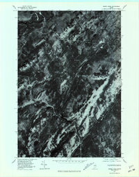
1977 Map of Misery Knob
USGS Topo · Published 1981About this map
Moose River and Long Pond anchor the northern landscape of this orthophotograph, which captures the dense Maine forest during the late 1970s. Produced by the Geological Survey from aerial imagery taken in 1977, this sheet provides a direct visual record of the timberlands and hydrological patterns before modern development or shifting logging practices altered the canopy. The terrain is defined by the prominent Misery Knob and the winding course of Misery Stream, which feeds into Misery Pond. Unlike traditional line-and-symbol maps, this photographic study reveals the actual texture of the woods and the precise boundaries of water bodies like Chase Stream and Churchill Stream, offering researchers a literal view of the vegetation and land use in this part of Somerset County.
Find a feature on this map
8 named features on this map. Tap any name to fly to it.
Don’t see what you’re looking for? This feature index may not catch every label — zoom into the map to look around manually.
Map Details
Editions of this 1977 Misery Knob Map
This is the sole edition of this map. No revisions or reprints were ever made.
Other maps of this area

1905 · The Forks
USGS Topo · 1:62,500

1907 · The Forks
USGS Topo · 1:62,500

1921 · Brassua Lake
USGS Topo · 1:62,500

1922 · Long Pond
USGS Topo · 1:62,500

1923 · Brassua Lake
USGS Topo · 1:62,500

1924 · Long Pond
USGS Topo · 1:62,500

1925 · Pierce Pond
USGS Topo · 1:48,000

1927 · Pierce Pond
USGS Topo · 1:62,500

1944 · Brassua Lake
USGS Topo · 1:62,500

1944 · Long Pond
USGS Topo · 1:62,500
Featured Places
- Misery Gore, ME
- Sandwich Academy Grant Township, ME
- Long Pond Township, ME
- Chase Stream Township, ME
- Misery Township, ME