Old Maps of Moose River, Maine for Metal Detecting
Plan your next treasure hunt with 35 historic maps of Moose River. Find old homesites, ghost towns, trails, and gathering spots that may be lost to time — perfect for identifying promising metal detecting locations.
- Locate forgotten sites: Uncover places like long-lost settlements, abandoned rail lines, or gathering spots.
- Plan better hunts: Use map overlays combined with LiDAR or satellite views to narrow in on historically rich areas.
- Made for detectorists: Thousands of hobbyists use these maps to discover relics, coins, and hidden history.
Use these historic maps to boost your research and find new opportunities beneath the surface of Moose River.
Moose River, ME maps
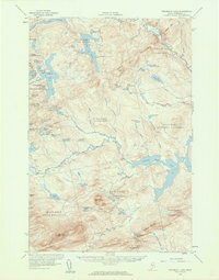
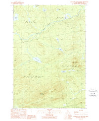
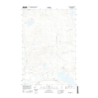
(35)- 1922 Map of Long Pond, 1955 Print
 1922 Long Pond1955 Print · USGSThe Maine north woods in the early twenties reveals a landscape defined by the Canadian Pacific rail line and the timber industry. Genealogists and historians can trace family-named sites like Fogg Farm, Mackamp, and Jackman Mill.5 unique versions available
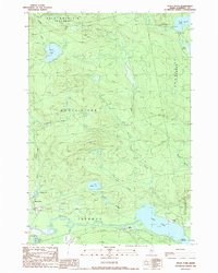
 - 1923 Map of Attean, 1965 Print
 1923 Attean1965 Print · USGSSomerset County's wilderness is captured here in the 1920s, showcasing a network of remote outposts and waterways along the international border. Genealogists and historians can trace the Canadian Pacific line to Jackman Station, Boston Ranch, and the Stetson School.2 unique versions available
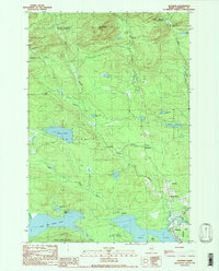
 - 1924 Map of Long Pond
 1924 Long Pond1924 Print · USGSSomerset County’s timber and rail landscape is captured here in the early twenties as the logging and sporting industries thrived. Trace the Canadian Pacific rail line through Jackman Station to remote outposts like Mackamp and the Whipple Farm.5 unique versions available
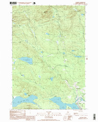
 - 1925 Map of Attean
 1925 Attean1925 Print · USGSThe Maine wilderness at the Canadian border in the mid-1920s is a landscape of timber and rail. Researchers can trace the development of Jackman and Jackman Station or locate remote sites like Boston Ranch and Stetson School.6 unique versions available
 - 1944 Map of Long Pond
 1944 Long Pond1944 Print · USGSSomerset County's timber and rail corridor is captured here during the mid-forties as the north woods economy thrived. Genealogists and historians can trace family locations at Whipple Farm or follow the Canadian Pacific line to Jackman Station and Mackamp.
 - 1949 Map of Jackman
 1949 Jackman1949 Print · USGSThe Quebec and Maine borderlands are shown in great detail during the late 1940s, highlighting the industrial and natural geography of the region. Trace old rail lines like the Canadian Pacific and locate settlements from Sherbrooke to Scotstown.2 unique versions available
 - 1950 Map of Attean
 1950 Attean1950 Print · USGSSomerset County’s northern timberlands and the Canadian border are captured here at mid-century, when the railroad remained the primary artery. Researchers can locate the old Stetson Sch, the remote Boston Ranch, and the railway hub at Jackman Station.2 unique versions available
 - 1956 Map of Penobscot Lake, 1960 Print
 1956 Penobscot Lake1960 Print · USGSThe Maine-Quebec borderlands in the mid-1950s reveal a landscape of timber townships and remote waterways. Trace the Bald Mtn Trail to the Lookout Tower or explore the vast Penobscot Lake and the North Branch Penobscot River.4 unique versions available
 - 1963 Map of Jackman
 1963 Jackman1963 Print · USGSThe international borderlands of Maine and Quebec come alive in the mid-twentieth century, showing a landscape of timber towns and rail connections. Genealogists and historians can trace the paths of the Canadian Pacific Railway through Jackman or locate families in Sherbrooke and Megantic.
 - 1966 Map of Sherbrooke
 1966 Sherbrooke1966 Print · USGSThe borderlands of Quebec and Maine come alive in the mid-1960s, documenting the industrial towns and deep woods of the Northeast. Genealogists can trace family lines through Sherbrooke and Coaticook, or locate remote logging outposts along the Moose River and Flagstaff Lake.
 - 1976 Map of Sherbrooke
 1976 Sherbrooke1976 Print · USGSThe northern Maine woods and Quebec’s Eastern Townships meet in this mid-century survey of the rugged international borderlands. Genealogists and historians can trace rail-and-river connections through Thetford Mines, follow the Dead River to Flagstaff Lake, or locate small border crossings at Stanhope and Beecher Falls.2 unique versions available
 - 1977 Map of Jackman, 1983 Print
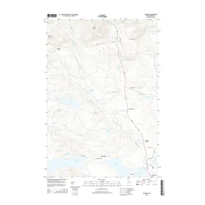
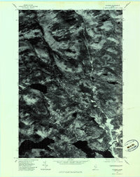 1977 Jackman1983 Print · USGSSomerset County's forested interior is captured in the late seventies, showing the development of Jackman and Dyerville. Local historians can trace the paths of Sandy Stream and the Moose River through this unique aerial perspective.
 - 1977 Map of Heald Pond, 1983 Print
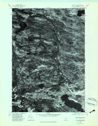 1977 Heald Pond1983 Print · USGSThe Maine woods and their industrial timber roots are visible in this late 1970s aerial survey of Somerset County. Researchers can trace the water-based economy of the day through the Jackman Mill and the vast reaches of Long Pond and the Moose River.
 - 1977 Map of Boundary Bald Mountain, 1983 Print
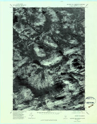 1977 Boundary Bald Mountain1983 Print · USGSThe Maine wilderness near the Canadian border is captured here in the late seventies, showing the dense timberlands of Somerset County. Outdoorsmen and historians can trace the headwaters of the South Branch Penobscot River and landmarks like Jones Pond and Boundary Bald Mountain.
 - 1986 Map of Megantic
 1986 Megantic1986 Print · USGSSettlement and industry along the international border define this mid-1980s survey of the Maine north woods. Genealogists and historians can trace the Canadian Pacific rail line through Jackman Station, Lowelltown, and the Jackman Mill.
 - 1989 Map of Boundary Bald Mountain
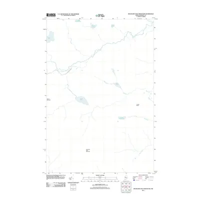
 1989 Boundary Bald Mountain1989 Print · USGSThe Maine wilderness near the Canadian border comes into focus in the late eighties, documenting the remote townships of Somerset County. Researchers can trace the waters of the South Branch Penobscot River and locate landmarks like Moose Mtn and Jones Pond.2 unique versions available
 - 1989 Map of Heald Pond
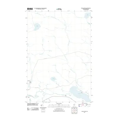
 1989 Heald Pond1989 Print · USGSSomerset County's remote timber and water systems are captured here in the late eighties, showing a landscape defined by the Moose River and its glacial ponds. Researchers can find old landmarks like Whipple Farm, the settlement of Blair, and several remote Gravel Pits.
 - 1989 Map of Jackman
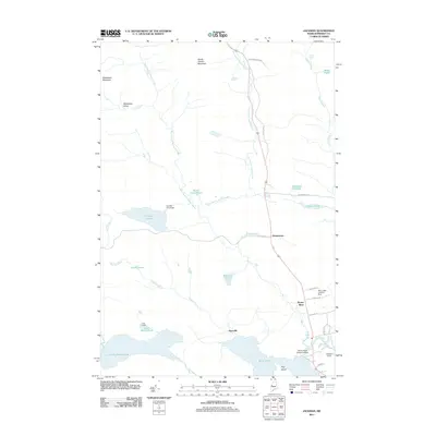
 1989 Jackman1989 Print · USGSJackman and the surrounding timberlands of Somerset County are documented here in the late eighties, just as modern aviation and recreation met traditional woods life. Trace the settlements at Dennistown, locate Foxs Camp, or follow the Moose River to Wood Pond.
 - 1994 Map of Megantic
 1994 Megantic1994 Print · USGSUpper Somerset County during the early 1990s shows a landscape of remote timber outposts and the Canadian Pacific railroad. Genealogists and historians can trace the corridor through Jackman and Dennistown or locate old rail points like Skinner and Lowelltown.
 - 1997 Map of Jackman, 1999 Print
 1997 Jackman1999 Print · USGSThe North Woods of Somerset County appear in the late nineties as a hub of rail and river activity. Researchers can trace the Canadian Pacific line through Jackman or locate remote sites like Foxs Camp and the Sky Lodge Landing Strip.
 - 2011 Map of Jackman, 2011 Print
 2011 Jackman2011 Print · USGSCovers Moose River, including Jackman, Dennistown Plantation, and other nearby areas
 - 2011 Map of Heald Pond, 2011 Print
 2011 Heald Pond2011 Print · USGSCovers Moose River, including Jackman, Thorndike Township, and other nearby areas
 - 2011 Map of Boundary Bald Mountain, 2011 Print
 2011 Boundary Bald Mountain2011 Print · USGSCovers Moose River, including Thorndike Township, Alder Brook Township, and other nearby areas
 - 2014 Map of Jackman, 2014 Print
 2014 Jackman2014 Print · USGSCovers Moose River, including Jackman, Dennistown Plantation, and other nearby areas
 - 2014 Map of Heald Pond, 2014 Print
 2014 Heald Pond2014 Print · USGSCovers Moose River, including Jackman, Thorndike Township, and other nearby areas
Showing maps 1-25 of 35
Top cities near Moose River
Frequently asked questions
- What are the different types of historical maps available for Moose River?
- What is the oldest map of Moose River?
- Where can I purchase historical maps of Moose River for my home or office?
- Where can I download high-res historical maps of Moose River?
- Are there historical topographic maps available for Moose River?
- Is there historical aerial imagery available for Moose River?
- Where are historical maps of Moose River sourced from?