Old Maps of Crows Nest, Northport for Genealogy
Trace your family roots with 12 historic maps of Crows Nest. These high-res maps reveal old neighborhoods, homesites, landmarks, and streets — helping you uncover where your ancestors lived and how the area evolved over time.
- Explore historic neighborhoods: Identify where your relatives may have lived in the 1800s or 1900s.
- Compare maps over time: Trace the changes in streets, buildings, and landmarks for multi-generational research.
- Perfect for genealogy & ancestry research: Used by family historians and researchers to map out lineage and migration.
These maps are an incredible resource for exploring your personal connection to Crows Nest's past.
Crows Nest, Northport maps
(12)- 1902 Map of Castine
 1902 Castine1902 Print · USGSCovers Crows Nest, including Belfast, Searsport, and other nearby areas
 - 1904 Map of Castine
 1904 Castine1904 Print · USGSCovers Crows Nest, including Belfast, Searsport, and other nearby areas7 unique versions available
 - 1905 Map of Penobscot Bay
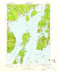
 1905 Penobscot Bay1905 Print · USGSCovers Crows Nest, including Belfast, Blue Hill, and other nearby areas3 unique versions available
 - 1941 Map of Castine, 1959 Print
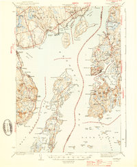
 1941 Castine1959 Print · USGSCovers Crows Nest, including Belfast, Searsport, and other nearby areas4 unique versions available
 - 1943 Map of Castine
 1943 Castine1943 Print · USGSCovers Crows Nest, including Belfast, Searsport, and other nearby areas3 unique versions available
 - 1948 Map of Bangor
 1948 Bangor1948 Print · USGSCovers Crows Nest, including Bangor, Augusta, and other nearby areas
 - 1956 Map of Bangor, 1966 Print
 1956 Bangor1966 Print · USGSCovers Crows Nest, including Bangor, Augusta, and other nearby areas3 unique versions available
 - 1960 Map of Bangor
 1960 Bangor1960 Print · USGSCovers Crows Nest, including Bangor, Augusta, and other nearby areas
 - 1961 Map of Bangor
 1961 Bangor1961 Print · USGSCovers Crows Nest, including Bangor, Augusta, and other nearby areas
 - 1973 Map of Islesboro, 1976 Print
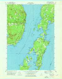 1973 Islesboro1976 Print · USGSCovers Crows Nest, including Lincolnville, Deer Isle, and other nearby areas2 unique versions available
 - 1985 Map of Bar Harbor
 1985 Bar Harbor1985 Print · USGSCovers Crows Nest, including Ellsworth, Belfast, and other nearby areas2 unique versions available
 - 2024 Map of Islesboro, 2024 Print
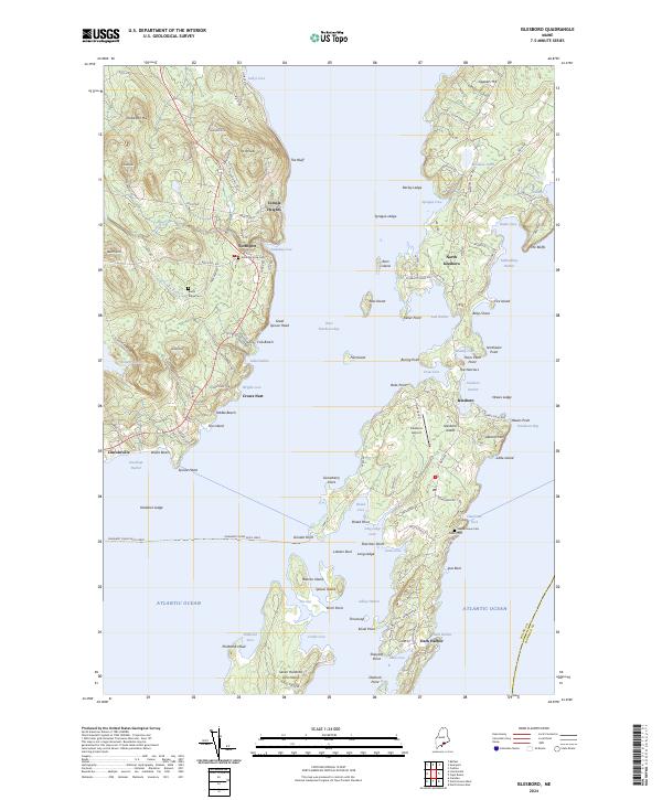 2024 Islesboro2024 Print · USGSCovers Crows Nest, including Lincolnville, Deer Isle, and other nearby areas
End of results
Showing maps 1-12 of 12
Frequently asked questions
- What are the different types of historical maps available for Crows Nest?
- What is the oldest map of Crows Nest?
- Where can I purchase historical maps of Crows Nest for my home or office?
- Where can I download high-res historical maps of Crows Nest?
- Are there historical topographic maps available for Crows Nest?
- Is there historical aerial imagery available for Crows Nest?
- Where are historical maps of Crows Nest sourced from?