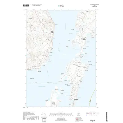
2018 Map of Islesboro
USGS Topo · Published 2018About this map
Islesboro Island dominates this maritime survey, stretching through West Penobscot Bay and acting as a central hub for the mid-coast region. The settlement of Islesboro serves as a midpoint between the northern village of North Islesboro and the southern enclave of Dark Harbor. These communities are bound together by a network of local roads like Babbidge Rd and Pendleton Point Rd, while the Margaret Chase Smith Ferry provides the vital link across the water to Lincolnville on the mainland.
Find a feature on this map
131 named features on this map. Tap any name to fly to it.
Don’t see what you’re looking for? This feature index may not catch every label — zoom into the map to look around manually.
Map Details
Editions of this 2018 Islesboro Map
This is the sole edition of this map. No revisions or reprints were ever made.
Other maps of this area

1902 · Castine
USGS Topo · 1:62,500

1904 · Castine
USGS Topo · 1:62,500

1904 · Vinalhaven
USGS Topo · 1:62,500

1904 · Rockland
USGS Topo · 1:62,500

1905 · Penobscot Bay
USGS Topo · 1:125,000

1906 · Rockland
USGS Topo · 1:62,500

1915 · Belfast
USGS Topo · 1:62,500

1917 · Belfast
USGS Topo · 1:62,500

1941 · Belfast
USGS Topo · 1:62,500

1941 · Rockland
USGS Topo · 1:62,500