2020s Maps of Allegany County, Maryland
Explore 15 historic maps of Allegany County from the 2020s. These maps offer a rare glimpse into what life looked like during the 2020s — showing old roads, neighborhoods, homes, and landmarks that have changed or disappeared over time.
Whether you're researching your family's past, planning a metal detecting trip, or studying how Allegany County's landscape evolved across the 2020s, these high-resolution maps are a powerful tool for exploring the history of this region.
- Focus on a specific era: All maps on this page are from the 2020s, giving you a focused view of this time period.
- See what’s changed: Compare century-old streets, trails, and buildings to today's modern landscape using overlays and satellite layers.
- Research with precision: Use these maps for genealogy, historical research, land use analysis, or educational projects.
- View, download, or print: Maps are fully viewable online in high resolution, and can be downloaded or printed for your own records.
Start exploring Allegany County's history through authentic maps from the 2020s. This is your window into the past.
Allegany County, MD maps
(15)- 2023 Map of Artemas, 2023 Print
 2023 Artemas2023 Print · USGSThe Pennsylvania and Maryland borderlands come alive in this survey, showcasing the ridge-and-valley terrain surrounding Artemas. Local historians can trace the paths of the National Pike and the Chesapeake and Ohio Canal, alongside sites like Saint Patricks Cem and Little Orleans.
 - 2023 Map of Westernport, 2023 Print
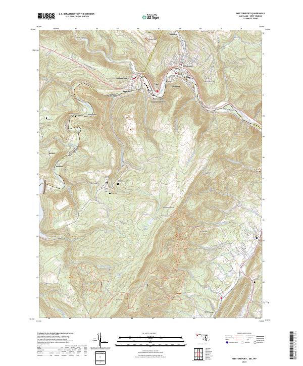 2023 Westernport2023 Print · USGSModern Westernport and the surrounding Potomac River valley appear in high detail at the junction of Maryland and West Virginia. Researchers can trace ancestral sites at Bloomington Cem or explore the mountain settlements of Warnocks and Barnum.
 - 2023 Map of Barton, 2023 Print
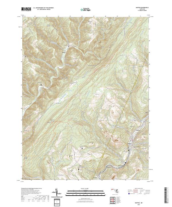 2023 Barton2023 Print · USGSAllegany County's steep ridges and coal-country valleys are shown here in recent detail, tracing the legacy of Maryland's mountain settlements. Researchers can locate numerous family burial sites like Sigler Family Cem and trace the paths of Georges Creek through Barton and Nikep.
 - 2023 Map of Frostburg, 2023 Print
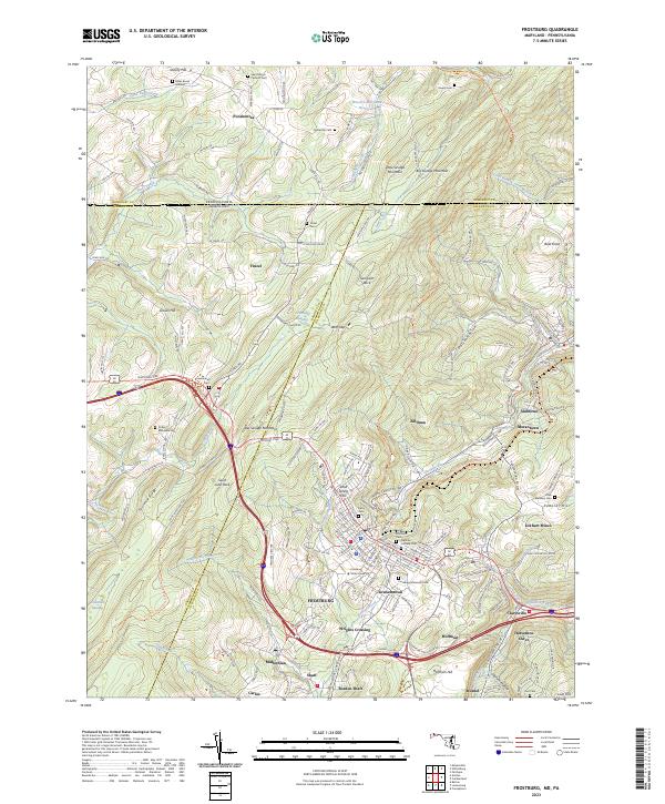 2023 Frostburg2023 Print · USGSFrostburg and the surrounding Allegheny ridges are captured here in the early twenty-first century, showing a landscape shaped by coal mining and mountain transit. Researchers can trace historic industrial sites like Eckhart Mines and Borden Shaft or locate family plots at Cutter McKenzie Cem and the Miller Burial Ground.
 - 2023 Map of Lonaconing, 2023 Print
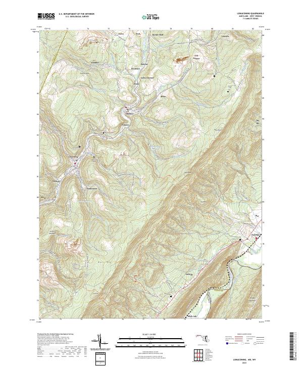 2023 Lonaconing2023 Print · USGSMaryland's mountain mining corridor along Georges Creek appears here in high detail, showing the modern layout of historic coal-country hamlets. Researchers can trace family ties through Saint Marys Cem, locate sites in Borden Shaft, or follow the CSX TRANSPORTATION line.
 - 2023 Map of Evitts Creek, 2023 Print
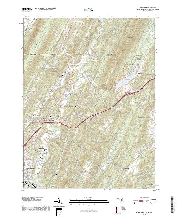 2023 Evitts Creek2023 Print · USGSThe rugged ridge-and-valley landscape east of Cumberland comes into focus in this recent survey. Local historians can trace family roots through sites like the Robinette Family Cem and Wolfe Mill or follow the path of Evitts Creek toward Lake Habeeb.
 - 2023 Map of Cumberland, 2023 Print
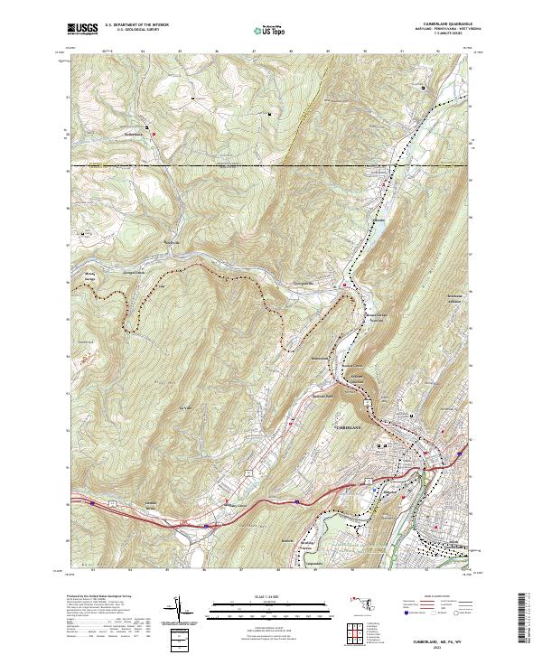 2023 Cumberland2023 Print · USGSCumberland and the Potomac River valley are shown in high detail at the dawn of the 2020s. Genealogists can locate family sites like Wellersburg Church Cem and Sixmile House near the historic passage of The Narrows.
 - 2023 Map of Oldtown, 2023 Print
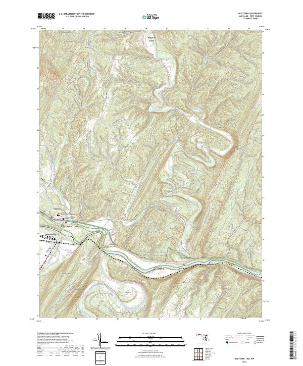 2023 Oldtown2023 Print · USGSThe Potomac River borderlands in the early 2020s show a landscape shaped by narrow water gaps and deep-rooted transportation corridors. Researchers can trace the path of the C&O Canal or locate family sites at Oldtown Catholic Cem and Fifty Four Cem.
 - 2023 Map of Flintstone, 2023 Print
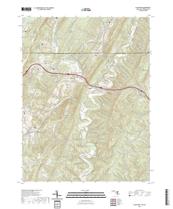 2023 Flintstone2023 Print · USGSThis cross-border region of Maryland and Pennsylvania shows a landscape of steep ridges and family-named hollows as it appeared in 2023. Researchers can trace ancestral locations at the Odd Fellows Cem or follow the historic National Pike NE through Flintstone.
 - 2023 Map of Cresaptown, 2023 Print
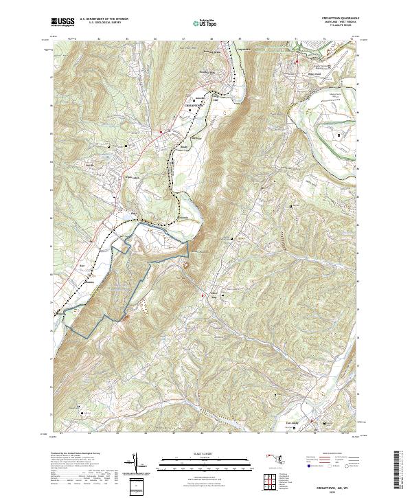 2023 Cresaptown2023 Print · USGSThe Potomac River valley on the Maryland-West Virginia border shows a complex mix of industrial history and modern aviation in this recent survey. Researchers can trace family plots like Abe Cem and Inkeep Cem or locate the sprawling Allegany Ballistics Lab.
 - 2023 Map of Paw Paw, 2023 Print
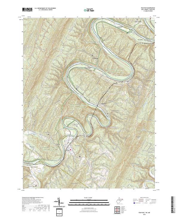 2023 Paw Paw2023 Print · USGSThe Potomac River meanders through the rugged borderlands of West Virginia and Maryland in this recent topographic survey. Researchers can trace historic family burial sites like Martin Cem and Ginevan Cem or explore the canal-side communities of Paw Paw and Magnolia.
 - 2023 Map of Patterson Creek, 2023 Print
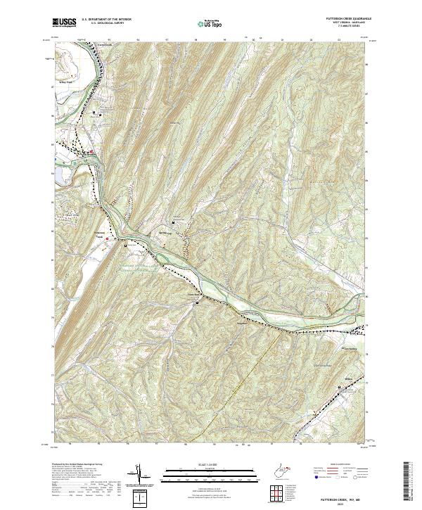 2023 Patterson Creek2023 Print · USGSMaryland and West Virginia meet along the North Branch Potomac River in this 2020s survey of the ridge-and-valley landscape. Genealogists can locate several historic cemeteries like Saint Marys Cem and Hardy Cem near the Patterson Creek valley.
 - 2023 Map of Great Cacapon, 2023 Print
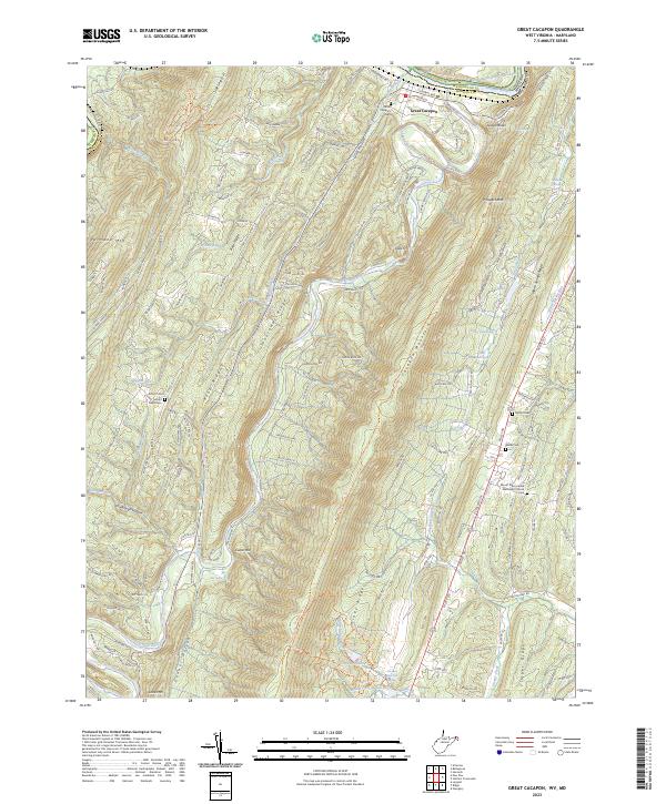 2023 Great Cacapon2023 Print · USGSThe ridges and river valleys of Morgan County are documented here in the early twenty-first century, centered on the community of Great Cacapon. Researchers can locate family sites at Mount Nebo Cem and Bethel Cem or trace the historic Chesapeake and Ohio Canal.
 - 2023 Map of Keyser, 2023 Print
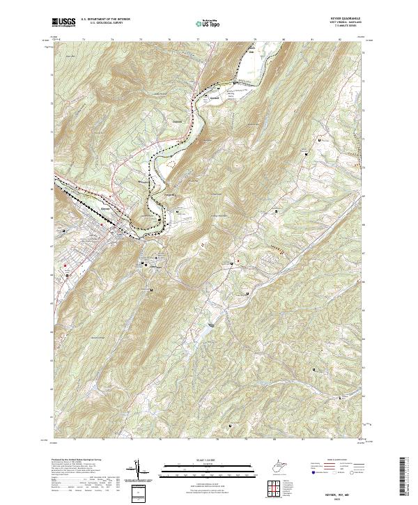 2023 Keyser2023 Print · USGSKeyser and the Potomac valley are shown here in the early 2020s, highlighting the area's deep institutional and family history. Genealogists can trace roots at Saint Marys Cem and Mount Zion Cem, while researchers will find Mineral County Courthouse at the heart of the settlement.
 - 2023 Map of Bellegrove, 2023 Print
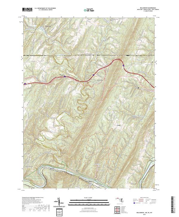 2023 Bellegrove2023 Print · USGSThe Potomac River valley and the ridges of the Appalachian mountains define this borderland region in the early twenty-first century. Researchers can trace the path of the Western Maryland Rail Trail or locate local landmarks like Bellegrove and Mount Olivet Cem.
End of results
Showing maps 1-15 of 15
Top cities of Allegany County
- Cumberland historical maps
- Frostburg historical maps
- La Vale historical maps
- Westernport historical maps
- Bel Air historical maps
- Lonaconing historical maps
See more
Frequently asked questions
- What are the different types of historical maps available for Allegany County?
- What is the oldest map of Allegany County?
- Where can I purchase historical maps of Allegany County for my home or office?
- Where can I download high-res historical maps of Allegany County?
- Are there historical topographic maps available for Allegany County?
- Is there historical aerial imagery available for Allegany County?
- Where are historical maps of Allegany County sourced from?