Old Maps of Allegany County, Maryland for Genealogy
Trace your family roots with 146 historic maps of Allegany County. These high-res maps reveal old neighborhoods, homesites, landmarks, and streets — helping you uncover where your ancestors lived and how the area evolved over time.
- Explore historic neighborhoods: Identify where your relatives may have lived in the 1800s or 1900s.
- Compare maps over time: Trace the changes in streets, buildings, and landmarks for multi-generational research.
- Perfect for genealogy & ancestry research: Used by family historians and researchers to map out lineage and migration.
These maps are an incredible resource for exploring your personal connection to Allegany County's past.
Allegany County, MD maps
(146)- 1891 Map of Romney, 1897 Print
 1891 Romney1897 Print · USGSHampshire, Hardy, and Mineral counties are captured here in the 1880s as the river valleys were transitioning from frontier outposts to connected industrial hubs. Genealogists and historians can trace family locations near Capon Iron Works, Adams Mill, and the many hamlets along Patterson Creek.5 unique versions available
 - 1895 Map of Piedmont
 1895 Piedmont1895 Print · USGSThe West Virginia and Maryland borderlands come to life in the 1890s, when coal and timber drove the expansion of the Potomac River valleys. Genealogists can trace the early industrial roots of Piedmont, locate the historic Fairfax Stone, or find the long-lost operations at Rees Tannery.4 unique versions available
 - 1898 Map of Frostburg
 1898 Frostburg1898 Print · USGSMaryland's coal country and the Potomac borderlands are captured here at the height of the Victorian industrial era. Researchers can trace the extensive rail lines and mining infrastructure connecting settlements like Eckhart Mines, Mount Savage, and the historic C & O Canal.
 - 1898 Map of Paw Paw, 1982 Print
 1898 Paw Paw1982 Print · USGSThe Potomac River meanders through the Appalachian ridges at the turn of the century, where Maryland, West Virginia, and Pennsylvania meet. Genealogists and historians can trace the early industrial corridor of the Chesapeake and Ohio Canal and find old rail stops like Magnolia and Doe Gully.
 - 1899 Map of Flintstone
 1899 Flintstone1899 Print · USGSThe Maryland, West Virginia, and Pennsylvania borders converge here during the late nineteenth century as industry follows the river. Genealogists can trace family footprints near Oldtown or locate vanished infrastructure like Patterson Depot and the C. & O. Canal.
 - 1899 Map of Grantsville
 1899 Grantsville1899 Print · USGSThe Maryland-Pennsylvania borderlands are documented here at the close of the nineteenth century, showing a landscape of high ridges and narrow valley settlements. Researchers can trace family-named landmarks like Ridgley Hill and early mountain hamlets such as New Germany or Moscow Mills.
 - 1900 Map of Pawpaw
 1900 Pawpaw1900 Print · USGSThe Potomac River's intricate meanders define this borderland at the close of the nineteenth century. Researchers can trace the parallel routes of the Chesapeake and Ohio Canal and the Baltimore and Ohio Railroad past Magnolia, Dam No. 6, and Fisher Ford.8 unique versions available
 - 1900 Map of Flintstone
 1900 Flintstone1900 Print · USGSThe Maryland and West Virginia border at the close of the nineteenth century centers on the vital Potomac River transportation corridor. Researchers can trace the Chesapeake and Ohio Canal, the B. & O. R. R., and early settlements like Oldtown, Flintstone, and Wolf Mill.6 unique versions available
 - 1901 Map of Frostburg
 1901 Frostburg1901 Print · USGSMaryland's coal country and the critical mountain pass at Cumberland are shown in detail at the turn of the century. Genealogists and industrial historians can locate old mining works at Eckhart Mines, the path of the C. & O. Canal, and the early layout of Frostburg.2 unique versions available
 - 1904 Map of Grantsville
 1904 Grantsville1904 Print · USGSGarrett County at the close of the nineteenth century is captured here as a rugged corridor of timbering and coal transport. You can trace the path of the National Road through Grantsville or locate early industrial sites like Moscow Mills and the Jennings Brothers RR.5 unique versions available
 - 1908 Map of Frostburg
 1908 Frostburg1908 Print · USGSAllegany County mining and rail networks are in full view at the turn of the century. Trace the old coal patches and rail spurs from Eckhart Mines to Borden Shaft, and follow the C & O Canal along the North Branch Potomac River.5 unique versions available
 - 1910 Map of Paw Paw, 1959 Print
 1910 Paw Paw1959 Print · USGSMaryland and West Virginia meet along the serpentine Potomac River in the early twentieth century as railroads and canals compete for the valley. Trace the industrial landscape from the Ohio and Chesapeake Canal to the river towns of Paw Paw and Little Orleans.
 - 1919 Map of Elk Garden
 1919 Elk Garden1919 Print · USGSThe Potomac River corridor in the years following the Great War reveals a landscape defined by rail and ridge. Genealogists can trace family names at Rehoboth Church or locate vanished school sites like Terra Firma School and Empire School.2 unique versions available
 - 1920 Map of Elk Garden
 1920 Elk Garden1920 Print · USGSThe West Virginia highlands and the Potomac River border are captured here just after the Great War, during the peak of the rail-and-coal era. Genealogists can locate numerous rural landmarks including Elk Garden, Rehoboth Church, and the Nethken School.
 - 1920 Map of Keyser, 1964 Print
 1920 Keyser1964 Print · USGSMineral and Hampshire counties in the 1920s reveal a landscape of deep river valleys and prominent ridges tied together by the Baltimore and Ohio RR. Researchers can locate dozens of country schools and churches, from Trinity Church to the Pancake School and Reeses Mill.
 - 1921 Map of Keyser
 1921 Keyser1921 Print · USGSThe Potomac River valley and the ridges of Mineral and Hampshire counties are captured here in the early twenties. Researchers can locate vanished landmarks like the Russellville PO, industrial sites at Ochre, and dozens of rural schoolhouses from Red Star School to Knobly School.2 unique versions available
 - 1922 Map of Elk Garden
 1922 Elk Garden1922 Print · USGSThe Potomac River highlands come to life in the early 1920s as rail and river industry define the border between Maryland and West Virginia. Genealogists and local historians can trace family roots through numerous small schools and churches like Sunnyside School, Mt Pisgah Church, and Hartmansville.2 unique versions available
 - 1922 Map of Keyser
 1922 Keyser1922 Print · USGSThe Potomac borderlands in the early 1920s reveal a landscape of deep valleys and vital rail connections along the West Virginia-Maryland line. Genealogists and local historians can trace rural family life through dozens of named schools like Red Star School and historic landmarks such as Trinity Church and Vanderlip P.O.3 unique versions available
 - 1947 Map of Barton, 1964 Print
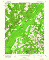 1947 Barton1964 Print · USGSMaryland's coal country comes into focus in the 1940s as industry and wilderness meet along the slopes of Big Savage Mountain. Genealogists can trace family sites from Barton to Pekin Nikep PO, including St Gabriels Cem and several local mines.4 unique versions available
 - 1948 Map of Cumberland
 1948 Cumberland1948 Print · USGSMid-century Appalachia and the Shenandoah Valley are shown in detail, documenting the industrial and transportation hubs of the tri-state area. Genealogists can trace family roots through settlements like Double Tollgate and Bunker Hill or along the Baltimore & Ohio RR.3 unique versions available
 - 1949 Map of Barton
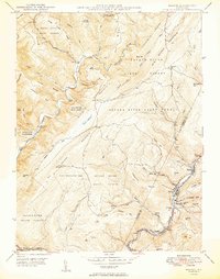 1949 Barton1949 Print · USGSThe industrial coal valleys of Western Maryland are shown here just after the war, where the Cumberland and Pennsylvania railroad links communities like Barton and Moscow. Genealogists can trace early landmarks like St Gabriels Cem and Bartlett Cem.2 unique versions available
 - 1949 Map of Cumberland, 1955 Print
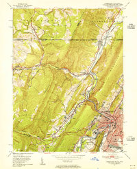 1949 Cumberland1955 Print · USGSCumberland and the Potomac River valley are shown in detail at mid-century, just as the region's rail and coal infrastructure reached its post-war peak. Local historians can trace the Mason and Dixon Line and locate historic landmarks like Sixmile House and The Narrows.10 unique versions available
 - 1949 Map of Evitts Creek, 1961 Print
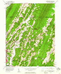 1949 Evitts Creek1961 Print · USGSThe northern edge of Allegany County meets the Mason and Dixon Line in this late-forties survey. Genealogists and local historians can trace rural family sites like Wolfe Mill, Cooks Mills, and the Union Grove Cem nestled between the ridges.3 unique versions available
 - 1949 Map of Patterson Creek, 1963 Print
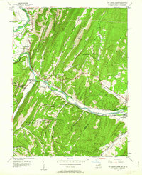 1949 Patterson Creek1963 Print · USGSThe Potomac River valley on the Maryland-West Virginia border is captured here during the late 1940s, showing a landscape shaped by rail and river transport. Genealogists and historians can trace the Chesapeake and Ohio Canal (Abandoned) past rural sites like Mt Tabor Ch and St Marys Cem.3 unique versions available
 - 1949 Map of Keyser, 1965 Print
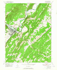 1949 Keyser1965 Print · USGSKeyser and the Potomac River valley are captured in the late 1940s as a vital railroad and college hub. Researchers can trace family roots through numerous sites like Meadow View Cem, Potomac State College, and the rural Willow Dale Chapel.3 unique versions available
Showing maps 1-25 of 146
Top cities of Allegany County
- Cumberland historical maps
- Frostburg historical maps
- La Vale historical maps
- Westernport historical maps
- Bel Air historical maps
- Lonaconing historical maps
See more
Frequently asked questions
- What are the different types of historical maps available for Allegany County?
- What is the oldest map of Allegany County?
- Where can I purchase historical maps of Allegany County for my home or office?
- Where can I download high-res historical maps of Allegany County?
- Are there historical topographic maps available for Allegany County?
- Is there historical aerial imagery available for Allegany County?
- Where are historical maps of Allegany County sourced from?