Old Maps of Anne Arundel County, Maryland for Genealogy
Trace your family roots with 193 historic maps of Anne Arundel County. These high-res maps reveal old neighborhoods, homesites, landmarks, and streets — helping you uncover where your ancestors lived and how the area evolved over time.
- Explore historic neighborhoods: Identify where your relatives may have lived in the 1800s or 1900s.
- Compare maps over time: Trace the changes in streets, buildings, and landmarks for multi-generational research.
- Perfect for genealogy & ancestry research: Used by family historians and researchers to map out lineage and migration.
These maps are an incredible resource for exploring your personal connection to Anne Arundel County's past.
Anne Arundel County, MD maps
(193)- 1892 Map of Laurel
 1892 Laurel1892 Print · USGSCentral Maryland at the end of the nineteenth century centers on the busy corridor between Baltimore and Washington. Genealogists and historians can trace rail-side industrial sites like Muirkirk, family-named crossings at Snell Bridge, and numerous Iron Ore deposits.
 - 1892 Map of Prince Frederick
 1892 Prince Frederick1892 Print · USGSCalvert County at the end of the Victorian era is captured here as a landscape of tobacco landings and emerging rail. Researchers can trace the Drum Point Railroad Proposed or locate old water-access points like Magruder Ferry and Leitches Wharf.
 - 1892 Map of Owensville
 1892 Owensville1892 Print · USGSCoastal Anne Arundel County comes alive in the 1890s, showing a world of tidewater landings and proposed rail lines. Trace old property locations near Obligation (Butler Tav.) or the early waterfront hubs of West River (Galesville) and Tracy Landing.
 - 1892 Map of Annapolis
 1892 Annapolis1892 Print · USGSMaryland's capital and the surrounding Chesapeake Bay shores appear here during the late Victorian era, before modern bridges linked the coastlines. Genealogists can trace early homesteads and rail lines in Annapolis or explore eastern shore landings like Claiborne and Kent Island.2 unique versions available
 - 1893 Map of Sharps Island
 1893 Sharps Island1893 Print · USGSThe Eastern Shore of Maryland is seen here in the 1890s, when Sharps Island and its lighthouse still commanded the mouth of the Choptank. Researchers can trace historic shorelines and early settlements like Tilghman and Neavitt before significant coastal erosion changed the bay.3 unique versions available
 - 1893 Map of North Point
 1893 North Point1893 Print · USGSMaryland's maritime heart is captured here in the late nineteenth century, showing the industrial rise of Steelton and the rural reaches of Anne Arundel. Researchers can trace old landings and light stations like Wilson Wharf, Sandy Pt. Light, and the settlement at Jacob Store.3 unique versions available
 - 1894 Map of Laurel
 1894 Laurel1894 Print · USGSMaryland's central corridor in the 1890s reveals a landscape of growing rail towns and early industrial activity between major cities. Genealogists and historians can trace family-named crossroads and rail stops from Savage Sta. and Annapolis Junc. to the iron deposits near Muirkirk.4 unique versions available
 - 1894 Map of Relay
 1894 Relay1894 Print · USGSAnne Arundel and Howard counties are shown in the late nineteenth century as the regional rail network reached its peak. Genealogists and historians can trace the early footprints of Glen Burnie, identify old landings like Whitneys Ld., and locate the St. Helena church.4 unique versions available
 - 1895 Map of Prince Frederick
 1895 Prince Frederick1895 Print · USGSMaryland's tobacco country and river-bound peninsulas are captured in the late nineteenth century before modern bridges spanned the waters. You can trace the path of the Drum Point Proposed R. R. or locate historic river landings like Magruder Ferry and Leitches Wharf.
 - 1895 Map of Owensville
 1895 Owensville1895 Print · USGSCoastal Anne Arundel County comes alive in this late nineteenth-century survey, from the winding Patuxent River to the shores of Herring Bay. Genealogists and local historians can trace the route of the Proposed Drum Point Railroad and find long-standing settlements like Obligation (Butler Tav.) and West River (Galesville).2 unique versions available
 - 1897 Map of Laurel
 1897 Laurel1897 Print · USGSMaryland's central corridor comes to life in the 1890s, capturing the rail-and-river economy where Howard and Prince George's counties meet. Researchers can trace historic stops along the Baltimore and Ohio RR, locate local Iron Ore pits, and find old community hubs like Savage Sta. and Oakland Mills.
 - 1898 Map of Choptank
 1898 Choptank1898 Print · USGSThe Maryland Eastern Shore and its intricate Chesapeake coastline are documented here in the late 1890s. Genealogists can trace family roots in Annapolis or Easton, while maritime historians can locate historic landings such as Corners Wharf and Wye Landing.2 unique versions available
 - 1898 Map of Tolchester
 1898 Tolchester1898 Print · USGSThe upper Chesapeake Bay and its tidal tributaries are shown in the late 1890s, when steamships and railroads still dominated regional commerce. Trace the landings and rail stops that fueled the bay economy, from Buck Neck Landing to Stillpond Sta. and the historic Harford Furnace.
 - 1899 Map of Patuxent
 1899 Patuxent1899 Print · USGSSouthern Maryland in the late nineteenth century was a world of river wharves and emerging rail lines. Genealogists can trace family names across landings and settlements like Bladensburg, Upper Marlboro, and Piscataway Reform School before the landscape was modernised.3 unique versions available
 - 1901 Map of Prince Frederick
 1901 Prince Frederick1901 Print · USGSThe Tidewater region of Maryland is captured here at the dawn of the twentieth century, when river travel and steamship wharves still defined the local economy. Researchers can locate vanished landings and ferry crossings like Magruder Ferry, Leitch Wharf, and Lower Marlboro.
 - 1903 Map of Tolchester
 1903 Tolchester1903 Print · USGSThe upper Chesapeake Bay at the turn of the century shows a bustling maritime landscape where steamship wharves and major rail lines met. Researchers can trace defunct stops like Baldwin Sta. and Clayton Sta. or locate historic landings such as Rockhall Landing and Quaker Wharf.
 - 1904 Map of North Point
 1904 North Point1904 Print · USGSChesapeake Bay maritime life at the turn of the century is captured here, from industrial waterfronts to rural landings. Genealogists can trace family landmarks and ferry points like Love Point Landing, Sparrow Point, and Skidmore.5 unique versions available
 - 1904 Map of Annapolis
 1904 Annapolis1904 Print · USGSMaryland's capital and the Eastern Shore are captured in detail just after the turn of the century. Genealogists and maritime historians can trace property near Annapolis, the grounds of the U. S. Naval Academy, and remote settlements like Stevensville on Kent Island.5 unique versions available
 - 1904 Map of Sharps Island
 1904 Sharps Island1904 Print · USGSThe Eastern Shore at the turn of the century shows a world of tidewater landings and island communities along the Choptank River. Genealogists and maritime historians can trace early settlements like Neavitt and Avalon, or locate the original site of the Sharps Island L.H.3 unique versions available
 - 1905 Map of Owensville
 1905 Owensville1905 Print · USGSCoastal Maryland in the early twentieth century was a landscape of tide-water wharves and rural post offices. Genealogists can trace family connections through sites like Owensville West River PO, Hartges Wharf, and Mitchellville PO.5 unique versions available
 - 1906 Map of Patuxent
 1906 Patuxent1906 Print · USGSThe Tidewater region of Maryland and the outskirts of the District of Columbia are shown here at the turn of the century. Researchers can trace the early footprints of Maryland Agril. College, find riverfront infrastructure at Milltown Landing, and follow long-established routes like the Marlboro Turnpike.4 unique versions available
 - 1907 Map of Laurel
 1907 Laurel1907 Print · USGSMaryland's transit corridor between Washington and Baltimore comes alive in the early 1900s as railroads and old turnpikes cross the Patuxent valley. Trace historical landmarks from the House of Reformation to old crossings like Old Forge Bridge and Brock Bridge.3 unique versions available
 - 1907 Map of Relay
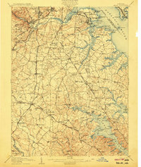 1907 Relay1907 Print · USGSAnne Arundel County and the Patapsco waterfront are shown here in the early nineteen-hundreds, as industry and maritime trade reshaped the Maryland coast. Genealogists and historians can trace rail lines and early settlements like Relay and Elkridge, or locate landmarks such as Fort Carroll and St. Stephens Church.8 unique versions available
 - 1908 Map of Patapsco
 1908 Patapsco1908 Print · USGSMaryland's central corridor at the opening of the twentieth century reveals a dense network of harbor defenses and rail-line economies. Genealogists and historians can trace the foundations of Baltimore alongside local landmarks like Ashland Furnace, St Charles College, and Fort McHenry.4 unique versions available
 - 1908 Map of Tolchester
 1908 Tolchester1908 Print · USGSChesapeake Bay life at the turn of the century centered on a complex network of tidewater landings and strategic railroad lines. Researchers can trace historic family settlements and maritime landmarks like Fort Howard, Harford Furnace, and the Sevenfoot Knoll LH.4 unique versions available
Showing maps 1-25 of 193
Top cities of Anne Arundel County
- Glen Burnie historical maps
- Odenton historical maps
- Severna Park historical maps
- Annapolis historical maps
- Crofton historical maps
- Pasadena historical maps
See more
Frequently asked questions
- What are the different types of historical maps available for Anne Arundel County?
- What is the oldest map of Anne Arundel County?
- Where can I purchase historical maps of Anne Arundel County for my home or office?
- Where can I download high-res historical maps of Anne Arundel County?
- Are there historical topographic maps available for Anne Arundel County?
- Is there historical aerial imagery available for Anne Arundel County?
- Where are historical maps of Anne Arundel County sourced from?