1940s Maps of Dorchester County, Maryland
Explore 48 historic maps of Dorchester County from the 1940s. These maps offer a rare glimpse into what life looked like during the 1940s — showing old roads, neighborhoods, homes, and landmarks that have changed or disappeared over time.
Whether you're researching your family's past, planning a metal detecting trip, or studying how Dorchester County's landscape evolved across the 1940s, these high-resolution maps are a powerful tool for exploring the history of this region.
- Focus on a specific era: All maps on this page are from the 1940s, giving you a focused view of this time period.
- See what’s changed: Compare century-old streets, trails, and buildings to today's modern landscape using overlays and satellite layers.
- Research with precision: Use these maps for genealogy, historical research, land use analysis, or educational projects.
- View, download, or print: Maps are fully viewable online in high resolution, and can be downloaded or printed for your own records.
Start exploring Dorchester County's history through authentic maps from the 1940s. This is your window into the past.
Dorchester County, MD maps
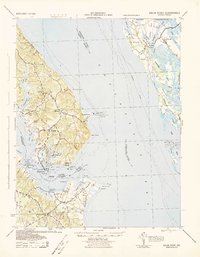
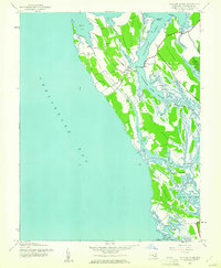
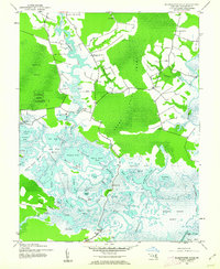
(48)- 1942 Map of Tilghman
 1942 Tilghman1942 Print · USGSChesapeake maritime life is captured here during the early war years, focusing on the communities of the Talbot County peninsula. Genealogists can trace family footprints through the Tilghman and Fairbank settlements, Peoples Chapel, and the Tilghman Island Landing.3 unique versions available
 - 1942 Map of Oxford
 1942 Oxford1942 Print · USGSThe Tred Avon and Choptank rivers dominate this coastal Maryland landscape during the early 1940s. Genealogists can trace family roots through the St Paul Church, John Wesley Church, and the Choptank River Lighthouse that guided local mariners.3 unique versions available
 - 1942 Map of Drum Point
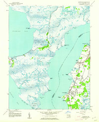
 1942 Drum Point1942 Print · USGSThe Chesapeake Bay shoreline in the early 1940s reveals a world of maritime activity and isolated coastal communities. Genealogists and local historians can trace the foundations of Solomons, locate Spencers Wharf, and explore the marshes of Taylors Island.
 - 1942 Map of Kedges Straits, 1957 Print
 1942 Kedges Straits1957 Print · USGSThe mid-century Chesapeake Bay shoreline comes to life through the tidal guts and marshes of the Somerset County islands. Trace the old waterway navigation routes past Holland Island Bar Lighthouse, Solomons Lump Lighthouse, and the landings at Smith Island.
 - 1942 Map of Bloodsworth Island, 1957 Print
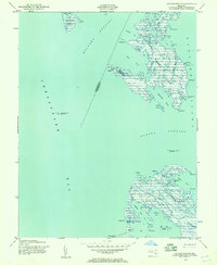
 1942 Bloodsworth Island1957 Print · USGSThe Dorchester County archipelago comes into focus during the early war years, revealing the complex marshes and tidal guts of the lower Chesapeake. Researchers can trace the maritime landscape of Bloodsworth Island and locate vanished landmarks like the Hooper Strait Lighthouse and the small settlement at Crocheron.
 - 1942 Map of Richland Point, 1957 Print
 1942 Richland Point1957 Print · USGSDorchester County's island communities are captured here during the 1940s, showing the delicate maritime landscape of the lower bay. Genealogists and historians can locate the small settlement at Applegarth and the family-named Mens Burial Pt on Lower Hooper Island.2 unique versions available
 - 1942 Map of Barren Island, 1957 Print
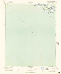
 1942 Barren Island1957 Print · USGSChesapeake Bay waters surround the isolated marshes of Dorchester County during the early 1940s. Maritime researchers can locate key navigational aids like the Cedar Point Lighthouse and trace the tidal channels of The Big Broads and Barren I Thorofare.3 unique versions available
 - 1942 Map of Church Creek, 1958 Print
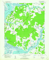
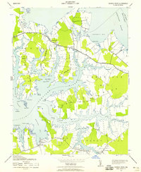 1942 Church Creek1958 Print · USGSThe Dorchester County tidewater region during the early 1940s is shown here through its intricate shoreline and rural peninsula settlements. Genealogists and historians can trace family roots through landmarks like Mace Cemetery, Gethsemane Church, and the village of Madison.2 unique versions available
 - 1942 Map of Honga, 1958 Print
 1942 Honga1958 Print · USGSDorchester County’s water-bound communities come alive in this wartime-era survey of the Eastern Shore. Genealogists and historians can trace the foundations of Hoopersville and Crapo, or locate forgotten docks like CARROLS LDG and the HOOPER ISLAND PIER.3 unique versions available
 - 1942 Map of Deal Island, 1958 Print
 1942 Deal Island1958 Print · USGSCoastal Somerset County is shown here in the early 1940s, a landscape of isolated fishing villages and vital Chesapeake Bay navigation aids. Researchers can trace the waterfront settlements of Wenona, Chance, and Deal Island or locate maritime landmarks like Haines Point Light.2 unique versions available
 - 1942 Map of Golden Hill, 1961 Print
 1942 Golden Hill1961 Print · USGSDorchester County's tidal wetlands and coastal settlements are captured here in the early 1940s. Genealogists and historians can trace the specific boundaries of Woolford Plantation Pt and locate rural hubs like Golden Hill and Riggins Corner.2 unique versions available
 - 1942 Map of Taylors Island, 1961 Print
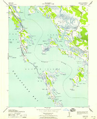
 1942 Taylors Island1961 Print · USGSThe Eastern Shore of Maryland in the early 1940s reveals a tidewater landscape of isolated necks and marshy islands. Genealogists can trace family footprints around Smithville, Bethlehem Ch, and the complex shorelines of Robinson Neck.
 - 1942 Map of Sharps Island, 1961 Print
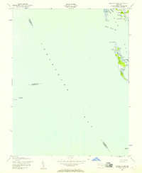
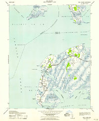
 1942 Sharps Island1961 Print · USGSThe Dorchester County coast and its isolated island landmasses are detailed in this wartime survey of the Chesapeake. Genealogists and historians can trace old homesteads around Thomas, the Hudson Sch, and the shifting shorelines of James Island.
 - 1942 Map of Wetipquin, 1962 Print
 1942 Wetipquin1962 Print · USGSCoastal Wicomico County comes to life in this mid-century survey of the river necks and marshlands along the Nanticoke. Genealogists can trace family roots through landings and local landmarks like Whitehaven, St Marys Ch, and the Wetipquin Ferry.
 - 1942 Map of Wingate, 1962 Print
 1942 Wingate1962 Print · USGSDorchester County's marshy lower peninsula is captured here during the early 1940s, showing a network of isolated water-bound communities. Genealogists and local historians can trace the small homesteads and landings at Bishops Head, Toddville, and the remote Elliott Island.2 unique versions available
 - 1942 Map of Mardela Springs, 1962 Print
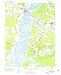 1942 Mardela Springs1962 Print · USGSMaryland's Eastern Shore during the early 1940s reveals a world of river-oriented necks and tidal marshlands. Genealogists can trace small settlements and river landings like Rabbit Town, Cherrywalk, and Jenkins Landing along the Nanticoke River.2 unique versions available
 - 1942 Map of Nanticoke, 1962 Print
 1942 Nanticoke1962 Print · USGSThe Chesapeake Bay shoreline in the early 1940s reveals a world of remote fishing villages and vast tidal marshes. You can trace the maritime layout of Nanticoke, Bivalve, and Elliott, or locate family landmarks like Ryles Hill and Nanticoke Wharf.
 - 1942 Map of Blackwater River, 1962 Print
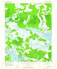
 1942 Blackwater River1962 Print · USGSDorchester County's intricate wetlands are captured in the early 1940s before modern development altered these tidewaters. Researchers can trace historical landings and small settlements like Shorters Wharf, Bucktown, and Between the Dams amid the sprawling Becker Island Marsh.2 unique versions available
 - 1942 Map of Chicamacomico, 1962 Print
 1942 Chicamacomico1962 Print · USGSDorchester County's intricate Eastern Shore waterways are captured here during the early 1940s, showing a world of isolated landings and marshland peninsulas. Genealogists and historians can locate family landmarks like Eagle Hall, the Bestpitch Ferry crossing, and rural congregations at Waters Ch.2 unique versions available
 - 1943 Map of Chicamacomico
 1943 Chicamacomico1943 Print · USGSDorchester County's river-laced landscape is captured here during the early 1940s, showing a world of tidal necks and isolated landings. Researchers can trace the heritage of Bestpitch and Cokeland, or locate family sites near Waters Church and Brick House Ldg.
 - 1943 Map of Mardela Springs
 1943 Mardela Springs1943 Print · USGSMaryland's Eastern Shore landscape is captured here in the early 1940s, where the winding Nanticoke River connects rural river towns and crossroads. Researchers can locate early landing sites and farmsteads at Ferry Pt, Rabbit Town, and Camphels Whf.
 - 1943 Map of Honga
 1943 Honga1943 Print · USGSChesapeake Bay island life is preserved on this mid-century survey of Dorchester County, Maryland. Genealogists and historians can trace family-named landings and points from Hoopersville to Lakesville, including the Cannery and Carrols Ldg.
 - 1943 Map of Richland Point
 1943 Richland Point1943 Print · USGSHooper Island and the surrounding Dorchester County marshes are shown in detail during the early 1940s. Genealogists and researchers can trace the coastal landscape around Applegarth, identify Mens Burial Pt, and locate family-named points like Nancys Pt.
 - 1943 Map of Barren Island
 1943 Barren Island1943 Print · USGSThe Chesapeake Bay shoreline of Dorchester County is captured here during the early war years, highlighting a fragile maritime landscape. Researchers can trace historic water navigation markers and coastal features like Barren Island, Cedar Point Lighthouse, and Meekins Neck.
 - 1943 Map of Sharps Island
 1943 Sharps Island1943 Print · USGSCoastal Dorchester County is captured during the early 1940s, showing a landscape of neck lands and island settlements. Genealogists and local historians can trace family locations near Hubbards Church, the Hudson School, and the remote James Island.
Showing maps 1-25 of 48
Top cities of Dorchester County
- Cambridge historical maps
- Hurlock historical maps
- Secretary historical maps
- Vienna historical maps
- East New Market historical maps
- Church Creek historical maps
See more
Frequently asked questions
- What are the different types of historical maps available for Dorchester County?
- What is the oldest map of Dorchester County?
- Where can I purchase historical maps of Dorchester County for my home or office?
- Where can I download high-res historical maps of Dorchester County?
- Are there historical topographic maps available for Dorchester County?
- Is there historical aerial imagery available for Dorchester County?
- Where are historical maps of Dorchester County sourced from?