Old Maps of Dorchester County, Maryland for Academic Research
Study the evolution of Dorchester County with 250 high-resolution historic maps. Whether you're teaching, researching, or modeling changes in land use, these maps provide essential visual documentation of urban, environmental, and geographic change.
- Analyze long-term change: Track patterns in development, transportation, and natural features.
- Ideal for environmental or urban studies: Support academic projects with primary historical map data.
- Use in the classroom or lab: Educators and researchers rely on these maps to bring historical context to life.
These maps are a powerful tool for teaching, research, and visualizing how Dorchester County has changed over the decades.
Dorchester County, MD maps
(250)- 1892 Map of Drum Point
 1892 Drum Point1892 Print · USGSThe lower Chesapeake Bay and Patuxent River shoreline appear here in the early 1890s, when maritime trade governed local life. Genealogists and historians can locate old post offices like Lusby and Jarboesville or trace the early waterfront at Solomon and Drum Pt. L.H.2 unique versions available
 - 1893 Map of Sharps Island
 1893 Sharps Island1893 Print · USGSThe Eastern Shore of Maryland is seen here in the 1890s, when Sharps Island and its lighthouse still commanded the mouth of the Choptank. Researchers can trace historic shorelines and early settlements like Tilghman and Neavitt before significant coastal erosion changed the bay.3 unique versions available
 - 1894 Map of Point Lookout
 1894 Point Lookout1894 Print · USGSSouthern St. Mary's County at the close of the nineteenth century was a world of landings and tidewater settlements. Researchers can trace historic river access at Bacon Wharf, locate the community of Ridge (Friendship), and study the shoreline of St. George Island.2 unique versions available
 - 1898 Map of Choptank
 1898 Choptank1898 Print · USGSThe Maryland Eastern Shore and its intricate Chesapeake coastline are documented here in the late 1890s. Genealogists can trace family roots in Annapolis or Easton, while maritime historians can locate historic landings such as Corners Wharf and Wye Landing.2 unique versions available
 - 1898 Map of St. Marys
 1898 St. Marys1898 Print · USGSMaryland's tidewater region is captured here in the late nineteenth century, showing the intricate geography of the lower Chesapeake. Genealogists can trace family roots through old landings and villages like Great Mills, Toddville, and Solomons.2 unique versions available
 - 1901 Map of Drum Point
 1901 Drum Point1901 Print · USGSThe maritime heart of the lower Chesapeake Bay comes alive in this turn-of-the-century survey of the Calvert and St. Mary’s coastline. Genealogists and historians can trace old landings and light stations like Millstone Landing, Spencers Wharf, and the Drum Pt. L.H. at the mouth of the Patuxent River.
 - 1903 Map of Nanticoke
 1903 Nanticoke1903 Print · USGSThe Nanticoke River and Fishing Bay define this era of Eastern Shore life at the opening of the twentieth century. Genealogists can trace family names at waterfront landings like Lewis Ldg. or find early rail connections at Vienna and Mardela Springs.4 unique versions available
 - 1903 Map of Bloodsworth Island
 1903 Bloodsworth Island1903 Print · USGSCoastal life in the Dorchester County marshes is preserved here at the turn of the century. Genealogists and maritime historians can trace the early layout of Applegarth and Holland Island alongside landmarks like Hooper Strait L.H.3 unique versions available
 - 1903 Map of Deal Island
 1903 Deal Island1903 Print · USGSSomerset County's coastal marshes and island communities come to life in this turn-of-the-century survey of the Chesapeake. Genealogists and maritime historians can trace family locations from DEAL ISLAND to Upper Fairmount, and locate early navigation aids like Great Shoals L.H. or the rail terminus at Hopewell.3 unique versions available
 - 1904 Map of Sharps Island
 1904 Sharps Island1904 Print · USGSThe Eastern Shore at the turn of the century shows a world of tidewater landings and island communities along the Choptank River. Genealogists and maritime historians can trace early settlements like Neavitt and Avalon, or locate the original site of the Sharps Island L.H.3 unique versions available
 - 1904 Map of Oxford
 1904 Oxford1904 Print · USGSCoastal Maryland at the start of the twentieth century was a world of steamships, rail landings, and tide-driven commerce. Genealogists can trace early homesteads and watermen's hubs near Cambridge, Oxford, and the landing at Trappe Ldg.3 unique versions available
 - 1905 Map of Crapo
 1905 Crapo1905 Print · USGSDorchester County at the turn of the century is a landscape of tide-water landings and island villages. Genealogists can trace family roots in Lakesville, Bucktown, and Hoopersville, or locate early maritime sites like Shorters Landing and the Steamboat Route.3 unique versions available
 - 1905 Map of Hurlock
 1905 Hurlock1905 Print · USGSDorchester and Caroline Counties thrive on a river-and-rail economy at the turn of the century. Genealogists can trace family roots through landings and crossings like Tennalls Wharf, Harrison Ferry, and the junction at Hurlock.3 unique versions available
 - 1905 Map of Drum Point
 1905 Drum Point1905 Print · USGSThe Chesapeake Bay shoreline at the turn of the century shows a landscape defined by deep-water landings and remote island settlements. Genealogists and maritime historians can trace early wharves and landings like Spencers Wharf, Millstone Landing, and the village of Solomons.4 unique versions available
 - 1906 Map of St. Marys
 1906 St. Marys1906 Print · USGSChesapeake Bay and the Potomac River converge in this 1906 survey of the Maryland and Virginia tidewater. Historians can trace the region's maritime heritage through dozens of named landings and islands, from Solomons Id. to the remote reaches of Smith Island.4 unique versions available
 - 1908 Map of Choptank
 1908 Choptank1908 Print · USGSMaryland's Eastern Shore and the Chesapeake Bay are captured here at the start of the twentieth century, showing a world of steamships and rail. Genealogists can trace family names at St Michaels, Oxford, and waterfront landings like Claiborne or Arundel on the Bay.5 unique versions available
 - 1912 Map of Point Lookout
 1912 Point Lookout1912 Print · USGSSouthern St. Mary's County appears here just after the turn of the century, showing a waterfront economy dependent on the river and bay. Genealogists and historians can trace family landings at Broomes Wharf and Miller Wharf or locate old settlements like St Inigoes and Great Mills.2 unique versions available
 - 1915 Map of Seaford
 1915 Seaford1915 Print · USGSCoastal Sussex County and the Maryland borderlands are seen here at a time when river traffic and rail lines were the lifeblood of the region. Researchers can trace the Steamboat Route up to Seaford or locate ancestral sites like Cannons Ferry and Cokesbury School.4 unique versions available
 - 1937 Map of Point Lookout, 1958 Print
 1937 Point Lookout1958 Print · USGSThe tip of St. Mary's County appears here in the late thirties, where the Potomac meets the Chesapeake. Genealogists can trace family footprints through historic landings like Broomes Wharf and settlements such as St Inigoes and Drayden.2 unique versions available
 - 1942 Map of Tilghman
 1942 Tilghman1942 Print · USGSChesapeake maritime life is captured here during the early war years, focusing on the communities of the Talbot County peninsula. Genealogists can trace family footprints through the Tilghman and Fairbank settlements, Peoples Chapel, and the Tilghman Island Landing.3 unique versions available
 - 1942 Map of Oxford
 1942 Oxford1942 Print · USGSThe Tred Avon and Choptank rivers dominate this coastal Maryland landscape during the early 1940s. Genealogists can trace family roots through the St Paul Church, John Wesley Church, and the Choptank River Lighthouse that guided local mariners.3 unique versions available
 - 1942 Map of Drum Point
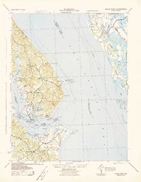 1942 Drum Point1942 Print · USGSThe Chesapeake Bay shoreline in the early 1940s reveals a world of maritime activity and isolated coastal communities. Genealogists and local historians can trace the foundations of Solomons, locate Spencers Wharf, and explore the marshes of Taylors Island.
 - 1942 Map of Kedges Straits, 1957 Print
 1942 Kedges Straits1957 Print · USGSThe mid-century Chesapeake Bay shoreline comes to life through the tidal guts and marshes of the Somerset County islands. Trace the old waterway navigation routes past Holland Island Bar Lighthouse, Solomons Lump Lighthouse, and the landings at Smith Island.
 - 1942 Map of Bloodsworth Island, 1957 Print
 1942 Bloodsworth Island1957 Print · USGSThe Dorchester County archipelago comes into focus during the early war years, revealing the complex marshes and tidal guts of the lower Chesapeake. Researchers can trace the maritime landscape of Bloodsworth Island and locate vanished landmarks like the Hooper Strait Lighthouse and the small settlement at Crocheron.
 - 1942 Map of Richland Point, 1957 Print
 1942 Richland Point1957 Print · USGSDorchester County's island communities are captured here during the 1940s, showing the delicate maritime landscape of the lower bay. Genealogists and historians can locate the small settlement at Applegarth and the family-named Mens Burial Pt on Lower Hooper Island.2 unique versions available
Showing maps 1-25 of 250
Top cities of Dorchester County
- Cambridge historical maps
- Hurlock historical maps
- Secretary historical maps
- Vienna historical maps
- East New Market historical maps
- Church Creek historical maps
See more
Frequently asked questions
- What are the different types of historical maps available for Dorchester County?
- What is the oldest map of Dorchester County?
- Where can I purchase historical maps of Dorchester County for my home or office?
- Where can I download high-res historical maps of Dorchester County?
- Are there historical topographic maps available for Dorchester County?
- Is there historical aerial imagery available for Dorchester County?
- Where are historical maps of Dorchester County sourced from?