1980s Maps of Dorchester County, Maryland
Explore 27 historic maps of Dorchester County from the 1980s. These maps offer a rare glimpse into what life looked like during the 1980s — showing old roads, neighborhoods, homes, and landmarks that have changed or disappeared over time.
Whether you're researching your family's past, planning a metal detecting trip, or studying how Dorchester County's landscape evolved across the 1980s, these high-resolution maps are a powerful tool for exploring the history of this region.
- Focus on a specific era: All maps on this page are from the 1980s, giving you a focused view of this time period.
- See what’s changed: Compare century-old streets, trails, and buildings to today's modern landscape using overlays and satellite layers.
- Research with precision: Use these maps for genealogy, historical research, land use analysis, or educational projects.
- View, download, or print: Maps are fully viewable online in high resolution, and can be downloaded or printed for your own records.
Start exploring Dorchester County's history through authentic maps from the 1980s. This is your window into the past.
Dorchester County, MD maps
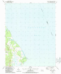
(27)- 1981 Map of Golden Hill, 1982 Print
 1981 Golden Hill1982 Print · USGSDorchester County's marshlands and coastal hamlets are captured here during the early eighties, showcasing the interface of land and water. Researchers can locate family landmarks like St Marys Star of the Sea Ch or trace the roads through Golden Hill and Woolford.2 unique versions available
 - 1982 Map of Church Creek
 1982 Church Creek1982 Print · USGSThe Dorchester County shoreline is revealed in this early 1980s survey, showing the intricate tidal necks and agricultural plots of the Eastern Shore. Trace local history at the St Johns Cem Chapel, or locate old crossroads in Cornersville and Dailsville.2 unique versions available
 - 1982 Map of Taylors Island
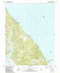
 1982 Taylors Island1982 Print · USGSThe Dorchester County coast is captured in the early eighties, showcasing the resilient island communities of the Maryland Eastern Shore. Genealogists can locate family landmarks like Bethlehem Ch, Smithville, and Old Trinity Cem among the marshlands.2 unique versions available
 - 1982 Map of Hudson
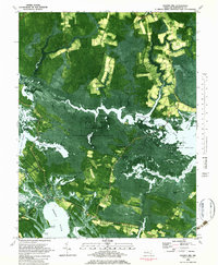
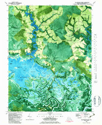
 1982 Hudson1982 Print · USGSDorchester County's shoreline and tidal flats are documented in high detail during the early eighties, capturing a landscape shaped by the Choptank River. Researchers can trace local history through the settlements of Hudson and Thomas or locate family cemeteries near Hills Point and Susquehanna Neck.
 - 1982 Map of Chicamacomico River, 1983 Print
 1982 Chicamacomico River1983 Print · USGSDorchester County's intricate shoreline and tidal marshes are captured here in the late seventies, showing a landscape defined by the Chicamacomico River. Researchers can locate family landmarks like Eagle Hall and Griffith Neck, or trace old landings at Cedar Landing and Brick House Landing.2 unique versions available
 - 1982 Map of East Of Point Lookout, 1983 Print
 1982 East Of Point Lookout1983 Print · USGSChesapeake Bay waters in the early 1980s are revealed in this detailed bathymetric study of the Maryland coast. Researchers can trace the submerged boundary between St Marys Co and Somerset Co and study the deep-water floor of the Chesapeake Bay.
 - 1982 Map of Blackwater River, 1983 Print
 1982 Blackwater River1983 Print · USGSThe Dorchester County wetlands come into sharp focus in the early eighties, showing a landscape defined by tidal guts and isolated landings. Trace family roots at Scotts Chapel or explore the river economy at Shorters Wharf and Barnes Landing.2 unique versions available
 - 1982 Map of Mardela Springs, 1983 Print
 1982 Mardela Springs1983 Print · USGSThe Eastern Shore's riverine culture is on full display in the early 1980s as the Nanticoke River winds through the Maryland marshlands. Genealogists and historians can trace the rural landscape from Mardela Springs to small settlements like Athol and Rewastico.
 - 1982 Map of Wingate, 1983 Print
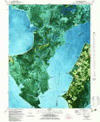
 1982 Wingate1983 Print · USGSDorchester County's marshy Chesapeake coastline is revealed in the early eighties as a network of tidal guts and small fishing settlements. Researchers can trace historic family locations in Wingate, Toddville, and Crapo, or locate the Ebenezer Ch and landings such as Wrights Landing.2 unique versions available
 - 1983 Map of Wetipquin
 1983 Wetipquin1983 Print · USGSThe Eastern Shore's river-driven geography is on full display here in the early 1980s. Genealogists and local historians can locate rural landmarks such as Whitehaven, Capitola, and the White Haven Church alongside the tidal reaches of the Wicomico River.
 - 1983 Map of Nanticoke
 1983 Nanticoke1983 Print · USGSThe marshes and maritime villages of the Chesapeake Bay's eastern shore are captured here in the early eighties. Researchers can trace land holdings and community sites near Nanticoke, the remote Elliott Island, and local landmarks like Elzey Ch and Roaring Point.
 - 1983 Map of Washington East, 1984 Print
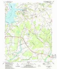
 1983 Washington East1984 Print · USGSThe Chesapeake Bay region in the early eighties shows the Maryland capital and its suburbs meeting the maritime traditions of the Eastern Shore. Researchers can trace land patterns from Andrews Air Force Base to waterfront settlements like Oxford and Chesapeake Beach.2 unique versions available
 - 1983 Map of Salisbury, 1984 Print
 1983 Salisbury1984 Print · USGSThe Lower Eastern Shore was a landscape of tide and timber in the early eighties, from the bustling streets of Salisbury to the wild coast of Assateague Island. Researchers can trace the rail-and-road network of the Conrail and U S Highway 50 while locating historic centers like Princess Anne and Crisfield.
 - 1983 Map of Leonardtown, 1984 Print
 1983 Leonardtown1984 Print · USGSSouthern Maryland and the Northern Neck of Virginia are shown in the early eighties as a mosaic of historic tidewater settlements and modern installations. Trace family roots and shoreline changes near St Marys City, Leonardtown, and Colonial Beach.2 unique versions available
 - 1984 Map of Barren Island
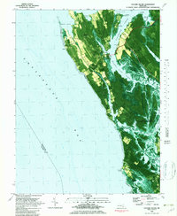
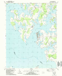
 1984 Barren Island1984 Print · USGSThe Dorchester County coastline in the mid-eighties shows a world of tidal marshes and remote island outposts. Trace the geography of Barren Island and its Landing Strip alongside the Cedar Point Lighthouse and Hooper Island Lighthouse.
 - 1984 Map of Honga
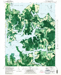
 1984 Honga1984 Print · USGSDorchester County's marshy estuaries and islands appear in detail in this mid-eighties survey. Genealogists and historians can trace the water-bound communities of Hoopersville and Lakesville, or locate landmarks like Hoopers Mem Church and The Canal.
 - 1984 Map of Seaford, 1986 Print
 1984 Seaford1986 Print · USGSCoastal Delaware and the Maryland borderlands are captured here in the mid-eighties as modern tourism and traditional agriculture coexist. Researchers can trace the rail-and-river routes through Seaford, explore inland millponds like Chipman Pond, or study the shoreline at Cape Henlopen.2 unique versions available
 - 1987 Map of Cove Point
 1987 Cove Point1987 Print · USGSMaryland's Chesapeake shoreline is captured here during a period of industrial expansion in the late eighties. Researchers can trace historic local congregations at Middleham Chapel and St Paul Ch, alongside the prominent Lighthouse at Cove Point.
 - 1987 Map of Point No Point
 1987 Point No Point1987 Print · USGSCoastal St. Mary's County appears in the late eighties as a landscape of interconnected tidal inlets and peninsulas. Researchers can trace local landmarks like St Jerome Beach, the community of Dameron, and the distinctive shoreline of Point No Point.
 - 1988 Map of Tilghman
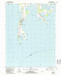 1988 Tilghman1988 Print · USGSTilghman Island and the surrounding Chesapeake shoreline appear in meticulous detail during the late eighties. Researchers can trace family history through the settlements of Tilghman and Avalon or locate landmarks like St Johns Ch and Knapps Narrows.2 unique versions available
 - 1988 Map of East New Market
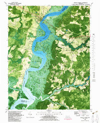
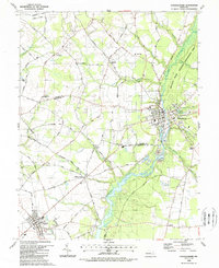
 1988 East New Market1988 Print · USGSDorchester County's Eastern Shore interior is captured in the late eighties, showing the traditional crossroads and river landings of the Chesapeake. Genealogists can trace family footprints at East New Market Cemetery, Friendship Church, and the settlement of Secretary.
 - 1988 Map of Preston
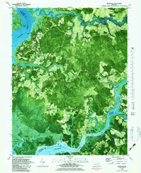
 1988 Preston1988 Print · USGSThe Maryland Eastern Shore in the 1980s is defined by its deep river bends and rural crossroads. Researchers can trace family history through the Maryland Veterans Cem (Eastern Shore) and local settlements like Linchester, Bruceville, and Preston.
 - 1988 Map of Oxford
 1988 Oxford1988 Print · USGSThe Tred Avon and Choptank rivers frame this detailed survey of Maryland's eastern shore in the late eighties. Genealogists can locate family landmarks like St Paul Ch and John Wesley Ch, or trace the legacy of the Old Railroad Grade.
 - 1988 Map of Federalsburg
 1988 Federalsburg1988 Print · USGSMaryland's Eastern Shore comes to life in the late eighties as the towns of Federalsburg and Hurlock anchor a landscape of creeks and crossroads. Trace family roots and local history through rural landmarks like Friendship Ch, Harrison Ferry Bridge, and Browns Landing.
 - 1988 Map of Cambridge
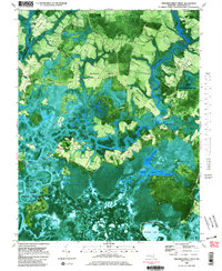
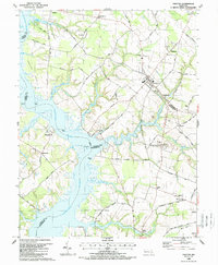
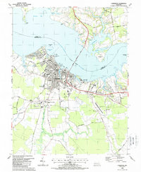 1988 Cambridge1988 Print · USGSThe Dorchester County shoreline and the city of Cambridge are captured here in the late eighties. Researchers can trace family history through sites like Bethel Cem, Maces Lane Middle Sch, and the outlying hamlet of Jacktown.
Showing maps 1-25 of 27
Top cities of Dorchester County
- Cambridge historical maps
- Hurlock historical maps
- Secretary historical maps
- Vienna historical maps
- East New Market historical maps
- Church Creek historical maps
See more
Frequently asked questions
- What are the different types of historical maps available for Dorchester County?
- What is the oldest map of Dorchester County?
- Where can I purchase historical maps of Dorchester County for my home or office?
- Where can I download high-res historical maps of Dorchester County?
- Are there historical topographic maps available for Dorchester County?
- Is there historical aerial imagery available for Dorchester County?
- Where are historical maps of Dorchester County sourced from?