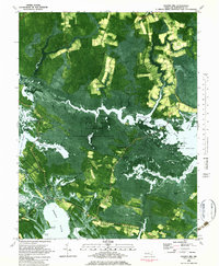
1981 Map of Golden Hill
USGS Topo · Published 1982About this map
Blackwater National Wildlife Refuge dominates this Dorchester County landscape, revealing an intricate network of marshes and tidal waterways as they appeared in the early 1980s. The geography is defined by the expansive Honga River and the winding Blackwater River, which carve out numerous necks and islands such as Wheatley Neck and Taylors Island. The map documents the persistent human presence within this water-logged environment, showing small communities like Golden Hill, Woolford, and Harrisville connected by roads that skirt the edge of Piney Swamp and Moneystump Swamp. Notable landmarks for local historians include St Marys Star of the Sea Ch near the southern coast and the South Dorchester Sch. This orthophotomap provides a clear view of the intersection between established settlements and the shifting marshlands of Great Marsh and Russell Swamp.
Find a feature on this map
66 named features on this map. Tap any name to fly to it.
Don’t see what you’re looking for? This feature index may not catch every label — zoom into the map to look around manually.
Map Details
Editions of this 1981 Golden Hill Map
2 editions found
Other maps of this area

1892 · Drum Point
USGS Topo · 1:62,500

1893 · Sharps Island
USGS Topo · 1:62,500

1898 · Choptank
USGS Topo · 1:125,000

1898 · St. Marys
USGS Topo · 1:125,000

1901 · Drum Point
USGS Topo · 1:62,500

1904 · Sharps Island
USGS Topo · 1:62,500

1904 · Oxford
USGS Topo · 1:62,500

1905 · Crapo
USGS Topo · 1:62,500

1905 · Drum Point
USGS Topo · 1:62,500

1906 · St. Marys
USGS Topo · 1:125,000