
1905 Map of Drum Point
USGS Topo · Published 1905About this map
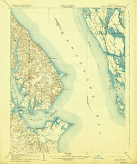
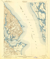
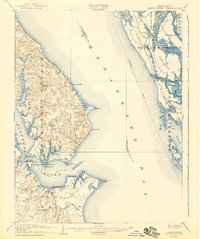
Solomons Id and the surrounding Chesapeake waterways dominate this 1905 turn-of-the-century maritime study. The landscape is defined by the deep-water access of the Patuxent River, where Spencers Wharf and Millstone Landing served as vital transfer points for the era's commerce. Across the Chesapeake Bay on the eastern shore, the intricate marshlands of Taylor Island and Robinson Neck are intricately mapped, showing the reliance on water transport before modern bridge networks transformed the region. Inland settlements like St. Leonard, Lusby, and Jarboesville are connected by a burgeoning road network, while the prominent Cove Point lighthouse site remains a critical navigational landmark. A notable Steamboat Route is marked cutting through the bay, illustrating the primary pulse of travel and trade that linked these isolated coastal communities during the early 1900s.
Find a feature on this map
66 named features on this map. Tap any name to fly to it.
Don’t see what you’re looking for? This feature index may not catch every label — zoom into the map to look around manually.
Map Details
Editions of this 1905 Drum Point Map
4 editions found
Other maps of this area

1892 · Leonardtown
USGS Topo · 1:62,500

1892 · Drum Point
USGS Topo · 1:62,500

1892 · Prince Frederick
USGS Topo · 1:62,500

1892 · Piney Point
USGS Topo · 1:62,500

1893 · Sharps Island
USGS Topo · 1:62,500

1894 · Piney Point
USGS Topo · 1:62,500

1894 · Point Lookout
USGS Topo · 1:62,500

1895 · Prince Frederick
USGS Topo · 1:62,500

1895 · Leonardtown
USGS Topo · 1:62,500

1895 · Nomini
USGS Topo · 1:125,000