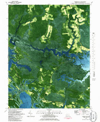
1981 Map of Golden Hill
USGS Topo · Published 1985About this map
Blackwater National Wildlife Refuge dominates this orthophotomap, showing the complex interaction of the Dorchester County landscape where tidal flats and marshes meet rural settlements. This 1981 survey reveals a world defined by its waterways, from the broad Honga River to the intricate reaches of Blackwater River and Meekins Creek. Small crossroads and inland hamlets like Golden Hill, Harrisville, and Riggins Corner are interspersed among extensive wetlands such as Moneystump Swamp and White Oak Swamp. The map provides specific locations for local landmarks like St Marys Star of the Sea Ch and South Dorchester Sch, which serve as anchors for the dispersed population. Aerial imagery integrated with topographic data highlights the transition from agricultural fields to the marshy necks of Wheatley Neck and Peters Neck, capturing the ecological and social character of the Eastern Shore during the early 1980s.
Find a feature on this map
65 named features on this map. Tap any name to fly to it.
Don’t see what you’re looking for? This feature index may not catch every label — zoom into the map to look around manually.
Map Details
Editions of this 1981 Golden Hill Map
2 editions found
Other maps of this area

1892 · Drum Point
USGS Topo · 1:62,500

1893 · Sharps Island
USGS Topo · 1:62,500

1898 · Choptank
USGS Topo · 1:125,000

1898 · St. Marys
USGS Topo · 1:125,000

1901 · Drum Point
USGS Topo · 1:62,500

1904 · Sharps Island
USGS Topo · 1:62,500

1904 · Oxford
USGS Topo · 1:62,500

1905 · Crapo
USGS Topo · 1:62,500

1905 · Drum Point
USGS Topo · 1:62,500

1906 · St. Marys
USGS Topo · 1:125,000