Old Maps of Harford County, Maryland for Metal Detecting
Plan your next treasure hunt with 135 historic maps of Harford County. Find old homesites, ghost towns, trails, and gathering spots that may be lost to time — perfect for identifying promising metal detecting locations.
- Locate forgotten sites: Uncover places like long-lost settlements, abandoned rail lines, or gathering spots.
- Plan better hunts: Use map overlays combined with LiDAR or satellite views to narrow in on historically rich areas.
- Made for detectorists: Thousands of hobbyists use these maps to discover relics, coins, and hidden history.
Use these historic maps to boost your research and find new opportunities beneath the surface of Harford County.
Harford County, MD maps
(135)- 1893 Map of Gunpowder
 1893 Gunpowder1893 Print · USGSMaryland's tidewater and interior rail corridors are captured here in the late nineteenth century as industry and agriculture intersected. Genealogists and historians can trace the development of Jerusalem Mills, the historic village of Joppa, and numerous stops along the Maryland Central Railroad.3 unique versions available
 - 1898 Map of Tolchester
 1898 Tolchester1898 Print · USGSThe upper Chesapeake Bay and its tidal tributaries are shown in the late 1890s, when steamships and railroads still dominated regional commerce. Trace the landings and rail stops that fueled the bay economy, from Buck Neck Landing to Stillpond Sta. and the historic Harford Furnace.
 - 1900 Map of Havre De Grace
 1900 Havre De Grace1900 Print · USGSThe Susquehanna River valley at the turn of the century shows a landscape transitioning from the canal era to the railroad age. Genealogists and historians can trace defunct transport routes like the Tidewater Canal alongside active hubs like Rising Sun and Port Deposit.7 unique versions available
 - 1900 Map of Betterton
 1900 Betterton1900 Print · USGSThe Upper Chesapeake Bay at the turn of the century reveals a landscape of thriving steamboat wharves and primary rail corridors. Local historians can trace early landings and forgotten infrastructure at Harris Wharf, Gales Whf., and the Fishing Battery L.H.6 unique versions available
 - 1900 Map of Parkton
 1900 Parkton1900 Print · USGSThe Pennsylvania-Maryland borderlands in the early 1900s were defined by the busy Northern Central RR and the many mills along Gunpowder Falls. Researchers can trace old family locales and crossroads like Philopolis, Mount Carmel Ch, and Gorsuchs Mills.
 - 1901 Map of Belair
 1901 Belair1901 Print · USGSThe Harford County borderlands at the start of the twentieth century show a landscape defined by rail corridors and early mining. Genealogists can trace family names and small settlements along the Maryland and Pennsylvania RR, such as Fawn Grove, McIntyre Minefield, and Delta.7 unique versions available
 - 1901 Map of Gunpowder
 1901 Gunpowder1901 Print · USGSCoastal Baltimore and Harford Counties are captured here at the turn of the century as the Chesapeake shoreline met a growing rail network. Genealogists and historians can trace old homesteads and landings near Abingdon, Joppa, and the Battle Monument.7 unique versions available
 - 1902 Map of Parkton
 1902 Parkton1902 Print · USGSMaryland and Pennsylvania borders were still defined by active rail and milling economies when this survey was completed. Genealogists can trace family homesteads near Gorsuchs Mills, the Northern Central R.R. corridor, and the historic Maryland Line.7 unique versions available
 - 1903 Map of Tolchester
 1903 Tolchester1903 Print · USGSThe upper Chesapeake Bay at the turn of the century shows a bustling maritime landscape where steamship wharves and major rail lines met. Researchers can trace defunct stops like Baldwin Sta. and Clayton Sta. or locate historic landings such as Rockhall Landing and Quaker Wharf.
 - 1908 Map of Tolchester
 1908 Tolchester1908 Print · USGSChesapeake Bay life at the turn of the century centered on a complex network of tidewater landings and strategic railroad lines. Researchers can trace historic family settlements and maritime landmarks like Fort Howard, Harford Furnace, and the Sevenfoot Knoll LH.4 unique versions available
 - 1941 Map of Gunpowder
 1941 Gunpowder1941 Print · USGSThe Chesapeake tidewater and the Gunpowder River valley are caught in their pre-war rural state in this early 1940s survey. Researchers can trace the paths of the P.R.R. System and locate historic sites like Harford Furnace and Osbornes Ruins.
 - 1942 Map of Havre De Grace
 1942 Havre De Grace1942 Print · USGSThe Susquehanna riverfront and Mason-Dixon borderlands are captured here in the early 1940s, just as modern infrastructure began to reshape the region. Genealogists can trace family roots through landmarks like Smith Chapel, Lees Mill, and the Brookview Cem near Rising Sun.4 unique versions available
 - 1942 Map of Bel Air
 1942 Bel Air1942 Print · USGSHarford and York counties at the start of the 1940s show a landscape shaped by the Maryland and Pennsylvania R.R. and deep-cut creek valleys. Trace the local rail-and-mill economy through Clermont Mills, Whiteford, and the village of Delta near the state line.
 - 1944 Map of Norrisville
 1944 Norrisville1944 Print · USGSMaryland and Pennsylvania borderlands meet along the Mason and Dixon Line during the mid-1940s. Genealogists and researchers can trace rural life through landmarks like Ivory Mill, Ebaughs School, and the McKendree Church.
 - 1944 Map of Phoenix
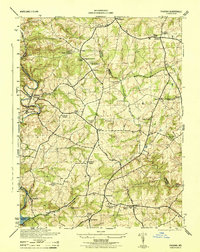 1944 Phoenix1944 Print · USGSBaltimore and Harford counties meet here during the mid-1940s, a landscape of historic manors and river-driven commerce. Genealogists can trace family roots through numerous country parishes like Clynmalira Church and small rural hubs like Monkton and Jacksonville.
 - 1944 Map of Hanesville
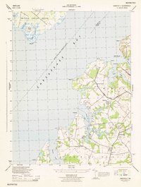 1944 Hanesville1944 Print · USGSCoastal Kent County appears in the mid-1940s as a landscape of rural crossroads and tidal creeks along the Chesapeake. Genealogists and local historians can trace family land across Fairlee Neck or locate community landmarks like St Georges Ch and Melitota.
 - 1944 Map of Perryman
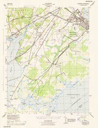 1944 Perryman1944 Print · USGSHarford County's coastal and military landscape is captured here during the height of the Second World War. Genealogists and historians can trace the intersection of family homesteads and military expansion near Perryman, the Harford Furnace School, and Spesutie Church.
 - 1944 Map of Spesutie
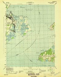 1944 Spesutie1944 Print · USGSCoastal Harford and Cecil Counties are seen here during the mid-forties, balanced between military expansion and traditional maritime life. Researchers can trace the boundaries of Aberdeen Proving Ground or locate family landmarks like Turkey Point LH and Woodcrest.
 - 1945 Map of Bel Air
 1945 Bel Air1945 Print · USGSThe Maryland-Pennsylvania borderlands are captured here at the end of the war, centered on the winding Maryland and Pennsylvania R. R. corridor. Genealogists and historians can trace the early layout of Whiteford, Delta, and Clermont Mills as they appeared in the mid-1940s.
 - 1948 Map of Baltimore
 1948 Baltimore1948 Print · USGSMaryland and Pennsylvania crossroads are captured in the late 1940s, showing a landscape defined by historic rail lines and major military installations. Genealogists can trace family connections in Gettysburg, Westminster, and near the U.S. Naval Academy in Annapolis.2 unique versions available
 - 1948 Map of Belair
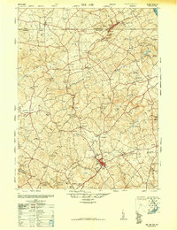 1948 Belair1948 Print · USGSHarford County and southern York County appear at a mid-century crossroads as the post-war era begins. Researchers can trace the winding Maryland and Pennsylvania railroad, find several dozen country churches, and locate industrial relics like the Talc (Abandoned) mine.2 unique versions available
 - 1948 Map of Perryman
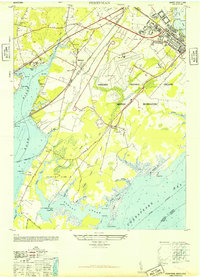 1948 Perryman1948 Print · USGSHarford County is captured in the late 1940s as military expansion reshapes the Chesapeake shoreline. Genealogists and historians can trace the foundations of Old Baltimore, the historic Spesutie Church, and the rural community of Perryman before modern suburban growth.5 unique versions available
 - 1948 Map of Spesutie
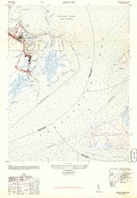 1948 Spesutie1948 Print · USGSThe Upper Chesapeake Bay comes alive in the late 1940s, showing the intersection of military testing grounds and quiet coastal necks. Trace the infrastructure of the Aberdeen Proving Ground or locate the lighthouse at Turkey Point and the small settlement of Grove.4 unique versions available
 - 1948 Map of Hanesville, 1985 Print
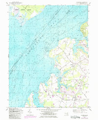 1948 Hanesville1985 Print · USGSKent County's eastern shore comes to life in the mid-century, showing a world of deep-water necks and agricultural landings. Genealogists can trace family roots through St James Church, the settlement at Hanesville, and historic sites like Buck Neck Landing.2 unique versions available
 - 1949 Map of Perryman
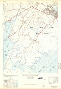 1949 Perryman1949 Print · USGSHarford County's coastal military and rail corridors are captured in detail just after the Second World War. Researchers can trace the layout of the Aberdeen Proving Ground, locate the historic Spesutie Church, and find the site of Old Baltimore along the Bush River.
Showing maps 1-25 of 135
Top cities of Harford County
- Edgewood historical maps
- Forest Hill historical maps
- Aberdeen historical maps
- Havre de Grace historical maps
- Bel Air historical maps
- Fallston historical maps
See more
Frequently asked questions
- What are the different types of historical maps available for Harford County?
- What is the oldest map of Harford County?
- Where can I purchase historical maps of Harford County for my home or office?
- Where can I download high-res historical maps of Harford County?
- Are there historical topographic maps available for Harford County?
- Is there historical aerial imagery available for Harford County?
- Where are historical maps of Harford County sourced from?