1940s Maps of Lynch, Maryland
Explore 3 historic maps of Lynch from the 1940s. These maps offer a rare glimpse into what life looked like during the 1940s — showing old roads, neighborhoods, homes, and landmarks that have changed or disappeared over time.
Whether you're researching your family's past, planning a metal detecting trip, or studying how Lynch's landscape evolved across the 1940s, these high-resolution maps are a powerful tool for exploring the history of this region.
- Focus on a specific era: All maps on this page are from the 1940s, giving you a focused view of this time period.
- See what’s changed: Compare century-old streets, trails, and buildings to today's modern landscape using overlays and satellite layers.
- Research with precision: Use these maps for genealogy, historical research, land use analysis, or educational projects.
- View, download, or print: Maps are fully viewable online in high resolution, and can be downloaded or printed for your own records.
Start exploring Lynch's history through authentic maps from the 1940s. This is your window into the past.
Lynch, MD maps
(3)- 1944 Map of Betterton
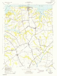 1944 Betterton1944 Print · USGSKent County's shoreline and agricultural interior are captured here during the mid-1940s, showing a landscape of tidal marshes and rail-linked hamlets. Genealogists can trace family footprints through sites like Butlertown, Mt Zion Ch, and Harris Wharf.
 - 1948 Map of Baltimore
 1948 Baltimore1948 Print · USGSMaryland and Pennsylvania crossroads are captured in the late 1940s, showing a landscape defined by historic rail lines and major military installations. Genealogists can trace family connections in Gettysburg, Westminster, and near the U.S. Naval Academy in Annapolis.2 unique versions available
 - 1948 Map of Betterton
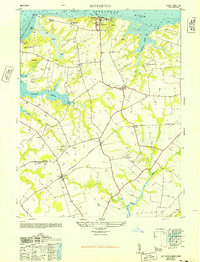 1948 Betterton1948 Print · USGSCoastal Maryland life meets the rails in the late 1940s, where the Sassafras River joins the Chesapeake. Genealogists can trace family names and local sites from Harris Wharf and Betterton to inland depots at Stillpond Station and Worton.4 unique versions available
End of results
Showing maps 1-3 of 3
Top cities near Lynch
- Aberdeen historical maps
- Chestertown historical maps
- Aberdeen Proving Ground historical maps
- Kingstown historical maps
- Rock Hall historical maps
- Cecilton historical maps
See more
Frequently asked questions
- What are the different types of historical maps available for Lynch?
- What is the oldest map of Lynch?
- Where can I purchase historical maps of Lynch for my home or office?
- Where can I download high-res historical maps of Lynch?
- Are there historical topographic maps available for Lynch?
- Is there historical aerial imagery available for Lynch?
- Where are historical maps of Lynch sourced from?