Old Maps of Palmers, Maryland for Genealogy
Trace your family roots with 20 historic maps of Palmers. These high-res maps reveal old neighborhoods, homesites, landmarks, and streets — helping you uncover where your ancestors lived and how the area evolved over time.
- Explore historic neighborhoods: Identify where your relatives may have lived in the 1800s or 1900s.
- Compare maps over time: Trace the changes in streets, buildings, and landmarks for multi-generational research.
- Perfect for genealogy & ancestry research: Used by family historians and researchers to map out lineage and migration.
These maps are an incredible resource for exploring your personal connection to Palmers's past.
Palmers, MD maps
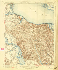
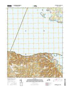
(20)- 1892 Map of Montross
 1892 Montross1892 Print · USGSThe Northern Neck of Virginia is shown here in the 1890s, when life revolved around the deep waters of the Potomac and Rappahannock. Genealogists can trace old family landing sites and settlements such as Montross, Stratford, and Potomac Mills.5 unique versions available
 - 1895 Map of Nomini
 1895 Nomini1895 Print · USGSSouthern Maryland and the Virginia tidewater shores meet along the Potomac in this late nineteenth-century survey. Genealogists can trace family holdings and river landings from Charlotte Hall down to Sotterly and the Nomini Ferry.
 - 1895 Map of Montross
 1895 Montross1895 Print · USGSWestmoreland and Richmond counties are shown in the 1890s as a thriving river-based economy on the Northern Neck peninsula. Genealogists and historians can trace family-named landings and settlements like Wirt Wharf, Montross, and Potomac Mills.2 unique versions available
 - 1898 Map of Nomini
 1898 Nomini1898 Print · USGSMaryland and Virginia's Tidewater region comes alive in the late nineteenth century as a world of river landings, rail terminals, and rural crossroads. Researchers can trace the maritime economy through Nomini Ferry and Stone Wharf, or locate ancestral homesteads near Charlotte Hall and Potomac Mills.5 unique versions available
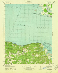
 - 1930 Map of Wakefield
 1930 Wakefield1930 Print · USGSWestmoreland County and the Northern Neck appear here in the early thirties, defined by a historic riverfront landscape and rural hamlets. Researchers can locate the Birthplace of Washington and Monroe Birthplace alongside old river ports like Leedstown and Steve Landing.
 - 1932 Map of Wakefield
 1932 Wakefield1932 Print · USGSWestmoreland County at the start of the 1930s shows a landscape defined by the great bends of the Potomac and Rappahannock Rivers. Researchers can trace ancestral locations near the George Washington Birthplace or find local landmarks like Potomac Mills and Monroe Hall.2 unique versions available
 - 1943 Map of Stratford
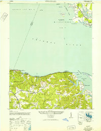
 1943 Stratford1943 Print · USGSMaryland and Virginia shorelines meet along the Potomac River in the early 1940s, highlighting the historic grounds of Stratford Hall. Genealogists and local historians can trace family-named sites like Goodrich Farm, Currioman Farm, and the riverside community of Colton.
 - 1946 Map of Stratford, 1952 Print
 1946 Stratford1952 Print · USGSThe Potomac River divides Maryland and Virginia in the mid-1940s, revealing a landscape of historic plantations and river landings. Researchers can trace the grounds of Stratford Hall or locate vanished sites like Hill School and Mt Airy Wharf.
 - 1948 Map of Washington
 1948 Washington1948 Print · USGSThe Potomac and Chesapeake regions in the late 1940s reveal a landscape of expanding military reach and deep-rooted Tidewater settlements. Trace old rail corridors like the Richmond Fredericksburg & Potomac RR or locate landmarks like the Wakefield Washington Monument and St. Marys College.2 unique versions available
 - 1957 Map of Washington, 1966 Print
 1957 Washington1966 Print · USGSThe mid-Atlantic region during the mid-fifties and early sixties reveals a landscape of growing suburbs and vital military outposts. Researchers can trace historic river towns and shorelines from Alexandria to the Hooper Islands and St Clements Island.5 unique versions available
 - 1961 Map of Washington
 1961 Washington1961 Print · USGSThe mid-Atlantic region in the late fifties is presented in remarkable detail, from the Blue Ridge foothills to the Chesapeake Eastern Shore. Researchers can trace historic river landings and military sites like Mount Vernon, Fort Belvoir, and Point Lookout.2 unique versions available
 - 1968 Map of Stratford Hall, 1974 Print
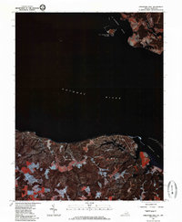
 1968 Stratford Hall1974 Print · USGSThe Westmoreland County shoreline comes alive in the late sixties, showcasing the historic Lee estate and the river-dependent life of the Northern Neck. Researchers can trace land use from Stratford Hall to the riverfront at Currioman Landing and Coltons Point.2 unique versions available
 - 1981 Map of Stratford Hall, 1985 Print
 1981 Stratford Hall1985 Print · USGSThe Potomac River tidewater region is captured in the early 1980s through high-altitude aerial photography. Researchers can trace the wooded shorelines near Stratford Hall or examine the Maryland docks and marshes at Coltons Point.2 unique versions available
 - 1983 Map of Leonardtown, 1984 Print
 1983 Leonardtown1984 Print · USGSSouthern Maryland and the Northern Neck of Virginia are shown in the early eighties as a mosaic of historic tidewater settlements and modern installations. Trace family roots and shoreline changes near St Marys City, Leonardtown, and Colonial Beach.2 unique versions available
 - 1989 Map of Washington
 1989 Washington1989 Print · USGSThe Potomac River valley and Chesapeake Bay are shown in comprehensive detail during the late 1980s. Genealogists and historians can trace the transition from urban Alexandria to the rural Northern Neck, locating landmarks like Mount Vernon and Stratford Hall.
 - 2011 Map of Stratford Hall, 2011 Print
 2011 Stratford Hall2011 Print · USGSCovers Palmers, including Bryant Town, Chiltons, and other nearby areas
 - 2013 Map of Stratford Hall, 2013 Print
 2013 Stratford Hall2013 Print · USGSCovers Palmers, including Bryant Town, Chiltons, and other nearby areas
 - 2016 Map of Stratford Hall, 2016 Print
 2016 Stratford Hall2016 Print · USGSCovers Palmers, including Bryant Town, Chiltons, and other nearby areas
 - 2019 Map of Stratford Hall, 2019 Print
 2019 Stratford Hall2019 Print · USGSCovers Palmers, including Bryant Town, Chiltons, and other nearby areas
 - 2022 Map of Stratford Hall, 2022 Print
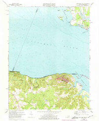
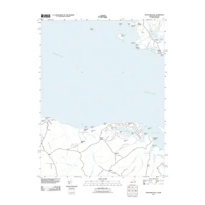
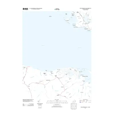
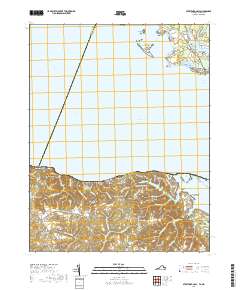
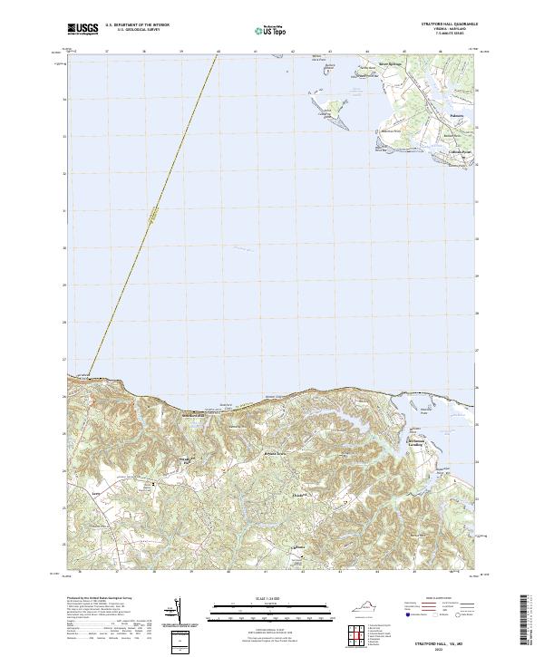 2022 Stratford Hall2022 Print · USGSThe Potomac River shoreline near the Westmoreland cliffs appears in this recent survey, capturing the rural character of Virginia's Northern Neck. Researchers can trace historic family landmarks such as Stratford Hall, Currioman Landing, and the Shiloh Baptist Church Cem.
End of results
Showing maps 1-20 of 20
Top cities near Palmers
- Lexington Park historical maps
- Wildewood historical maps
- Colonial Beach historical maps
- Leonardtown historical maps
- Mechanicsville historical maps
- Cobb Island historical maps
See more
Frequently asked questions
- What are the different types of historical maps available for Palmers?
- What is the oldest map of Palmers?
- Where can I purchase historical maps of Palmers for my home or office?
- Where can I download high-res historical maps of Palmers?
- Are there historical topographic maps available for Palmers?
- Is there historical aerial imagery available for Palmers?
- Where are historical maps of Palmers sourced from?