Old Maps of Piney Island, Maryland for Academic Research
Study the evolution of Piney Island with 19 high-resolution historic maps. Whether you're teaching, researching, or modeling changes in land use, these maps provide essential visual documentation of urban, environmental, and geographic change.
- Analyze long-term change: Track patterns in development, transportation, and natural features.
- Ideal for environmental or urban studies: Support academic projects with primary historical map data.
- Use in the classroom or lab: Educators and researchers rely on these maps to bring historical context to life.
These maps are a powerful tool for teaching, research, and visualizing how Piney Island has changed over the decades.
Piney Island, MD maps
(19)- 1901 Map of Ocean City
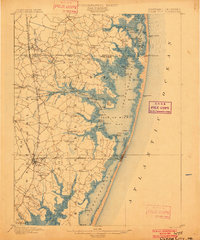 1901 Ocean City1901 Print · USGSThe Maryland and Delaware coastlines were still largely defined by maritime labor and new rail lines at the turn of the century. You can trace the early streets of Ocean City and Berlin or locate landmarks like the Fenwick Island Lighthouse and Muskrattown.5 unique versions available
 - 1942 Map of Ocean City
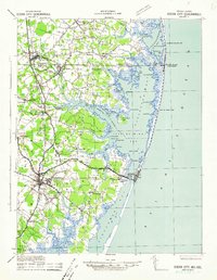 1942 Ocean City1942 Print · USGSThe Maryland and Delaware coastline at the onset of the 1940s reveals a region of tidal bays and rail-dependent coastal towns. Genealogists and historians can trace family roots in early settlements like Berlin, Sinepuxent, and Bishopville or locate maritime landmarks including Fenwick Island Lighthouse.2 unique versions available
 - 1943 Map of Selbyville
 1943 Selbyville1943 Print · USGSDelaware and Maryland borderlands come to life in this mid-century survey of the Selbyville area, showing the region just as wartime mapping efforts reached their peak. Genealogists can trace family footprints through historic centers like Bishopville, Showell, and St Martins Church.2 unique versions available
 - 1946 Map of Salisbury, 1948 Print
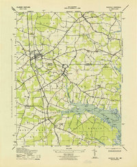
 1946 Salisbury1948 Print · USGSThe Delmarva Peninsula in the late nineteen-forties shows a landscape defined by its deep river arteries and emerging coastal defenses. Genealogists and historians can trace rail-connected towns like Federalsburg or locate maritime landmarks such as the Ocean City Seaplane Base and Fort Miles Military Reservation.4 unique versions available
 - 1947 Map of Salisbury, 1948 Print
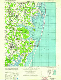
 1947 Salisbury1948 Print · USGSThe Delmarva Peninsula in the late forties reveals a coastal landscape of maritime defense and growing seaside towns. Trace the post-war footprint of Salisbury, the strategic Fort Miles Military Reservation, and the Ocean City Seaplane Base.
 - 1948 Map of Salisbury, 1951 Print
 1948 Salisbury1951 Print · USGSThe Delmarva Peninsula in the late 1940s is shown here as a busy network of rail-towns and coastal outposts. Researchers can trace the legacy of the Pennsylvania Railroad through inland hubs like Georgetown or the maritime reaches of Crisfield and Cape May.
 - 1957 Map of Salisbury
 1957 Salisbury1957 Print · USGSThe Delmarva Peninsula in the mid-1950s reveals a landscape of coastal defenses and rail-driven commerce. Researchers can trace the Pennsylvania railroad lines or locate historic landmarks like the Fenwick Island Lighthouse and St Martin church.
 - 1961 Map of Ocean City
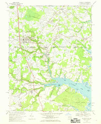
 1961 Ocean City1961 Print · USGSThe Maryland and Delaware coastlines come alive in this mid-century survey of the barrier islands and quiet inland towns. Genealogists and historians can trace the early layout of Ocean City and Berlin, or locate vanished rail stops along the Philadelphia Wilmington and Baltimore RR.
 - 1961 Map of Salisbury
 1961 Salisbury1961 Print · USGSThe Delmarva Peninsula comes into focus in the early sixties, showing the vital road and rail networks connecting the Chesapeake to the Atlantic. Genealogists and historians can trace family-named landings and coastal landmarks from Crisfield to the Brandywine Shoal Lighthouse.
 - 1965 Map of Salisbury
 1965 Salisbury1965 Print · USGSThe Delmarva Peninsula in the mid-1960s is depicted here as a landscape of coastal defenses and maritime hubs. Genealogists and local historians can trace the foundations of bayside towns like Crisfield and the tactical positioning of the Fort Miles Military Reservation and Cape May Naval Air Station.
 - 1967 Map of Selbyville, 1969 Print
 1967 Selbyville1969 Print · USGSThe Delaware-Maryland border region near Selbyville comes to life in the late 1960s, showing a landscape of rail-linked towns and tidal creeks. Genealogists can locate family landmarks like Old St Martins Ch, Showell Sch, and the Wilgus Cem.3 unique versions available
 - 1980 Map of Selbyville, 1982 Print
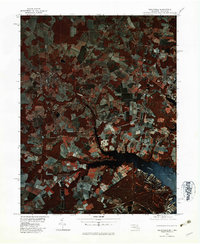 1980 Selbyville1982 Print · USGSThe Delaware-Maryland borderlands appear in striking infrared detail during the early 1980s, showing a landscape defined by traditional agriculture and winding waterways. Researchers can trace the rural layouts of Selbyville, Bishopville, and Roxana as they existed forty years ago.
 - 1983 Map of Salisbury, 1984 Print
 1983 Salisbury1984 Print · USGSThe Lower Eastern Shore was a landscape of tide and timber in the early eighties, from the bustling streets of Salisbury to the wild coast of Assateague Island. Researchers can trace the rail-and-road network of the Conrail and U S Highway 50 while locating historic centers like Princess Anne and Crisfield.
 - 1992 Map of Selbyville
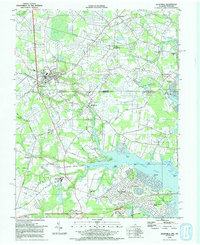 1992 Selbyville1992 Print · USGSThe Delaware-Maryland border region near Selbyville is captured in the early nineties as modern residential growth meets rural crossroads. Trace family history at Old St Martins Ch or explore the tidal reaches of the St Martin River and Shingle Landing Prong.
 - 2011 Map of Selbyville, 2011 Print
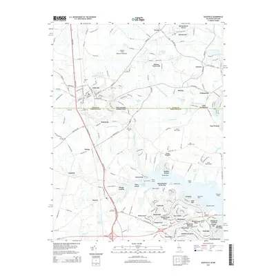
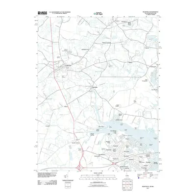 2011 Selbyville2011 Print · USGSCovers Piney Island, including Ocean Pines, Selbyville, and other nearby areas
 - 2014 Map of Selbyville, 2014 Print
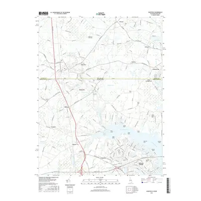
 2014 Selbyville2014 Print · USGSCovers Piney Island, including Ocean Pines, Selbyville, and other nearby areas
 - 2016 Map of Selbyville, 2016 Print
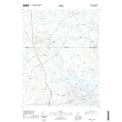
 2016 Selbyville2016 Print · USGSCovers Piney Island, including Ocean Pines, Selbyville, and other nearby areas
 - 2019 Map of Selbyville, 2019 Print
 2019 Selbyville2019 Print · USGSCovers Piney Island, including Ocean Pines, Selbyville, and other nearby areas
 - 2023 Map of Selbyville, 2023 Print
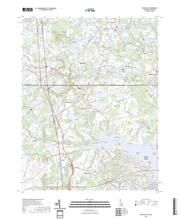 2023 Selbyville2023 Print · USGSThe Delaware-Maryland border country comes into focus in this recent survey of Sussex and Worcester counties. Researchers can trace family history through a dense network of local landmarks, including the Old Sound Methodist Church, Showell School, and Red Men Cem.
End of results
Showing maps 1-19 of 19
Top cities near Piney Island
- Ocean Pines historical maps
- Ocean City historical maps
- West Ocean City historical maps
- Berlin historical maps
- Millsboro historical maps
- Selbyville historical maps
See more
Frequently asked questions
- What are the different types of historical maps available for Piney Island?
- What is the oldest map of Piney Island?
- Where can I purchase historical maps of Piney Island for my home or office?
- Where can I download high-res historical maps of Piney Island?
- Are there historical topographic maps available for Piney Island?
- Is there historical aerial imagery available for Piney Island?
- Where are historical maps of Piney Island sourced from?