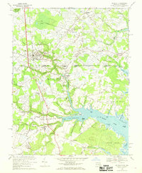
1967 Map of Selbyville
USGS Topo · Published 1969About this map
Selbyville sits as a central hub at the intersection of the Penn Central railroad and the Maryland-Delaware state line. In the late 1960s, this border region remained deeply rural, defined by intricate tidal waterways like the St Martin River and its numerous branches, including Shingle Landing Prong and Slab Bridge Prong. The presence of Old St Martins Ch and several smaller community churches such as Ebenezer Ch and Wilson Ch points to long-established rural settlements that predated the coastal development of the neighboring Atlantic shore.
Find a feature on this map
83 named features on this map. Tap any name to fly to it.
Don’t see what you’re looking for? This feature index may not catch every label — zoom into the map to look around manually.
Map Details
Editions of this 1967 Selbyville Map
3 editions found
Other maps of this area

1901 · Ocean City
USGS Topo · 1:62,500

1902 · Pittsville
USGS Topo · 1:62,500

1917 · Millsboro
USGS Topo · 1:62,500

1918 · Rehoboth
USGS Topo · 1:62,500

1938 · Millsboro
USGS Topo · 1:62,500

1938 · Rehoboth
USGS Topo · 1:62,500

1942 · Ocean City
USGS Topo · 1:62,500

1942 · Ninepin
USGS Topo · 1:24,000

1942 · Ocean City
USGS Topo · 1:24,000

1942 · Whaleysville
USGS Topo · 1:24,000