1940s Maps of Bristol County, Massachusetts
Explore 48 historic maps of Bristol County from the 1940s. These maps offer a rare glimpse into what life looked like during the 1940s — showing old roads, neighborhoods, homes, and landmarks that have changed or disappeared over time.
Whether you're researching your family's past, planning a metal detecting trip, or studying how Bristol County's landscape evolved across the 1940s, these high-resolution maps are a powerful tool for exploring the history of this region.
- Focus on a specific era: All maps on this page are from the 1940s, giving you a focused view of this time period.
- See what’s changed: Compare century-old streets, trails, and buildings to today's modern landscape using overlays and satellite layers.
- Research with precision: Use these maps for genealogy, historical research, land use analysis, or educational projects.
- View, download, or print: Maps are fully viewable online in high resolution, and can be downloaded or printed for your own records.
Start exploring Bristol County's history through authentic maps from the 1940s. This is your window into the past.
Bristol County, MA maps
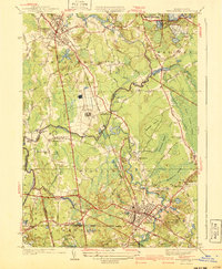
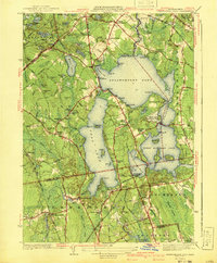
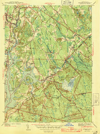
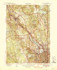
(48)- 1940 Map of Wrentham
 1940 Wrentham1940 Print · USGSNorfolk County in the late 1930s shows a landscape of busy mill villages and expanding state institutions. Genealogists can trace family roots through the Bacon Cem, Quaker Cem, and local schools like Vogel Sch and Everett Sch.2 unique versions available
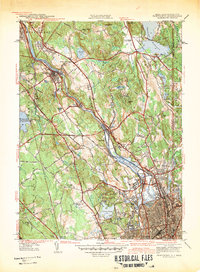
 - 1940 Map of Bridgewater
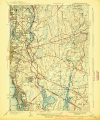
 1940 Bridgewater1940 Print · USGSSoutheastern Massachusetts at the dawn of the 1940s reveals a landscape shaped by state institutions and the cranberry industry. Researchers can trace family sites near The Green, find the Fair Grounds, or locate old schoolhouses like the Pleasant Street School.3 unique versions available
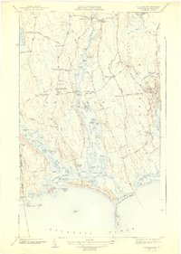
 - 1940 Map of Sconticut Neck
 1940 Sconticut Neck1940 Print · USGSCoastal Fairhaven and its surrounding islands appear here in the mid-1930s, showing the early layout of the peninsula and its maritime borders. Trace the path of Sconticut Neck Road to the tip at Sconticut Point or explore the shores of West Island.3 unique versions available
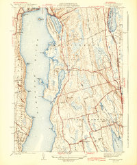
 - 1941 Map of Marion
 1941 Marion1941 Print · USGSThe Buzzards Bay coastline flourished in the late 1930s with a blend of maritime education, rail commerce, and seaside recreation. Genealogists and historians can trace family burial sites at Barlow Cem, locate the landmark Tabor Academy, and follow the New York New Haven and Hartford railroad.3 unique versions available
 - 1941 Map of East Providence
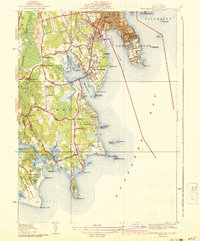
 1941 East Providence1941 Print · USGSThe Rhode Island and Massachusetts borderlands show a unique mix of urban growth and coastal tradition in the late 1930s. Researchers can trace family roots through numerous local landmarks like Newman Ave Sch, Hurst Cemetery, and the Narragansett Race Track.3 unique versions available
 - 1941 Map of New Bedford South
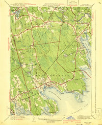
 1941 New Bedford South1941 Print · USGSCoastal Massachusetts at the start of the 1940s reveals a landscape of harbor defenses, seaside villages, and rural schools. Researchers can trace historic family-named landmarks and institutions like Fort Phoenix, St Johns Ch, and the Padanaram Breakwater.3 unique versions available
 - 1941 Map of New Bedford North
 1941 New Bedford North1941 Print · USGSIn the early 1940s, the New Bedford waterfront was a complex network of rail and industry. Trace the historic neighborhoods of Fairhaven and Acushnet, locating family landmarks like St Marys Cem or the Evergreen Racetrack.3 unique versions available
 - 1941 Map of Mansfield
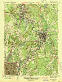
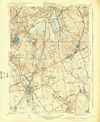 1941 Mansfield1941 Print · USGSThe Norfolk and Bristol county borderlands are shown here just before the mid-century suburban boom, centered on the New York New Haven and Hartford rail corridor. Genealogists and historians can locate old rural corners like Ginty Corner and school sites such as the Poquanticut Sch.3 unique versions available
 - 1941 Map of Brockton
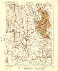 1941 Brockton1941 Print · USGSSoutheastern Massachusetts is captured here in the early 1940s, showing the dense rail-centered growth of the region. Researchers can trace historic family landmarks and institutional sites like the Howard Seminary, St Patrick Cem, and Easton Sta.3 unique versions available
 - 1941 Map of Assawompset Pond
 1941 Assawompset Pond1941 Print · USGSSoutheastern Massachusetts in the early 1940s is defined here by its massive freshwater pond systems and the infrastructure of the local waterworks. Genealogists can trace family footprints across dozens of local landmarks like Haskins Cem, Bettys Neck, and the East Freetown Sta.3 unique versions available
 - 1942 Map of Newport
 1942 Newport1942 Print · USGSThe Rhode Island coast appears here at a critical wartime moment, showing the heavy fortification of Narragansett Bay. Researchers can trace military sites like Fort Kearny, maritime landmarks like the Point Judith Life Saving Station, and old ferry routes.2 unique versions available
 - 1942 Map of Pawtucket
 1942 Pawtucket1942 Print · USGSThe Blackstone River valley thrives at the start of the 1940s, showcasing a landscape defined by mill towns and extensive rail infrastructure. Researchers can trace the heritage of local communities through landmarks like the Cistercian Monastery, Lonsdale Sta, and the Moshassuck Cem.
 - 1942 Map of Marthas Vineyard
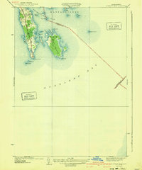
 1942 Marthas Vineyard1942 Print · USGSMartha's Vineyard and the Elizabeth Islands appear here during the early years of the second World War. Researchers can trace historical lighthouse locations like Gay Head LH and Tarpaulin Cove LH, and explore the 1940s boundaries of Edgartown and Vineyard Haven.
 - 1942 Map of Westport
 1942 Westport1942 Print · USGSThe Westport and Dartmouth coastlines appear in the early 1940s as a landscape of tidal rivers and rural crossroads. Trace the legacy of family settlements and local landmarks like Westport Point, Beech Grove Cem, and the National Guard Rifle Range.3 unique versions available
 - 1942 Map of New Bedford
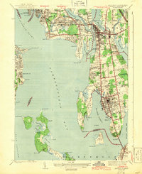
 1942 New Bedford1942 Print · USGSSoutheastern Massachusetts at the start of the 1940s shows a region defined by maritime defense and industrial rail corridors. Genealogists and historians can trace the massive Camp Edwards boundary, old rail stops like Rock Station, and vanished local industry at Paper Mill Village.2 unique versions available
 - 1942 Map of Tiverton
 1942 Tiverton1942 Print · USGSNewport County in the early 1940s reflects a coastal farming and fishing era before post-war suburbanization. Trace ancestral connections in Little Compton Commons or locate historic mill sites at Grays Mill Pond and Adamsville.4 unique versions available
 - 1943 Map of Assonet
 1943 Assonet1943 Print · USGSBristol County at the height of the war years reveals a landscape defined by tidal rivers and the steady pulse of the New Haven and Hartford Railroad. Researchers can trace ancestral sites from Dighton Rock to several family plots like Winslow Cem and the Old Quaker Cem.2 unique versions available
 - 1943 Map of Providence
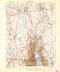
 1943 Providence1943 Print · USGSNarragansett Bay and the industrial Blackstone Valley appear here in the midst of the Second World War. Genealogists and researchers can trace local landmarks like Lonsdale Station, the St Marys Reservoir, and the Rhode Island State Airport.
 - 1943 Map of Boston
 1943 Boston1943 Print · USGSGreater Boston and its southern suburbs appear here during the mobilization of the early 1940s. Genealogists and historians can trace the early footprints of Commonwealth Airport, military sites like Fort Winthrop, and local institutions such as Pondville State Hospital.
 - 1943 Map of Attleboro
 1943 Attleboro1943 Print · USGSAttleboro and its surrounding mill villages are captured here during the Second World War era. Researchers can trace ancestral roots through sites like the Old Town Hall, Newell Cem, and the specialized Attleboro Springs Sanitarium.3 unique versions available
 - 1943 Map of Somerset
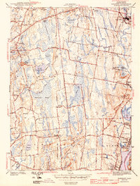 1943 Somerset1943 Print · USGSThe Bristol County interior in the 1940s reveals a patchwork of small crossroad settlements and expansive marshlands. Genealogists can locate family landmarks like Annawan Rock and the Horton Cem, or trace the development of Pottersville and Swansea Factory.4 unique versions available
 - 1943 Map of Bristol
 1943 Bristol1943 Print · USGSNarragansett Bay and the Bristol peninsula appear here in the early 1940s, showing a landscape defined by maritime commerce and rail travel. Trace the former route of the New York New Haven and Hartford railroad or locate the Soldiers Home and historic Juniper Hill Cem.2 unique versions available
 - 1943 Map of Marion, 1957 Print
 1943 Marion1957 Print · USGSThe Buzzards Bay shoreline in the early 1940s reveals a landscape of harbor villages and coastal rail commerce. Genealogists and historians can trace local family landmarks and institutions like Tabor Academy, the Sturtevant Mill, and Old Landing Cem.
 - 1944 Map of Fall River East
 1944 Fall River East1944 Print · USGSBristol County during the mid-forties shows a landscape of growing townships and preserved woodlands before the modern suburban boom. Researchers can trace ancestral property near Fighting Rock Corner, Westport Mills, and the Evergreen Cem.2 unique versions available
 - 1944 Map of Pawtucket
 1944 Pawtucket1944 Print · USGSThe industrial corridor of the Blackstone River valley is frozen in time during the mid-1940s, showing the dense rail networks and mill towns of northern Rhode Island. Genealogists and historians can trace family roots through the Moshassuck Cem, find local schools like Garvin Sch, and locate the Cistercian Monastery.3 unique versions available
Showing maps 1-25 of 48
Top cities of Bristol County
- New Bedford historical maps
- Fall River historical maps
- Taunton historical maps
- Attleboro historical maps
- Dartmouth historical maps
- North Attleborough historical maps
See more
Frequently asked questions
- What are the different types of historical maps available for Bristol County?
- What is the oldest map of Bristol County?
- Where can I purchase historical maps of Bristol County for my home or office?
- Where can I download high-res historical maps of Bristol County?
- Are there historical topographic maps available for Bristol County?
- Is there historical aerial imagery available for Bristol County?
- Where are historical maps of Bristol County sourced from?