2000s (21st Century) Maps of Tolland, Massachusetts
Explore 20 historic maps of Tolland from the 2000s (21st Century). These maps offer a rare glimpse into what life looked like during the 2000s — showing old roads, neighborhoods, homes, and landmarks that have changed or disappeared over time.
Whether you're researching your family's past, planning a metal detecting trip, or studying how Tolland's landscape evolved across the 2000s, these high-resolution maps are a powerful tool for exploring the history of this region.
- Focus on a specific era: All maps on this page are from the 2000s, giving you a focused view of this time period.
- See what’s changed: Compare century-old streets, trails, and buildings to today's modern landscape using overlays and satellite layers.
- Research with precision: Use these maps for genealogy, historical research, land use analysis, or educational projects.
- View, download, or print: Maps are fully viewable online in high resolution, and can be downloaded or printed for your own records.
Start exploring Tolland's history through authentic maps from the 2000s. This is your window into the past.
Tolland, MA maps
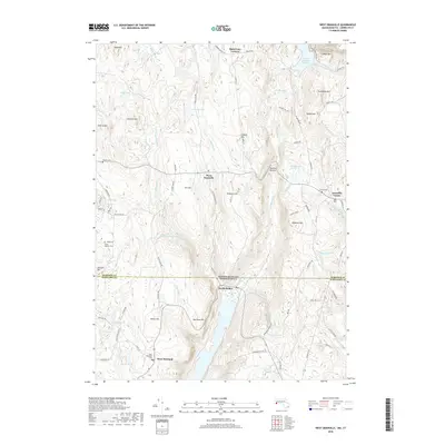
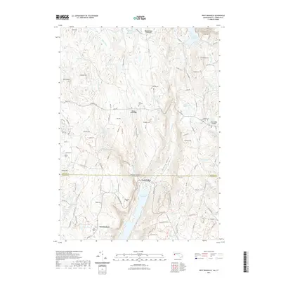
(20)- 2012 Map of Tolland Center, 2012 Print
 2012 Tolland Center2012 Print · USGSCovers Tolland, including Hartland, Colebrook, and other nearby areas
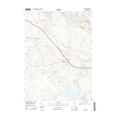
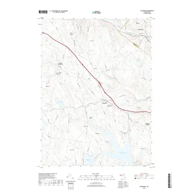
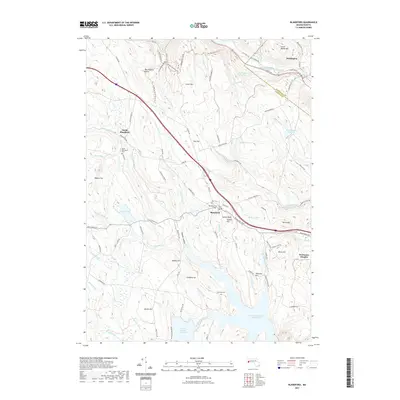
 - 2012 Map of Blandford, 2012 Print
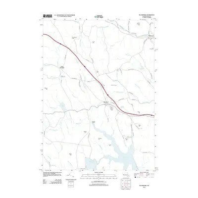 2012 Blandford2012 Print · USGSCovers Tolland, including Huntington, Russell, and other nearby areas
 - 2012 Map of Otis, 2012 Print
 2012 Otis2012 Print · USGSCovers Tolland, including Becket, Otis, and other nearby areas
 - 2012 Map of West Granville, 2012 Print
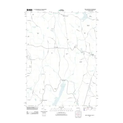 2012 West Granville2012 Print · USGSCovers Tolland, including Granby, Hartland, and other nearby areas
 - 2015 Map of Otis, 2015 Print
 2015 Otis2015 Print · USGSCovers Tolland, including Becket, Otis, and other nearby areas
 - 2015 Map of Tolland Center, 2015 Print
 2015 Tolland Center2015 Print · USGSCovers Tolland, including Hartland, Colebrook, and other nearby areas
 - 2015 Map of West Granville, 2015 Print
 2015 West Granville2015 Print · USGSCovers Tolland, including Granby, Hartland, and other nearby areas
 - 2015 Map of Blandford, 2015 Print
 2015 Blandford2015 Print · USGSCovers Tolland, including Huntington, Russell, and other nearby areas
 - 2018 Map of Tolland Center, 2018 Print
 2018 Tolland Center2018 Print · USGSCovers Tolland, including Hartland, Colebrook, and other nearby areas
 - 2018 Map of Otis, 2018 Print
 2018 Otis2018 Print · USGSCovers Tolland, including Becket, Otis, and other nearby areas
 - 2018 Map of West Granville, 2018 Print
 2018 West Granville2018 Print · USGSCovers Tolland, including Granby, Hartland, and other nearby areas
 - 2018 Map of Blandford, 2018 Print
 2018 Blandford2018 Print · USGSCovers Tolland, including Huntington, Russell, and other nearby areas
 - 2021 Map of West Granville, 2021 Print
 2021 West Granville2021 Print · USGSCovers Tolland, including Granby, Hartland, and other nearby areas
 - 2021 Map of Tolland Center, 2021 Print
 2021 Tolland Center2021 Print · USGSCovers Tolland, including Hartland, Colebrook, and other nearby areas
 - 2021 Map of Otis, 2021 Print
 2021 Otis2021 Print · USGSCovers Tolland, including Becket, Otis, and other nearby areas
 - 2021 Map of Blandford, 2021 Print
 2021 Blandford2021 Print · USGSCovers Tolland, including Huntington, Russell, and other nearby areas
 - 2024 Map of Blandford, 2024 Print
 2024 Blandford2024 Print · USGSThe hilltop village of Blandford and its surrounding reservoirs are captured here in the 2020s. Genealogists can locate several family burial sites like Hubbard Cem and Warfield Cem or trace the early paths of John Knox Road Trl.
 - 2024 Map of West Granville, 2024 Print
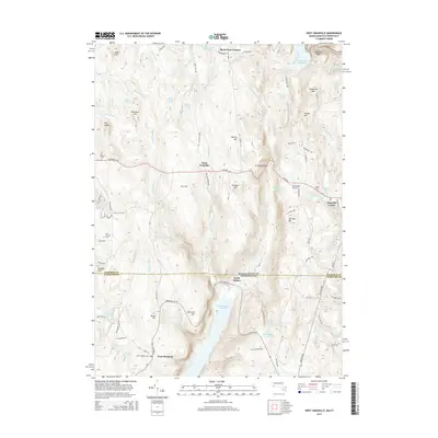
 2024 West Granville2024 Print · USGSThe Massachusetts-Connecticut borderlands appear here in the modern era, centered on the highland settlements of West Granville and Granville Center. Genealogists can locate several historic burial sites like Spring Hill Cem and South Quarter Cem among the peaks of Ore Hill and Winchell Mtn.
 - 2024 Map of Otis, 2024 Print
 2024 Otis2024 Print · USGSThe Berkshire hills near the Hampden County line come into focus in this recent survey of the Otis area. Genealogists can locate family sites at Otis Center Cem and East Otis Cem, while tracing the waters of the Otis Reservoir and Big Pond.
 - 2024 Map of Tolland Center, 2024 Print
 2024 Tolland Center2024 Print · USGSThe borderlands between Massachusetts and Connecticut are captured here in the mid-2020s, showing the intersection of the Berkshire and Northwest Hills. Researchers can trace ancestral sites at Baptist Cem or the Babcock Family Cem, and locate older settlements like Roosterville and McClaveville.
End of results
Showing maps 1-20 of 20
Top cities near Tolland
- Westfield historical maps
- Torrington historical maps
- Simsbury historical maps
- Bloomfield historical maps
- Granby historical maps
- Canton historical maps
See more
Top neighborhoods of Tolland
Frequently asked questions
- What are the different types of historical maps available for Tolland?
- What is the oldest map of Tolland?
- Where can I purchase historical maps of Tolland for my home or office?
- Where can I download high-res historical maps of Tolland?
- Are there historical topographic maps available for Tolland?
- Is there historical aerial imagery available for Tolland?
- Where are historical maps of Tolland sourced from?