1940s Maps of Huntington, Massachusetts
Explore 7 historic maps of Huntington from the 1940s. These maps offer a rare glimpse into what life looked like during the 1940s — showing old roads, neighborhoods, homes, and landmarks that have changed or disappeared over time.
Whether you're researching your family's past, planning a metal detecting trip, or studying how Huntington's landscape evolved across the 1940s, these high-resolution maps are a powerful tool for exploring the history of this region.
- Focus on a specific era: All maps on this page are from the 1940s, giving you a focused view of this time period.
- See what’s changed: Compare century-old streets, trails, and buildings to today's modern landscape using overlays and satellite layers.
- Research with precision: Use these maps for genealogy, historical research, land use analysis, or educational projects.
- View, download, or print: Maps are fully viewable online in high resolution, and can be downloaded or printed for your own records.
Start exploring Huntington's history through authentic maps from the 1940s. This is your window into the past.
Huntington, MA maps
(7)- 1942 Map of Woronoco
 1942 Woronoco1942 Print · USGSThe Berkshires meet industrial river valleys in the early 1940s, where the railroad and river define local life. Trace historic marble extraction at the Marble Quarries or find family roots at Clarks Cem and settlements like Woronoco Heights.2 unique versions available
 - 1943 Map of Holyoke
 1943 Holyoke1943 Print · USGSThe Pioneer Valley and the eastern Berkshires are captured here in the early 1940s, showing a robust network of river-side industry and hill-country forests. Researchers can locate vanished landmarks and institutional grounds like Northampton State Hospital, Barnes Airport, and the Nat Gd Rifle Range.
 - 1946 Map of Blandford
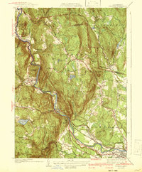
 1946 Blandford1946 Print · USGSBlandford and Huntington are captured here in the mid-1940s, a period defined by the expansion of reservoirs and old mountain turnpikes. Researchers can trace the General Knox Trail, locate the North Blandford Cem, and study the industrial rail lines of the Boston and Albany RR.2 unique versions available
 - 1946 Map of Westhampton
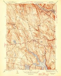
 1946 Westhampton1946 Print · USGSHampshire County at the dawn of the post-war era shows a landscape transitioning between traditional milling and modern water management. Researchers can trace historic family cemeteries like Torrey Cem and early industrial sites such as Bisbee Mill near the Knightville Reservoir.
 - 1947 Map of Westhampton
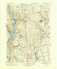 1947 Westhampton1947 Print · USGSHampshire County's hill country is frozen in time during the late 1940s, showing the rural character of Westhampton and Norwich. Researchers can find small family burial grounds like Damon Cem, old industrial sites like Bisbee Mill, and landmarks like Pine Island Lake.2 unique versions available
 - 1948 Map of Chester
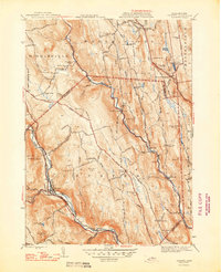 1948 Chester1948 Print · USGSThe Berkshires hill country comes alive in this post-war survey of the Westfield River valley and its surrounding ridges. Genealogists can locate family burial grounds like Converse Cem and trace the winding Boston and Albany RR through Chester.2 unique versions available
 - 1948 Map of Albany, 1951 Print
 1948 Albany1951 Print · USGSThe Hudson and Connecticut River valleys are captured here in the late 1940s, showing the vital rail and water corridors of the Northeast. You can trace the Boston and Maine tracks past Mt Greylock or locate early settlements like Great Barrington and Bennington.
End of results
Showing maps 1-7 of 7
Top cities near Huntington
- Westfield historical maps
- Holyoke historical maps
- Northampton historical maps
- Agawam historical maps
- West Springfield historical maps
- Easthampton historical maps
See more
Top neighborhoods of Huntington
- Littleville Lake historical maps
- Norwich historical maps
- Goss Heights historical maps
- Knightville historical maps
Frequently asked questions
- What are the different types of historical maps available for Huntington?
- What is the oldest map of Huntington?
- Where can I purchase historical maps of Huntington for my home or office?
- Where can I download high-res historical maps of Huntington?
- Are there historical topographic maps available for Huntington?
- Is there historical aerial imagery available for Huntington?
- Where are historical maps of Huntington sourced from?