1980s Maps of Marshfield, Massachusetts
Explore 3 historic maps of Marshfield from the 1980s. These maps offer a rare glimpse into what life looked like during the 1980s — showing old roads, neighborhoods, homes, and landmarks that have changed or disappeared over time.
Whether you're researching your family's past, planning a metal detecting trip, or studying how Marshfield's landscape evolved across the 1980s, these high-resolution maps are a powerful tool for exploring the history of this region.
- Focus on a specific era: All maps on this page are from the 1980s, giving you a focused view of this time period.
- See what’s changed: Compare century-old streets, trails, and buildings to today's modern landscape using overlays and satellite layers.
- Research with precision: Use these maps for genealogy, historical research, land use analysis, or educational projects.
- View, download, or print: Maps are fully viewable online in high resolution, and can be downloaded or printed for your own records.
Start exploring Marshfield's history through authentic maps from the 1980s. This is your window into the past.
Marshfield, MA maps
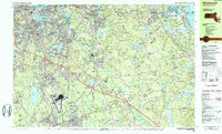
(3)- 1984 Map of Scituate
 1984 Scituate1984 Print · USGSCoastal Plymouth County in the mid-eighties shows a landscape of storied sea cliffs and winding tidal marshes. Genealogists and local historians can trace family roots through Meeting House Lane Cem, locate the Scituate Station, or explore the heritage of Scituate Harbor.2 unique versions available
 - 1984 Map of Weymouth
 1984 Weymouth1984 Print · USGSCoastal Plymouth and Norfolk Counties are captured here in the mid-eighties, showing the region's transition from a naval hub to a modern suburban corridor. Researchers can trace family sites at Village Cem or explore the massive layout of the South Weymouth Naval Air Station and Wompatuck State Park.2 unique versions available
 - 1984 Map of Provincetown, 1986 Print
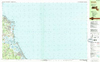
 1984 Provincetown1986 Print · USGSThe Massachusetts coastline and the tip of Cape Cod appear here during the mid-eighties, highlighting the region's dense coastal settlements and maritime defenses. You can locate family landmarks in Marshfield, trace the grounds of the North Truro Air Force Station, and explore the islands of Boston Harbor like Peddocks Island.2 unique versions available
End of results
Showing maps 1-3 of 3
Top cities near Marshfield
- Boston historical maps
- Plymouth historical maps
- Weymouth historical maps
- Bridgewater historical maps
- Hingham historical maps
- Pembroke historical maps
See more
Top neighborhoods of Marshfield
- Green Harbor historical maps
- Kent Park historical maps
- Little Bridge historical maps
- Marshfield Hills historical maps
- Ferry Hill historical maps
- North Marshfield historical maps
See more
Frequently asked questions
- What are the different types of historical maps available for Marshfield?
- What is the oldest map of Marshfield?
- Where can I purchase historical maps of Marshfield for my home or office?
- Where can I download high-res historical maps of Marshfield?
- Are there historical topographic maps available for Marshfield?
- Is there historical aerial imagery available for Marshfield?
- Where are historical maps of Marshfield sourced from?