1970s Maps of Marshfield, Massachusetts
Explore 8 historic maps of Marshfield from the 1970s. These maps offer a rare glimpse into what life looked like during the 1970s — showing old roads, neighborhoods, homes, and landmarks that have changed or disappeared over time.
Whether you're researching your family's past, planning a metal detecting trip, or studying how Marshfield's landscape evolved across the 1970s, these high-resolution maps are a powerful tool for exploring the history of this region.
- Focus on a specific era: All maps on this page are from the 1970s, giving you a focused view of this time period.
- See what’s changed: Compare century-old streets, trails, and buildings to today's modern landscape using overlays and satellite layers.
- Research with precision: Use these maps for genealogy, historical research, land use analysis, or educational projects.
- View, download, or print: Maps are fully viewable online in high resolution, and can be downloaded or printed for your own records.
Start exploring Marshfield's history through authentic maps from the 1970s. This is your window into the past.
Marshfield, MA maps
(8)- 1974 Map of Scituate, 1976 Print
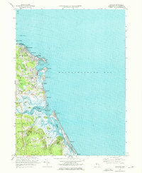 1974 Scituate1976 Print · USGSThe South Shore of Massachusetts in the mid-seventies reveals a mix of coastal resort life and deep-seated maritime history. Genealogists and historians can trace family plots at Union Cem, locate the old Railroad Grade near Greenbush, or study the shoreline at Peggotty Beach.3 unique versions available
 - 1974 Map of Cohasset, 1976 Print
 1974 Cohasset1976 Print · USGSCoastal Massachusetts at the height of the 1970s reveals a mix of maritime villages and expanding suburban centers nestled between massive state parklands. Genealogists and historians can trace lineage through First Parish Cem or locate the historic Maryknoll Seminary and Glastonbury Monastery.2 unique versions available
 - 1974 Map of Duxbury, 1978 Print
 1974 Duxbury1978 Print · USGSCoastal Massachusetts in the mid-seventies shows a fascinating blend of Pilgrim-era landmarks and modern coastal growth. Genealogists and historians can trace the Site of Myles Standish Homestead, locate the Old Burying Ground (Myles Standish), and explore the rail corridor of the Penn Central.2 unique versions available
 - 1977 Map of Cohasset, 1980 Print
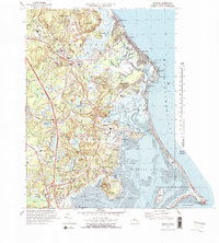
 1977 Cohasset1980 Print · USGSThe South Shore landscape of the late seventies is captured here in literal detail, from the coastline to the inland woods. Researchers can examine the exact layout of settlements like Cohasset, North Scituate, and Greenbush.
 - 1977 Map of Hanover, 1981 Print
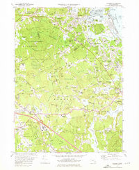
 1977 Hanover1981 Print · USGSPlymouth County during the late seventies is revealed through detailed aerial imagery of the South Shore's inland villages and waterways. Researchers can trace land use and local development around Hanover, Bryantville, and the shores of Silver Lake.
 - 1977 Map of Scituate, 1981 Print
 1977 Scituate1981 Print · USGSThe South Shore's tidal estuaries and coastal neighborhoods are captured in this late 1970s aerial survey. Trace the winding paths of the North River and South River as they meet at Humarock and the harbor at Scituate.
 - 1977 Map of Duxbury, 1981 Print
 1977 Duxbury1981 Print · USGSThe South Shore landscape of the late seventies is captured here in sharp aerial detail, showing the tidal inlets and growing coastal towns. Trace the evolution of waterfront communities from Fieldston to South Duxbury and the winding South River.
 - 1978 Map of Hanover, 1979 Print
 1978 Hanover1979 Print · USGSThe South Shore landscape in the late seventies is defined by its massive pond systems and specialized agriculture. Genealogists can trace family names through Sylvester Ch and Sachem Lodge Cem while exploring the Cranberry Bogs near Monponsett.2 unique versions available
End of results
Showing maps 1-8 of 8
Top cities near Marshfield
- Boston historical maps
- Plymouth historical maps
- Weymouth historical maps
- Bridgewater historical maps
- Hingham historical maps
- Pembroke historical maps
See more
Top neighborhoods of Marshfield
- Green Harbor historical maps
- Kent Park historical maps
- Little Bridge historical maps
- Marshfield Hills historical maps
- Ferry Hill historical maps
- North Marshfield historical maps
See more
Frequently asked questions
- What are the different types of historical maps available for Marshfield?
- What is the oldest map of Marshfield?
- Where can I purchase historical maps of Marshfield for my home or office?
- Where can I download high-res historical maps of Marshfield?
- Are there historical topographic maps available for Marshfield?
- Is there historical aerial imagery available for Marshfield?
- Where are historical maps of Marshfield sourced from?