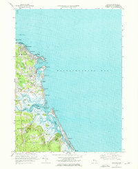
1974 Map of Scituate
USGS Topo · Published 1976About this map
Scituate Harbor serves as the focal point for this coastal survey, where the historic Lighthouse and Coast Guard Station overlook a deeply indented shoreline. The residential and maritime character of the mid-1970s is evident in the cluster of shorefront communities like Shore Acres, Sand Hills, and Humarock. Inward from the Atlantic, the landscape transitions into tidal estuaries and marshlands where the North River and South River converge. Local history and genealogy are anchored by several burial grounds, including the Union Cem and Meeting House Lane Cem near Scituate village. Evidence of former transport networks appears as a Railroad Grade passing through Greenbush, while the southern reaches near Marshfield Hills are defined by wooded elevations like Carolina Hill and managed agricultural features such as a Cranberry Bog.
Find a feature on this map
69 named features on this map. Tap any name to fly to it.
Don’t see what you’re looking for? This feature index may not catch every label — zoom into the map to look around manually.
Map Details
Editions of this 1974 Scituate Map
3 editions found
Other maps of this area

1885 · Abington
USGS Topo · 1:62,500

1885 · Duxbury
USGS Topo · 1:62,500

1888 · Duxbury
USGS Topo · 1:62,500

1888 · Abington
USGS Topo · 1:62,500

1892 · Boston Bay
USGS Topo · 1:62,500

1893 · Abington
USGS Topo · 1:62,500

1893 · Duxbury
USGS Topo · 1:62,500

1903 · Boston Bay
USGS Topo · 1:62,500

1918 · Duxbury
USGS Topo · 1:62,500

1920 · Abington
USGS Topo · 1:62,500