1930s Maps of West Bridgewater, Massachusetts
Explore 3 historic maps of West Bridgewater from the 1930s. These maps offer a rare glimpse into what life looked like during the 1930s — showing old roads, neighborhoods, homes, and landmarks that have changed or disappeared over time.
Whether you're researching your family's past, planning a metal detecting trip, or studying how West Bridgewater's landscape evolved across the 1930s, these high-resolution maps are a powerful tool for exploring the history of this region.
- Focus on a specific era: All maps on this page are from the 1930s, giving you a focused view of this time period.
- See what’s changed: Compare century-old streets, trails, and buildings to today's modern landscape using overlays and satellite layers.
- Research with precision: Use these maps for genealogy, historical research, land use analysis, or educational projects.
- View, download, or print: Maps are fully viewable online in high resolution, and can be downloaded or printed for your own records.
Start exploring West Bridgewater's history through authentic maps from the 1930s. This is your window into the past.
West Bridgewater, MA maps
(3)- 1936 Map of Whitman
 1936 Whitman1936 Print · USGSPlymouth County towns like Whitman and Abington are shown during the mid-1930s as they balanced industrial works with growing residential neighborhoods. Trace local family history through numerous landmarks like St Patricks Cem, Union Cong Ch, and Jones Pond Sch.
 - 1936 Map of Brockton
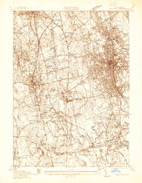 1936 Brockton1936 Print · USGSBrockton and Stoughton are captured here during the mid-1930s, showing a landscape of burgeoning industrial centers and rural family corners. Researchers can trace ancestral roots through dozens of named cemeteries like Washington Cem or locate old industrial sites like Oconnors Cider Mill and the Brockton Filter Beds.
 - 1937 Map of Middleboro
 1937 Middleboro1937 Print · USGSThe rail-and-river hub of Middleborough and its surrounding cranberry bogs are frozen in time just before the war. Researchers can trace family roots at Purchase Cem, locate the Thompsonville Sch, or follow the New York New Haven and Hartford railroad line.
End of results
Showing maps 1-3 of 3
Top cities near West Bridgewater
- Boston historical maps
- Brockton historical maps
- Quincy historical maps
- Taunton historical maps
- Weymouth historical maps
- Attleboro historical maps
See more
Top neighborhoods of West Bridgewater
- Bennetts Corner historical maps
- Brooks Place historical maps
- Cochesett historical maps
- Elm Square historical maps
- West Meadow historical maps
- Matfield historical maps
See more
Frequently asked questions
- What are the different types of historical maps available for West Bridgewater?
- What is the oldest map of West Bridgewater?
- Where can I purchase historical maps of West Bridgewater for my home or office?
- Where can I download high-res historical maps of West Bridgewater?
- Are there historical topographic maps available for West Bridgewater?
- Is there historical aerial imagery available for West Bridgewater?
- Where are historical maps of West Bridgewater sourced from?