Old Maps of Boston, Massachusetts
Explore 79 old maps of Boston, spanning from 1886 to today. These high-resolution historic maps reveal how streets, neighborhoods, landmarks, and natural features evolved over time — perfect for genealogy, metal detecting, research, and local history exploration.
What you can do with these maps:
- See how Boston changed over time: Compare historical maps to modern-day views to trace roads, homesites, rail lines & more.
- View detailed metadata: Each map includes creators, publishers, year, scale, and archive source.
- Overlay maps with satellite & LiDAR: Visualize the past alongside modern tools to explore terrain & human change.
- Trusted historical sources: Maps sourced from the USGS, Library of Congress, and other archives.
- Access maps your way: View online, download high-res files, or order prints for personal or research use.
Start exploring old maps of Boston to uncover forgotten places, hidden landmarks, and the deep history beneath your feet.
Boston, MA maps
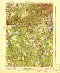
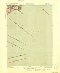
(79)- 1886 Map of Dedham
 1886 Dedham1886 Print · USGSCovers Boston, including Brockton, Quincy, and other nearby areas
 - 1892 Map of Boston Bay
 1892 Boston Bay1892 Print · USGSCovers Boston, including Quincy, Lynn, and other nearby areas4 unique versions available
 - 1893 Map of Boston
 1893 Boston1893 Print · USGSCovers Boston, including Cambridge, Quincy, and other nearby areas4 unique versions available
 - 1894 Map of Dedham
 1894 Dedham1894 Print · USGSCovers Boston, including Brockton, Quincy, and other nearby areas10 unique versions available
 - 1903 Map of Boston
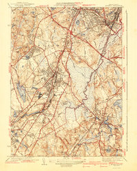
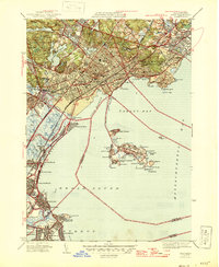
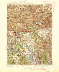
 1903 Boston1903 Print · USGSCovers Boston, including Cambridge, Quincy, and other nearby areas13 unique versions available
 - 1903 Map of Boston Bay
 1903 Boston Bay1903 Print · USGSCovers Boston, including Quincy, Lynn, and other nearby areas9 unique versions available
 - 1919 Map of Dedham
 1919 Dedham1919 Print · USGSCovers Boston, including Brockton, Quincy, and other nearby areas
 - 1936 Map of Blue Hills
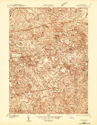
 1936 Blue Hills1936 Print · USGSCovers Boston, including Brockton, Quincy, and other nearby areas
 - 1936 Map of Norwood
 1936 Norwood1936 Print · USGSCovers Boston, including Norwood, Stoughton, and other nearby areas
 - 1936 Map of Nantasket
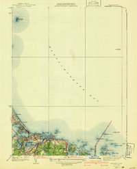
 1936 Nantasket1936 Print · USGSCovers Boston, including Hingham, Scituate, and other nearby areas
 - 1941 Map of Blue Hills
 1941 Blue Hills1941 Print · USGSCovers Boston, including Brockton, Quincy, and other nearby areas4 unique versions available
 - 1941 Map of Nantasket
 1941 Nantasket1941 Print · USGSCovers Boston, including Hingham, Scituate, and other nearby areas3 unique versions available
 - 1941 Map of Norwood
 1941 Norwood1941 Print · USGSCovers Boston, including Norwood, Stoughton, and other nearby areas3 unique versions available
 - 1943 Map of Boston
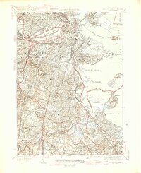
 1943 Boston1943 Print · USGSCovers Boston, including Cambridge, Brockton, and other nearby areas
 - 1943 Map of Boston North
 1943 Boston North1943 Print · USGSCovers Boston, including Cambridge, Lynn, and other nearby areas
 - 1943 Map of Lynn
 1943 Lynn1943 Print · USGSCovers Boston, including Lynn, Revere, and other nearby areas
 - 1944 Map of Newton
 1944 Newton1944 Print · USGSCovers Boston, including Cambridge, Newton, and other nearby areas
 - 1944 Map of Lynn
 1944 Lynn1944 Print · USGSCovers Boston, including Lynn, Revere, and other nearby areas
 - 1944 Map of Hull
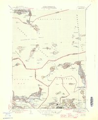
 1944 Hull1944 Print · USGSCovers Boston, including Quincy, Weymouth, and other nearby areas
 - 1944 Map of Boston South
 1944 Boston South1944 Print · USGSCovers Boston, including Cambridge, Quincy, and other nearby areas
 - 1945 Map of Marblehead South
 1945 Marblehead South1945 Print · USGSCovers Boston, including Lynn, Salem, and other nearby areas3 unique versions available
 - 1946 Map of Lynn
 1946 Lynn1946 Print · USGSCovers Boston, including Lynn, Revere, and other nearby areas3 unique versions available
 - 1946 Map of Hull
 1946 Hull1946 Print · USGSCovers Boston, including Quincy, Weymouth, and other nearby areas4 unique versions available
 - 1946 Map of Boston South
 1946 Boston South1946 Print · USGSCovers Boston, including Cambridge, Quincy, and other nearby areas3 unique versions available
 - 1946 Map of Newton
 1946 Newton1946 Print · USGSCovers Boston, including Cambridge, Newton, and other nearby areas3 unique versions available
Showing maps 1-25 of 79
Top cities near Boston
- Cambridge historical maps
- Brockton historical maps
- Quincy historical maps
- Lynn historical maps
- Newton historical maps
- Somerville historical maps
See more
Top neighborhoods of Boston
- Roxbury Crossing historical maps
- Fort Warren historical maps
- Dorchester Center historical maps
- Fenway-Kenmore historical maps
- Back Bay historical maps
- South Boston historical maps
See more
Frequently asked questions
- What are the different types of historical maps available for Boston?
- What is the oldest map of Boston?
- Where can I purchase historical maps of Boston for my home or office?
- Where can I download high-res historical maps of Boston?
- Are there historical topographic maps available for Boston?
- Is there historical aerial imagery available for Boston?
- Where are historical maps of Boston sourced from?