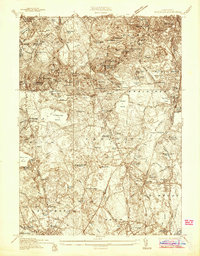
1936 Map of Blue Hills
USGS Topo · Published 1936About this map
Great Blue Hill and the surrounding reservation dominate this 1930s landscape, featuring the Observatory and CCC Camp No 1170 nestled within the terrain. The map captures a moment when institutional life was a primary feature of the region, evidenced by the Milton Academy, Jeanne D'arc Academy, and the Boston Sch for the Deaf in Randolph. The industrial footprint of the era is remarkably specific, locating the American Fireworks Co of Mass near North Stoughton and the textile-related Sloughton Mills to the south.
Find a feature on this map
105 named features on this map. Tap any name to fly to it.
Don’t see what you’re looking for? This feature index may not catch every label — zoom into the map to look around manually.
Map Details
Editions of this 1936 Blue Hills Map
This is the sole edition of this map. No revisions or reprints were ever made.
Other maps of this area

1885 · Abington
USGS Topo · 1:62,500

1886 · Dedham
USGS Topo · 1:62,500

1888 · Abington
USGS Topo · 1:62,500

1892 · Boston Bay
USGS Topo · 1:62,500

1893 · Abington
USGS Topo · 1:62,500

1893 · Boston
USGS Topo · 1:62,500

1894 · Dedham
USGS Topo · 1:62,500

1903 · Boston
USGS Topo · 1:62,500

1903 · Boston Bay
USGS Topo · 1:62,500

1919 · Dedham
USGS Topo · 1:62,500