1970s Maps of Boston, Massachusetts
Explore 18 historic maps of Boston from the 1970s. These maps offer a rare glimpse into what life looked like during the 1970s — showing old roads, neighborhoods, homes, and landmarks that have changed or disappeared over time.
Whether you're researching your family's past, planning a metal detecting trip, or studying how Boston's landscape evolved across the 1970s, these high-resolution maps are a powerful tool for exploring the history of this region.
- Focus on a specific era: All maps on this page are from the 1970s, giving you a focused view of this time period.
- See what’s changed: Compare century-old streets, trails, and buildings to today's modern landscape using overlays and satellite layers.
- Research with precision: Use these maps for genealogy, historical research, land use analysis, or educational projects.
- View, download, or print: Maps are fully viewable online in high resolution, and can be downloaded or printed for your own records.
Start exploring Boston's history through authentic maps from the 1970s. This is your window into the past.
Boston, MA maps
(18)- 1970 Map of Marblehead South, 1972 Print
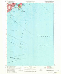 1970 Marblehead South1972 Print · USGSThe North Shore coastline comes into focus in the 1970s, showcasing the maritime heritage and residential growth of Marblehead and Devereux. Researchers can trace the town's layout through sites like Alley Hospital, Seaside Park, and the Bell Sch.2 unique versions available
 - 1970 Map of Lynn, 1972 Print
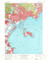 1970 Lynn1972 Print · USGSThe North Shore coastline comes alive in the early seventies, detailing the dense urban neighborhoods of Lynn and the seaside character of Nahant. Genealogists and historians can trace family roots through numerous sites like Pickering Cem, St Josephs Ch, and the Boston and Maine rail lines.2 unique versions available
 - 1970 Map of Norwood, 1972 Print
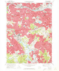
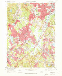 1970 Norwood1972 Print · USGSGreater Norfolk County comes alive in the early seventies, showing a suburban landscape woven together by the Penn Central railroad and the Neponset River. Trace family roots at Old Parish Cem or locate former landmarks like the Norwood Arena and Kendall Whaling Museum.2 unique versions available
 - 1970 Map of Boston South, 1973 Print
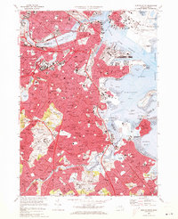 1970 Boston South1973 Print · USGSBoston and its southern neighborhoods are shown at a peak of urban development in the early seventies. Genealogists and historians can trace family roots through the dense streets of Dorchester or locate ancestral plots in Cedar Grove Cem and New Calvary Cem.2 unique versions available
 - 1970 Map of Newton, 1973 Print
 1970 Newton1973 Print · USGSThe western suburbs of Boston reached a peak of mid-century density during this era of highway and rail expansion. Researchers can trace historic parish boundaries and burial sites like Newton Cemetery or locate landmarks like Boston College and the Arnold Arboretum.2 unique versions available
 - 1971 Map of Blue Hills, 1972 Print
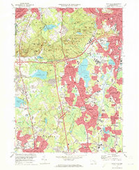 1971 Blue Hills1972 Print · USGSGreater Boston's southern suburbs and the forested Blue Hills are captured here during the early seventies' era of suburban expansion. Trace local family history at Blue Hill Cemetery or Holy Sepulchre Cem, and locate long-standing institutions like Curry College and Thayer Academy.2 unique versions available
 - 1971 Map of Hull, 1972 Print
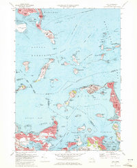 1971 Hull1972 Print · USGSThe outer Boston islands and the Nantasket peninsula are shown in detail during the early seventies, capturing a landscape of coastal defense and maritime history. Researchers can trace the footprints of Fort Warren, the iconic Boston Lighthouse, and institutional sites like the Long Island Hospital.2 unique versions available
 - 1971 Map of Boston North, 1973 Print
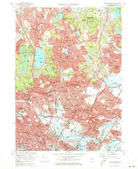 1971 Boston North1973 Print · USGSThe northern reaches of the Massachusetts capital show a landscape of dense suburbs and protected woodlands in the early seventies. Researchers can locate landmark sites like the Bunker Hill Monument, trace the MBTA System rail lines, or explore the grounds of Harvard University and Holy Cross Cemetery.2 unique versions available
 - 1974 Map of Nantasket Beach, 1975 Print
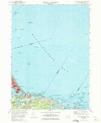 1974 Nantasket Beach1975 Print · USGSThe South Shore's famous coastal resorts and hazardous shipping lanes are detailed in this mid-seventies survey of the Massachusetts coast. Genealogists and historians can trace the footprint of Paragon Park, the homes of North Cohasset, and the offshore beacons like Boston Light.2 unique versions available
 - 1977 Map of Boston South, 1980 Print
 1977 Boston South1980 Print · USGSThe Boston metropolitan area is captured in the late seventies through detailed aerial photography, showing the city's dense urban layout and harbor. Trace the industrial waterfront of Boston Harbor or follow the Neponset River as it winds toward Squantum.
 - 1977 Map of Nantasket Beach, 1980 Print
 1977 Nantasket Beach1980 Print · USGSThe South Shore's coastline in the late seventies is captured here through detailed aerial photography. You can trace the residential patterns of North Cohasset and the fragile peninsula of Nantasket Beach along Straits Pond.
 - 1977 Map of Hull, 1980 Print
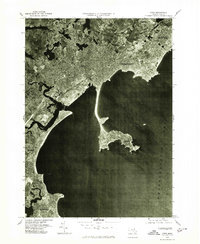
 1977 Hull1980 Print · USGSThe Massachusetts coastline and Boston Harbor islands are captured in high detail in the late seventies. Genealogists and historians can trace the exact footprint of neighborhoods in Hull and Winthrop or follow the paths of the Fore River and Weir River.
 - 1977 Map of Lynn, 1980 Print
 1977 Lynn1980 Print · USGSThe North Shore coastline is seen in sharp photographic detail in the late seventies as urban sprawl reaches the edges of Massachusetts Bay. Genealogists and historians can trace the dense street grids of Lynn and the iconic causeway leading to Nahant.
 - 1977 Map of Boston North, 1980 Print
 1977 Boston North1980 Print · USGSThe northern suburbs of Boston come into focus in the late 1970s through this detailed orthophotoquad survey. Trace the urban landscape from the Mystic River waterfront to the dense neighborhoods of Malden, Everett, and Revere.
 - 1977 Map of Blue Hills, 1980 Print
 1977 Blue Hills1980 Print · USGSSouth of the city in the late seventies, this aerial survey captures the evolving suburban landscape between the Blue Hills Range and Stoughton. Researchers can trace the development of residential neighborhoods and highway corridors in Randolph, Quincy, and Braintree.
 - 1977 Map of Newton, 1980 Print
 1977 Newton1980 Print · USGSThe western suburbs of Boston are revealed in detail during the late seventies, showing the dense development of these historic townships. Trace the winding Charles River through Newton, Brookline, and Watertown to see the region's layout.
 - 1977 Map of Norwood, 1980 Print
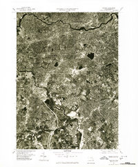
 1977 Norwood1980 Print · USGSGreater Boston and the Neponset Valley are captured in high-resolution detail during the late seventies as suburban growth reshaped Norfolk County. Researchers can trace the mid-century footprints of Norwood, Dedham, and the banks of the Neponset River.
 - 1977 Map of Marblehead South, 1980 Print
 1977 Marblehead South1980 Print · USGSThe coastline around Marblehead is captured in detail during the late seventies, showing the transition from settlement to sea. Researchers can trace the town's coastal perimeter and rocky harbor shoreline where it meets Massachusetts Bay.
End of results
Showing maps 1-18 of 18
Top cities near Boston
- Cambridge historical maps
- Brockton historical maps
- Quincy historical maps
- Lynn historical maps
- Newton historical maps
- Somerville historical maps
See more
Top neighborhoods of Boston
- Dorchester Center historical maps
- Roxbury Crossing historical maps
- Fort Warren historical maps
- Hyde Park historical maps
- Jamaica Plain historical maps
- Brighton historical maps
See more
Frequently asked questions
- What are the different types of historical maps available for Boston?
- What is the oldest map of Boston?
- Where can I purchase historical maps of Boston for my home or office?
- Where can I download high-res historical maps of Boston?
- Are there historical topographic maps available for Boston?
- Is there historical aerial imagery available for Boston?
- Where are historical maps of Boston sourced from?