1971 Map of Hull
USGS Topo · Published 1972About this map
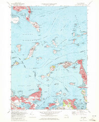
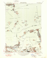
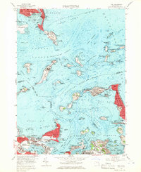
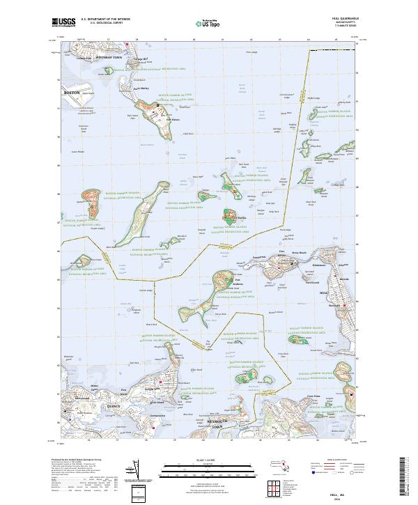
The outer harbor of Boston Harbor is defined here by a dense archipelago of islands and narrow navigation channels such as The Narrows and Nubble Channel. Coastal fortifications from several eras are clearly visible, including Fort Warren on Georges Island, Fort Strong on Long Island, and Fort Duvall near Allerton. These installations, alongside the Boston Lighthouse and the Long Island Head Light, illustrate the maritime defense and navigation infrastructure essential to protecting the Massachusetts coastline.
Find a feature on this map
163 named features on this map. Tap any name to fly to it.
Don’t see what you’re looking for? This feature index may not catch every label — zoom into the map to look around manually.
Map Details
Editions of this 1971 Hull Map
2 editions found
Historical Maps of Boston Through Time
16 maps found

1944 Boston South
Suffolk County, MA

1944 Hull
Suffolk County, MA
1946 Boston South
Suffolk County, MA
1946 Hull
Suffolk County, MA

1948 Hull
Suffolk County, MA

1949 Hull
Suffolk County, MA

1954 Boston South
Suffolk County, MA
1956 Boston South
Suffolk County, MA
1958 Hull
Suffolk County, MA
1970 Boston South
Suffolk County, MA
1971 Hull
Suffolk County, MA

1977 Boston South
Suffolk County, MA

1977 Hull
Suffolk County, MA
1987 Boston South
Suffolk County, MA
2024 Boston South
Suffolk County, MA
2024 Hull
Suffolk County, MA