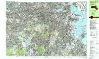
1987 Map of Boston South
USGS Topo · Published 1987About this map
The Charles River winds through this late-twentieth-century landscape, linking the industrial legacy of the Watertown Arsenal to the academic corridors of Northeastern University and Boston University. The map documents a densely developed urban and suburban corridor before the massive infrastructural shifts of the turn of the century, showing the Mass Turnpike and Southeast Expwy as they integrated the city's neighborhoods. Beyond the downtown core, the sheet details the residential and institutional character of places like Brookline Village, Newton Center, and Jamaica Plain.
Find a feature on this map
143 named features on this map. Tap any name to fly to it.
Don’t see what you’re looking for? This feature index may not catch every label — zoom into the map to look around manually.
Map Details
Editions of this 1987 Boston South Map
2 editions found
Other maps of this area

1885 · Abington
USGS Topo · 1:62,500

1886 · Dedham
USGS Topo · 1:62,500

1886 · Framingham
USGS Topo · 1:62,500

1887 · Franklin
USGS Topo · 1:62,500

1888 · Abington
USGS Topo · 1:62,500

1889 · Franklin
USGS Topo · 1:62,500

1889 · Framingham
USGS Topo · 1:62,500

1892 · Boston Bay
USGS Topo · 1:62,500

1893 · Abington
USGS Topo · 1:62,500

1893 · Franklin
USGS Topo · 1:62,500