1960s Maps of Charlton, Massachusetts
Explore 6 historic maps of Charlton from the 1960s. These maps offer a rare glimpse into what life looked like during the 1960s — showing old roads, neighborhoods, homes, and landmarks that have changed or disappeared over time.
Whether you're researching your family's past, planning a metal detecting trip, or studying how Charlton's landscape evolved across the 1960s, these high-resolution maps are a powerful tool for exploring the history of this region.
- Focus on a specific era: All maps on this page are from the 1960s, giving you a focused view of this time period.
- See what’s changed: Compare century-old streets, trails, and buildings to today's modern landscape using overlays and satellite layers.
- Research with precision: Use these maps for genealogy, historical research, land use analysis, or educational projects.
- View, download, or print: Maps are fully viewable online in high resolution, and can be downloaded or printed for your own records.
Start exploring Charlton's history through authentic maps from the 1960s. This is your window into the past.
Charlton, MA maps
(6)- 1961 Map of Boston
 1961 Boston1961 Print · USGSThe Massachusetts coastline and its industrial interior are detailed here in the mid-twentieth century, from the Monadnock highlands to Cape Cod. Researchers can trace the rail routes of the Boston and Maine or locate landmarks like Fort Devens and the Wachusett Reservoir.2 unique versions available
 - 1962 Map of Albany
 1962 Albany1962 Print · USGSThe Hudson and Connecticut River valleys meet the Green Mountains and Berkshires in this mid-century overview of the Northeast. Genealogists and historians can trace the industrial hearts of Albany and Springfield or locate features like Quabbin Reservoir and Westover Air Force Base.
 - 1967 Map of Southbridge
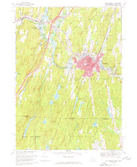 1967 Southbridge1967 Print · USGSMassachusetts and Connecticut meet in this late 1960s survey as the Quinebaug River valley transitions from industrial centers to quiet forest. Researchers can locate family sites and landmarks like Old Sturbridge Village, St Annes Shrine, and the old crossroads at Sherman Corner.6 unique versions available
 - 1969 Map of Leicester, 1971 Print
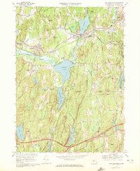
 1969 Leicester1971 Print · USGSWorcester County's industrial and rural character is captured in the late sixties, showing the interplay of rail lines and reservoir systems. Genealogists can locate family sites near Pine Grove Cemetery or trace the development of Charlton Depot and Cherry Valley.3 unique versions available
 - 1969 Map of East Brookfield, 1972 Print
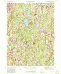
 1969 East Brookfield1972 Print · USGSWorcester County's lakelands and town centers are captured here in the late sixties, showcasing a landscape shaped by the Penn Central rail and early automotive turnpikes. Researchers can trace family roots through sites like Holy Rosary Cem or explore the shoreline developments of Quaboag Pond and Lake Lashaway.2 unique versions available
 - 1969 Map of Webster, 1972 Print
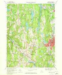 1969 Webster1972 Print · USGSThe industrial river valleys of the Massachusetts borderlands are captured here during the late sixties. Genealogists can trace old family burial grounds like Blackmer Cem and Dresser Cem or the mill-town heritage of Perryville and Quinebaug.4 unique versions available
End of results
Showing maps 1-6 of 6
Top cities near Charlton
- Worcester historical maps
- Shrewsbury historical maps
- Webster historical maps
- Southbridge historical maps
- Holden historical maps
- Auburn historical maps
See more
Top neighborhoods of Charlton
- Northside historical maps
- South Charlton historical maps
- Charlton City historical maps
- Charlton Depot historical maps
- Mystic Grove historical maps
- Morseville historical maps
See more
Frequently asked questions
- What are the different types of historical maps available for Charlton?
- What is the oldest map of Charlton?
- Where can I purchase historical maps of Charlton for my home or office?
- Where can I download high-res historical maps of Charlton?
- Are there historical topographic maps available for Charlton?
- Is there historical aerial imagery available for Charlton?
- Where are historical maps of Charlton sourced from?