1980s Maps of Spencer, Massachusetts
Explore 7 historic maps of Spencer from the 1980s. These maps offer a rare glimpse into what life looked like during the 1980s — showing old roads, neighborhoods, homes, and landmarks that have changed or disappeared over time.
Whether you're researching your family's past, planning a metal detecting trip, or studying how Spencer's landscape evolved across the 1980s, these high-resolution maps are a powerful tool for exploring the history of this region.
- Focus on a specific era: All maps on this page are from the 1980s, giving you a focused view of this time period.
- See what’s changed: Compare century-old streets, trails, and buildings to today's modern landscape using overlays and satellite layers.
- Research with precision: Use these maps for genealogy, historical research, land use analysis, or educational projects.
- View, download, or print: Maps are fully viewable online in high resolution, and can be downloaded or printed for your own records.
Start exploring Spencer's history through authentic maps from the 1980s. This is your window into the past.
Spencer, MA maps
(7)- 1982 Map of North Brookfield, 1984 Print
 1982 North Brookfield1984 Print · USGSWorcester County's rural character is on full display in the early 1980s, before modern suburban expansion altered the hills around North Brookfield. Genealogists and historians can trace family locations through numerous landmarks like St Josephs Abbey, Walnut Grove Cem, and the Eagle Hill Sch.2 unique versions available
 - 1982 Map of Warren, 1984 Print
 1982 Warren1984 Print · USGSThe Quaboag River valley in the early eighties shows a landscape of industrial river towns and sprawling state parks. Local researchers can trace the rail lines of Conrail, find family plots at Pine Grove Cem, or locate landmarks like Steerage Rock.2 unique versions available
 - 1983 Map of Worcester South, 1984 Print
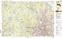
 1983 Worcester South1984 Print · USGSThe Worcester hills and southern suburbs are captured here in the early 1980s as the regional highway network matured. Researchers can trace historic family burial sites at Hope Cemetery and St Josephs Cem or locate institutional landmarks like Clark University.2 unique versions available
 - 1983 Map of Worcester North, 1984 Print
 1983 Worcester North1984 Print · USGSNorth Worcester and its neighboring hill towns are shown in the early eighties as the region's academic and medical campuses expanded. Genealogists and local historians can trace the grounds of Assumption College, the Rural Cemetery, and the Rutland Heights Hospital.2 unique versions available
 - 1985 Map of Holyoke, 1986 Print
 1985 Holyoke1986 Print · USGSThe Pioneer Valley and surrounding uplands appear here in the mid-eighties, showing a landscape defined by the Connecticut River and modern highway expansion. Genealogists and historians can trace rail lines like the Central Vermont Railway and locate regional landmarks from Mount Tom State Reservation to the Quabbin Reservoir.2 unique versions available
 - 1985 Map of Boston, 1986 Print
 1985 Boston1986 Print · USGSThe Massachusetts urban core and its expanding suburbs are captured in the mid-eighties, showing the reach of the Mass Turnpike and Route 128. Genealogists and historians can trace the evolution of towns from Lexington to Waltham, locating landmarks like Harvard University and Minute Man National Historical Park.
 - 1989 Map of Boston
 1989 Boston1989 Print · USGSGreater Boston and the central Massachusetts corridor appear here in the late eighties as suburban growth reshaped the region. Genealogists and historians can trace the transit networks between Boston, Worcester, and Quincy, while locating landmarks like Bunker Hill Monument and Wachusett Reservoir.2 unique versions available
End of results
Showing maps 1-7 of 7
Top cities near Spencer
- Worcester historical maps
- Shrewsbury historical maps
- Webster historical maps
- Southbridge historical maps
- Holden historical maps
- Auburn historical maps
See more
Top neighborhoods of Spencer
- South Spencer historical maps
- North Spencer historical maps
- Camp Neyati historical maps
- Lower Wire Village historical maps
- Tafts Corner historical maps
- Upper Wire Village historical maps
See more
Frequently asked questions
- What are the different types of historical maps available for Spencer?
- What is the oldest map of Spencer?
- Where can I purchase historical maps of Spencer for my home or office?
- Where can I download high-res historical maps of Spencer?
- Are there historical topographic maps available for Spencer?
- Is there historical aerial imagery available for Spencer?
- Where are historical maps of Spencer sourced from?