Old Maps of Alcona Township, Michigan for Genealogy
Trace your family roots with 27 historic maps of Alcona Township. These high-res maps reveal old neighborhoods, homesites, landmarks, and streets — helping you uncover where your ancestors lived and how the area evolved over time.
- Explore historic neighborhoods: Identify where your relatives may have lived in the 1800s or 1900s.
- Compare maps over time: Trace the changes in streets, buildings, and landmarks for multi-generational research.
- Perfect for genealogy & ancestry research: Used by family historians and researchers to map out lineage and migration.
These maps are an incredible resource for exploring your personal connection to Alcona Township's past.
Alcona Township, MI maps
(27)- 1954 Map of Tawas City, 1968 Print
 1954 Tawas City1968 Print · USGSCoastal life along Lake Huron was defined by a mix of military aviation and hydroelectric power in the mid-fifties. Researchers can trace the river dams like Cooke Dam, the layout of Wurtsmith AFB, and the coastal mining operations at Alabaster.4 unique versions available
 - 1958 Map of Tawas City
 1958 Tawas City1958 Print · USGSThe Lake Huron shoreline and northern Michigan timberlands come into focus in the late fifties, during the expansion of the Cold War. Genealogists and historians can trace rail lines like the Detroit and Mackinac, find regional landmarks like the Lumbermans Memorial Monument, and locate coastal facilities including Wurtsmith AFB.2 unique versions available
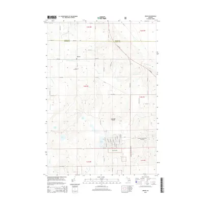
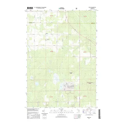
 - 1971 Map of Spruce, 1974 Print
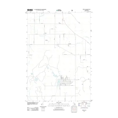
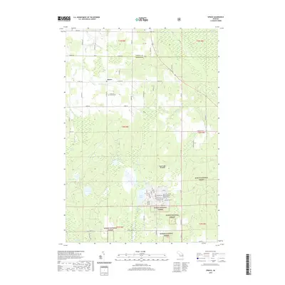
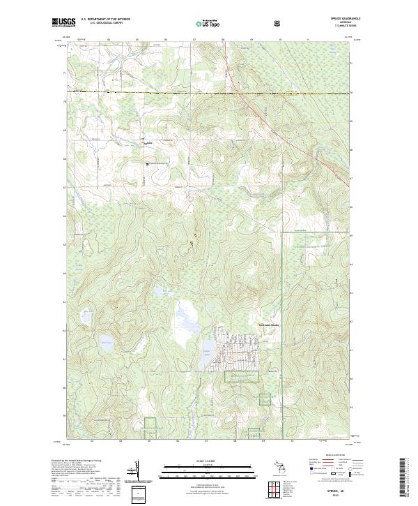
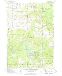 1971 Spruce1974 Print · USGSAlcona County's transition from timber production to a forested recreational landscape is clear in this early 1970s survey. Genealogists and local historians can trace family roots near Spruce and Township Cem, or follow the Old Railroad Grade past Badger Lake.2 unique versions available
 - 1971 Map of Black River, 1974 Print
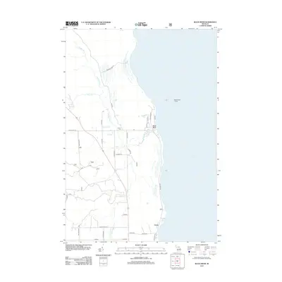
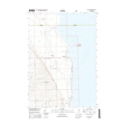
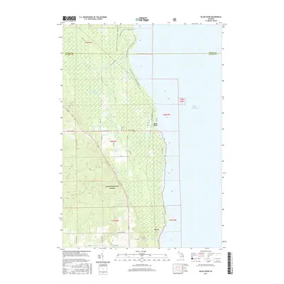
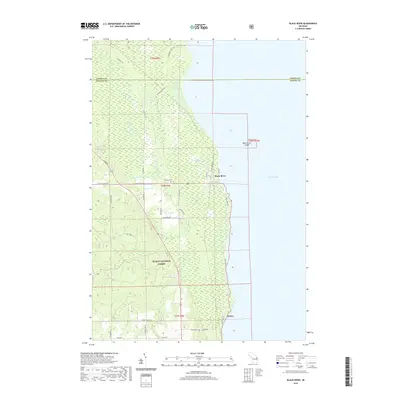
 1971 Black River1974 Print · USGSThe Alcona County coastline comes alive in the early 1970s, showcasing the intersection of the Detroit and Mackinac railroad and the Lake Huron shore. Researchers can trace the layout of the Black River settlement, locating family landmarks like the Black River Sch and Calvary Cem.
 - 1972 Map of Hubbard Lake
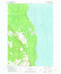
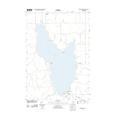
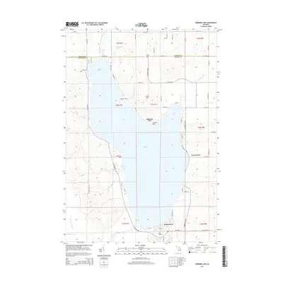
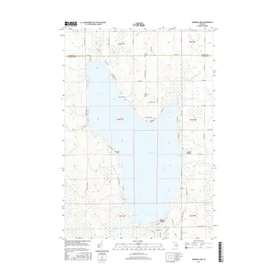
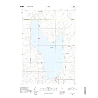
 1972 Hubbard Lake1972 Print · USGSHubbard Lake's expansive shoreline is mapped here in the early seventies, detailing the transition from rural Alcona and Alpena counties to a lakeside community. Researchers can locate local landmarks like the Caledonia Sch, the slopes of Mt Maria, and the docks at Larson Beach.2 unique versions available
 - 1972 Map of Hubbard Lake SW, 1975 Print
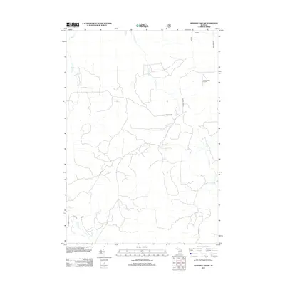
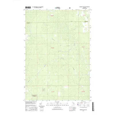
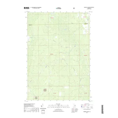
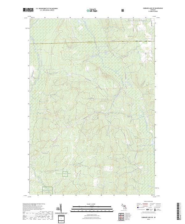
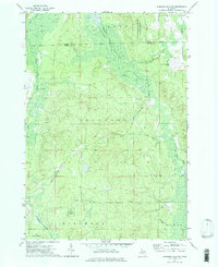 1972 Hubbard Lake SW1975 Print · USGSAlcona County's dense timberlands and marshy creek bottoms are captured here in the early 1970s. Researchers can locate the small Hubbard Lake Village and its Airfield, or trace the rural road network past a Covered Bridge over Wolf Creek.2 unique versions available
 - 1983 Map of Hubbard Lake, 1984 Print
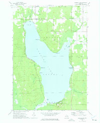
 1983 Hubbard Lake1984 Print · USGSThe shorelines of Alcona and Alpena Counties come to life in this early 1980s overview of the Lake Huron coast and its deep timberlands. Researchers can trace historic rail routes like the Detroit and Mackinac or locate quiet inland hubs such as Barton City and Killmaster.
 - 2011 Map of Hubbard Lake, 2011 Print
 2011 Hubbard Lake2011 Print · USGSCovers Alcona Township, including Ossineke Township, Hubbard Lake, and other nearby areas
 - 2012 Map of Hubbard Lake SW, 2012 Print
 2012 Hubbard Lake SW2012 Print · USGSCovers Alcona Township, including Ossineke Township, Mitchell Township, and other nearby areas
 - 2012 Map of Spruce, 2012 Print
 2012 Spruce2012 Print · USGSCovers Alcona Township, including Lost Lake Woods, Caledonia Township, and other nearby areas
 - 2012 Map of Black River, 2012 Print
 2012 Black River2012 Print · USGSCovers Alcona Township, including Alcona, Black River, and other nearby areas
 - 2014 Map of Black River, 2014 Print
 2014 Black River2014 Print · USGSCovers Alcona Township, including Alcona, Black River, and other nearby areas
 - 2014 Map of Spruce, 2014 Print
 2014 Spruce2014 Print · USGSCovers Alcona Township, including Lost Lake Woods, Caledonia Township, and other nearby areas
 - 2014 Map of Hubbard Lake SW, 2014 Print
 2014 Hubbard Lake SW2014 Print · USGSCovers Alcona Township, including Ossineke Township, Mitchell Township, and other nearby areas
 - 2014 Map of Hubbard Lake, 2014 Print
 2014 Hubbard Lake2014 Print · USGSCovers Alcona Township, including Ossineke Township, Hubbard Lake, and other nearby areas
 - 2017 Map of Black River, 2017 Print
 2017 Black River2017 Print · USGSCovers Alcona Township, including Alcona, Black River, and other nearby areas
 - 2017 Map of Spruce, 2017 Print
 2017 Spruce2017 Print · USGSCovers Alcona Township, including Lost Lake Woods, Caledonia Township, and other nearby areas
 - 2017 Map of Hubbard Lake SW, 2017 Print
 2017 Hubbard Lake SW2017 Print · USGSCovers Alcona Township, including Ossineke Township, Mitchell Township, and other nearby areas
 - 2017 Map of Hubbard Lake, 2017 Print
 2017 Hubbard Lake2017 Print · USGSCovers Alcona Township, including Ossineke Township, Hubbard Lake, and other nearby areas
 - 2019 Map of Black River, 2019 Print
 2019 Black River2019 Print · USGSCovers Alcona Township, including Alcona, Black River, and other nearby areas
 - 2019 Map of Hubbard Lake SW, 2019 Print
 2019 Hubbard Lake SW2019 Print · USGSCovers Alcona Township, including Ossineke Township, Mitchell Township, and other nearby areas
 - 2019 Map of Spruce, 2019 Print
 2019 Spruce2019 Print · USGSCovers Alcona Township, including Lost Lake Woods, Caledonia Township, and other nearby areas
 - 2019 Map of Hubbard Lake, 2019 Print
 2019 Hubbard Lake2019 Print · USGSCovers Alcona Township, including Ossineke Township, Hubbard Lake, and other nearby areas
 - 2023 Map of Hubbard Lake SW, 2023 Print
 2023 Hubbard Lake SW2023 Print · USGSThe Alpena and Alcona county line in the early 2020s remains a landscape of dense timber and winding waterways. Researchers can trace the modern boundaries of the Huron National Forest and locate specific backcountry routes like Hubbard Lake Trl and Fruchey Ranch Rd.
 - 2023 Map of Spruce, 2023 Print
 2023 Spruce2023 Print · USGSSpruce and the surrounding Alcona County woodlands are documented here in the early twenty-first century. Genealogists and outdoor historians can trace the development of Lost Lake Woods or locate family lands near Bear Lake and Ludwig Swamp.
Showing maps 1-25 of 27
Top cities near Alcona Township
- Ossineke historical maps
- Alcona historical maps
- Mikado historical maps
- Gustin historical maps
- Harrisville historical maps
- Lincoln historical maps
See more
Top neighborhoods of Alcona Township
Frequently asked questions
- What are the different types of historical maps available for Alcona Township?
- What is the oldest map of Alcona Township?
- Where can I purchase historical maps of Alcona Township for my home or office?
- Where can I download high-res historical maps of Alcona Township?
- Are there historical topographic maps available for Alcona Township?
- Is there historical aerial imagery available for Alcona Township?
- Where are historical maps of Alcona Township sourced from?