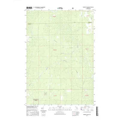
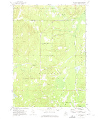
2017 Map of Hubbard Lake SW
USGS Topo · Published 2017About this map
The northern reaches of the Huron National Forest dominate this landscape, where the border of Alpena and Alcona counties meets. A complex network of creeks and drainage basins defines the terrain, centered on the Smokey Hollow Swamp and the headwaters of Wolf Cr. The map reveals a transition from these protected timberlands to a more managed forest environment, marked by numerous access trails and fire roads. Local infrastructure relies on established pathways such as Fruhey Ranch Rd and the Hubbard Lake Trl, which provide navigation through the dense secondary growth. Hydrological features like Davis Cr, Silver Brook Trl, and Cabbage Cr illustrate the drainage patterns of the region's low-lying areas. This document serves as a precise record of the public and private land boundaries within the township system of Northern Michigan during the mid-2010s.
Find a feature on this map
26 named features on this map. Tap any name to fly to it.
Don’t see what you’re looking for? This feature index may not catch every label — zoom into the map to look around manually.
Map Details
Editions of this 2017 Hubbard Lake SW Map
This is the sole edition of this map. No revisions or reprints were ever made.
Other maps of this area

1954 · Tawas City
USGS Topo · 1:250,000

1958 · Tawas City
USGS Topo · 1:250,000

1959 · Glennie
USGS Topo · 1:62,500

1972 · Hubbard Lake
USGS Topo · 1:24,000

1972 · Curran
USGS Topo · 1:24,000

1972 · Hubbard Lake SW
USGS Topo · 1:24,000
1972 · Big Ravine Creek
USGS Topo · 1:24,000
1972 · Beaver Lake
USGS Topo · 1:24,000
1972 · Evans Creek
USGS Topo · 1:24,000
1972 · McGinn Creek
USGS Topo · 1:24,000
Featured Places
- Ossineke Township, MI
- Mitchell Township, MI
- Caledonia Township, MI
- Hawes Township, MI
- Alcona Township, MI