
1972 Map of Curran
USGS Topo · Published 1975About this map
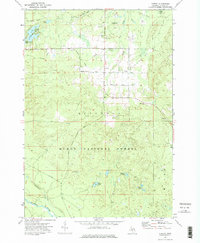
Huron National Forest dominates the southern landscape of this Alcona County quadrangle, where the Au Sable River cuts across the southwestern corner. The mapping shows a transition from the protected forest lands to the settled area around Curran, centered at the junction of Tower Road and Reaves Road. This region is defined by its glacial hydrology, featuring numerous isolated water bodies such as Hoist Lakes, Byron Lake, and Penoyer Lake, many of which feed into the Blockhouse Creek and Penoyer Creek systems.
Find a feature on this map
28 named features on this map. Tap any name to fly to it.
Don’t see what you’re looking for? This feature index may not catch every label — zoom into the map to look around manually.
Map Details
Editions of this 1972 Curran Map
2 editions found
Other maps of this area

1954 · Tawas City
USGS Topo · 1:250,000

1958 · Tawas City
USGS Topo · 1:250,000

1959 · Glennie
USGS Topo · 1:62,500

1972 · McKinley
USGS Topo · 1:24,000

1972 · McCollum Lake
USGS Topo · 1:24,000

1972 · Hubbard Lake SW
USGS Topo · 1:24,000

1972 · Goodar
USGS Topo · 1:24,000

1972 · Alcona Dam Pond
USGS Topo · 1:24,000
1972 · McGinn Creek
USGS Topo · 1:24,000

1983 · Hubbard Lake
USGS Topo · 1:100,000