1920s Maps of Allegan County, Michigan
Explore 4 historic maps of Allegan County from the 1920s. These maps offer a rare glimpse into what life looked like during the 1920s — showing old roads, neighborhoods, homes, and landmarks that have changed or disappeared over time.
Whether you're researching your family's past, planning a metal detecting trip, or studying how Allegan County's landscape evolved across the 1920s, these high-resolution maps are a powerful tool for exploring the history of this region.
- Focus on a specific era: All maps on this page are from the 1920s, giving you a focused view of this time period.
- See what’s changed: Compare century-old streets, trails, and buildings to today's modern landscape using overlays and satellite layers.
- Research with precision: Use these maps for genealogy, historical research, land use analysis, or educational projects.
- View, download, or print: Maps are fully viewable online in high resolution, and can be downloaded or printed for your own records.
Start exploring Allegan County's history through authentic maps from the 1920s. This is your window into the past.
Allegan County, MI maps
(4)- 1927 Map of Bangor, 1959 Print
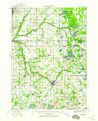 1927 Bangor1959 Print · USGSVan Buren and Allegan counties show a landscape of thriving lakeside resorts and rail-fed farming towns in the late twenties. Trace family roots at Kibbie Chapel or the many local schools like Garden of Eden School and Arlington Center School.2 unique versions available
 - 1927 Map of South Haven, 1972 Print
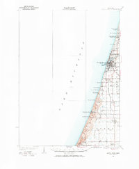 1927 South Haven1972 Print · USGSThe Lake Michigan shoreline of Van Buren County flourished as a resort and agricultural destination during the late twenties. You can trace the Pere Marquette rail line through South Haven and Covert, or find old schoolhouses like Law Sch and Fish Sch.
 - 1928 Map of Fennville, 1955 Print
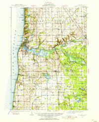 1928 Fennville1955 Print · USGSThe Lake Michigan shoreline and Kalamazoo River delta are captured here in the late 1920s during a peak era of coastal resort development and inland farming. Researchers can locate numerous one-room schoolhouses like Peach Belt Sch and trace the original Pere Marquette rail line through Fennville and New Richmond.4 unique versions available
 - 1929 Map of Holland, 1959 Print
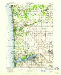 1929 Holland1959 Print · USGSThe Lake Michigan shoreline and the city of Holland appear here as they were in the late 1920s. Local researchers can trace the historic lakefront developments and rural landmarks including Getz Lakewood Farm, the Waukantanka Lodge, and the Pere Marquette rail lines.2 unique versions available
End of results
Showing maps 1-4 of 4
Top cities of Allegan County
- Allegan historical maps
- Plainwell historical maps
- Wayland historical maps
- Otsego historical maps
- Watson historical maps
- Fennville historical maps
See more
Frequently asked questions
- What are the different types of historical maps available for Allegan County?
- What is the oldest map of Allegan County?
- Where can I purchase historical maps of Allegan County for my home or office?
- Where can I download high-res historical maps of Allegan County?
- Are there historical topographic maps available for Allegan County?
- Is there historical aerial imagery available for Allegan County?
- Where are historical maps of Allegan County sourced from?