1950s Maps of Allegan County, Michigan
Explore 5 historic maps of Allegan County from the 1950s. These maps offer a rare glimpse into what life looked like during the 1950s — showing old roads, neighborhoods, homes, and landmarks that have changed or disappeared over time.
Whether you're researching your family's past, planning a metal detecting trip, or studying how Allegan County's landscape evolved across the 1950s, these high-resolution maps are a powerful tool for exploring the history of this region.
- Focus on a specific era: All maps on this page are from the 1950s, giving you a focused view of this time period.
- See what’s changed: Compare century-old streets, trails, and buildings to today's modern landscape using overlays and satellite layers.
- Research with precision: Use these maps for genealogy, historical research, land use analysis, or educational projects.
- View, download, or print: Maps are fully viewable online in high resolution, and can be downloaded or printed for your own records.
Start exploring Allegan County's history through authentic maps from the 1950s. This is your window into the past.
Allegan County, MI maps
(5)- 1958 Map of Allegan, 1959 Print
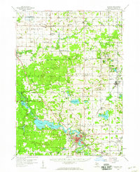 1958 Allegan1959 Print · USGSAllegan and the surrounding Michigan countryside are captured here in the late fifties, showcasing a landscape of river-fed industry and deep-wooded preserves. Genealogists can trace family roots through dozens of local landmarks like Maple Grove Sch, the Indian Mission, and the Oversel Cem.2 unique versions available
 - 1958 Map of Grandville, 1959 Print
 1958 Grandville1959 Print · USGSOttawa and Allegan counties are captured here in the late fifties, showing a landscape of small towns and rural school districts connected by the Grand River. Researchers can trace family roots through the many local landmarks, including the Zutphen Cem, Hanley Sch, and South Blendon.2 unique versions available
 - 1958 Map of Racine, 1971 Print
 1958 Racine1971 Print · USGSThe Lake Michigan shoreline in the late fifties was a study in contrasts between the industrial bustle of Kenosha and the quiet woods of the Allegan State Forest. Genealogists and historians can trace the urban footprint of Evanston or locate strategic sites like Fort Sheridan and the Wind Point Light.3 unique versions available
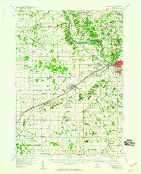
 - 1958 Map of Grand Rapids, 1973 Print
 1958 Grand Rapids1973 Print · USGSSouthern Michigan at the peak of the postwar era shows a landscape of burgeoning cities and new interstate highways. Trace family roots and regional growth in Grand Rapids, Battle Creek, and the glacial lake country around Gun Lake or Gull Lake.2 unique versions available
 - 1959 Map of Wayland
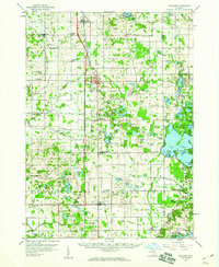 1959 Wayland1959 Print · USGSAllegan and Barry counties at the end of the fifties show a landscape of thriving rail towns and lakeside summer retreats. Genealogists and local historians can trace family-named sites like Bowens Mill, rural parish schools such as St Stanislaus Sch, and the numerous islands of Gun Lake.2 unique versions available
End of results
Showing maps 1-5 of 5
Top cities of Allegan County
- Allegan historical maps
- Plainwell historical maps
- Wayland historical maps
- Otsego historical maps
- Watson historical maps
- Fennville historical maps
See more
Frequently asked questions
- What are the different types of historical maps available for Allegan County?
- What is the oldest map of Allegan County?
- Where can I purchase historical maps of Allegan County for my home or office?
- Where can I download high-res historical maps of Allegan County?
- Are there historical topographic maps available for Allegan County?
- Is there historical aerial imagery available for Allegan County?
- Where are historical maps of Allegan County sourced from?