1970s Maps of Berrien County, Michigan
Explore 13 historic maps of Berrien County from the 1970s. These maps offer a rare glimpse into what life looked like during the 1970s — showing old roads, neighborhoods, homes, and landmarks that have changed or disappeared over time.
Whether you're researching your family's past, planning a metal detecting trip, or studying how Berrien County's landscape evolved across the 1970s, these high-resolution maps are a powerful tool for exploring the history of this region.
- Focus on a specific era: All maps on this page are from the 1970s, giving you a focused view of this time period.
- See what’s changed: Compare century-old streets, trails, and buildings to today's modern landscape using overlays and satellite layers.
- Research with precision: Use these maps for genealogy, historical research, land use analysis, or educational projects.
- View, download, or print: Maps are fully viewable online in high resolution, and can be downloaded or printed for your own records.
Start exploring Berrien County's history through authentic maps from the 1970s. This is your window into the past.
Berrien County, MI maps
(13)- 1970 Map of New Buffalo West, 1973 Print
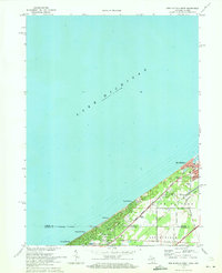 1970 New Buffalo West1973 Print · USGSThe Michigan-Indiana borderlands meet the lakefront in the early 1970s, showcasing a dense network of coastal settlements and rail corridors. Genealogists and local historians can trace property near Pine Grove Cem or locate the St Mary of the Lake Sch and West Sch.2 unique versions available
 - 1970 Map of Coloma, 1973 Print
 1970 Coloma1973 Print · USGSSouthwestern Michigan's orchard and lake country is captured here during the 1970s, as regional commerce followed the Paw Paw River and rail lines. Researchers can trace family ties through several local burial grounds like St Joseph Cem and Coloma Cem, or locate landmarks such as the Watervliet Mun Airport.2 unique versions available
 - 1970 Map of Benton Harbor, 1973 Print
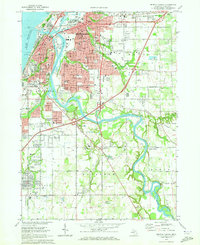 1970 Benton Harbor1973 Print · USGSThe twin cities of the Michigan shoreline are documented here during a period of mid-century growth and industrial rail activity. Researchers can trace the legacy of the House of David, locate old neighborhood landmarks like Calvin Britain Sch, or follow the winding St Joseph River to Kings Landing.2 unique versions available
 - 1970 Map of Baroda, 1973 Print
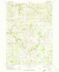
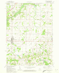
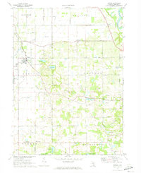 1970 Baroda1973 Print · USGSBerrien County is captured in the early seventies, showing a landscape of small orchards and glacial lakes surrounding Baroda. Genealogists and local historians can trace family-named landmarks like Ruggles Cem, Hickox Landing Strip, and the tracks of the C & O RR.
 - 1970 Map of Sodus, 1973 Print
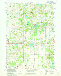
 1970 Sodus1973 Print · USGSBerrien County is shown in the early seventies, a time when small crossroads communities and rural family cemeteries still anchored the landscape. Genealogists can locate family-named markers at Byers Cem or Pennyan Cem and trace settlements like Spinks Corners and Sodus.
 - 1970 Map of Stevensville, 1973 Print
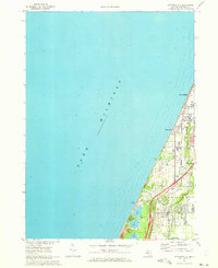 1970 Stevensville1973 Print · USGSThe Berrien County coast during the 1970s shows a landscape of lakeside communities and evolving infrastructure along Lake Michigan. Genealogists and historians can trace local family roots through the Stevensville Cem, Lake Shore Sch, and early residential layouts in Shoreham.2 unique versions available
 - 1970 Map of New Buffalo East, 1973 Print
 1970 New Buffalo East1973 Print · USGSCoastal Michigan and the Indiana borderlands are captured here in the early seventies as lakefront communities and rail corridors defined the region. Genealogists and local historians can trace the grounds of St Paul Monastery, Posey Chapel, and the Forest Lawn Cem.
 - 1970 Map of Benton Heights, 1973 Print
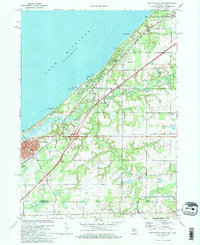
 1970 Benton Heights1973 Print · USGSThe Berrien County shoreline and the lower Paw Paw River valley are shown here in the early 1970s. Trace local roots at St Marys Ch, locate vanished classrooms at School No 6, and follow the Chesapeake and Ohio rail line.
 - 1970 Map of Bridgman, 1973 Print
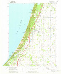 1970 Bridgman1973 Print · USGSThe Berrien County shoreline at the start of the 1970s shows a landscape of massive dunes and growing coastal villages. Genealogists and historians can trace the foundations of Bridgman and Sawyer while locating landmarks like Greenwood Cem and the Chesapeake and Ohio tracks.2 unique versions available
 - 1970 Map of Three Oaks, 1973 Print
 1970 Three Oaks1973 Print · USGSBerrien County and the Indiana state line meet here in the early 1970s, where the Chesapeake and Ohio rail line links rural villages and woodlots. Researchers can trace historic local institutions from River Valley High Sch to quiet rural burial grounds like Shedd Cem.
 - 1971 Map of Galien, 1973 Print
 1971 Galien1973 Print · USGSThe Michigan-Indiana borderlands come to life in the early seventies, showing a landscape defined by the Galien River and rural townships. Trace the paths of the Penn Central railroad and find local landmarks like Oak Ridge Cemetery and Camp Madron.
 - 1971 Map of Berrien Springs, 1973 Print
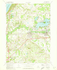
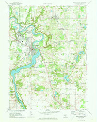 1971 Berrien Springs1973 Print · USGSBerrien County in the early 1970s is a landscape shaped by the winding St Joseph River and the growth of local institutions. Researchers can trace the layout of Andrews University, locate rural burial sites like Rose Hill Cemetery, and follow the Penn Central tracks through Eau Claire.2 unique versions available
 - 1971 Map of Niles West, 1973 Print
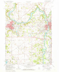 1971 Niles West1973 Print · USGSNiles and Buchanan anchor this 1970s river valley landscape along the Michigan-Indiana border. Researchers can trace ancestral roots at Portage Prairie Ch or locate family plots in St Josephs Cem and Howe Cem.2 unique versions available
End of results
Showing maps 1-13 of 13
Top cities of Berrien County
- Niles historical maps
- Benton Harbor historical maps
- Saint Joseph historical maps
- Buchanan historical maps
- Bridgman historical maps
- New Buffalo historical maps
See more
Frequently asked questions
- What are the different types of historical maps available for Berrien County?
- What is the oldest map of Berrien County?
- Where can I purchase historical maps of Berrien County for my home or office?
- Where can I download high-res historical maps of Berrien County?
- Are there historical topographic maps available for Berrien County?
- Is there historical aerial imagery available for Berrien County?
- Where are historical maps of Berrien County sourced from?