2020s Maps of Berrien County, Michigan
Explore 18 historic maps of Berrien County from the 2020s. These maps offer a rare glimpse into what life looked like during the 2020s — showing old roads, neighborhoods, homes, and landmarks that have changed or disappeared over time.
Whether you're researching your family's past, planning a metal detecting trip, or studying how Berrien County's landscape evolved across the 2020s, these high-resolution maps are a powerful tool for exploring the history of this region.
- Focus on a specific era: All maps on this page are from the 2020s, giving you a focused view of this time period.
- See what’s changed: Compare century-old streets, trails, and buildings to today's modern landscape using overlays and satellite layers.
- Research with precision: Use these maps for genealogy, historical research, land use analysis, or educational projects.
- View, download, or print: Maps are fully viewable online in high resolution, and can be downloaded or printed for your own records.
Start exploring Berrien County's history through authentic maps from the 2020s. This is your window into the past.
Berrien County, MI maps
(18)- 2023 Map of Niles East, 2023 Print
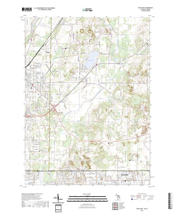 2023 Niles East2023 Print · USGSThe Michigan-Indiana borderlands near Niles and Granger are captured here in the early twenty-first century. Genealogists can trace family sites across many local burial grounds, including Smith's Chapel Cem, Silverbrook Cem, and Harris Prairie Cem.
 - 2023 Map of Bridgman OE W, 2023 Print
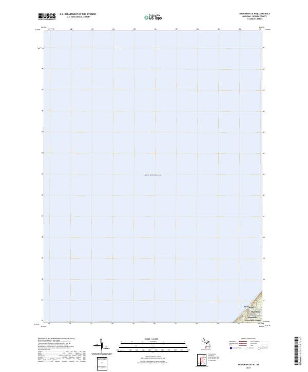 2023 Bridgman OE W2023 Print · USGSThe Berrien County shoreline and open waters of southern Lake Michigan are captured here in the early 2020s. Researchers can trace the layout of waterfront communities including Birchwood, Hazelhurst, and the coastal stretch of Shorewood-Tower Hills-Harbert.
 - 2023 Map of Sumnerville, 2023 Print
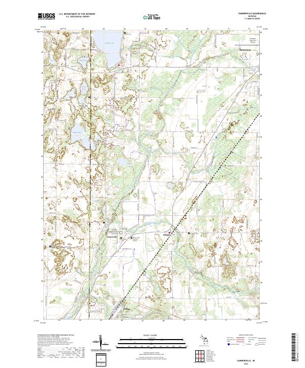 2023 Sumnerville2023 Print · USGSSouthwestern Michigan's rural landscapes between the Dowagiac and Niles area are captured here in the early twenty-first century. Researchers can trace family history at Mission Hills Memorial Gardens or explore the settlements of Sumnerville and Pokagon.
 - 2023 Map of Galien, 2023 Print
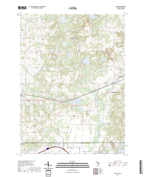 2023 Galien2023 Print · USGSTracing the border of Michigan and Indiana, this 2023 survey captures the rural character and glacial lake network of Berrien County. Researchers can locate family landmarks and burial sites such as Bakertown Cem, McGowan Cem, and the Landing Strip De Rey Rey.
 - 2023 Map of Sister Lakes, 2023 Print
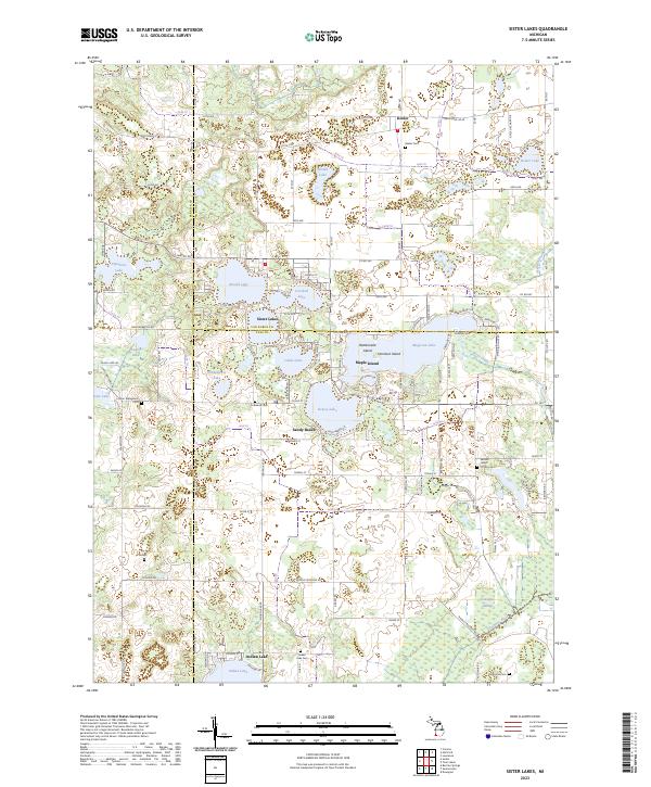 2023 Sister Lakes2023 Print · USGSThe interconnected waters of southwest Michigan are captured here in the early twenty-first century, showing the established communities of Sister Lakes and Keeler. Researchers can trace family history through numerous local sites including Keeler Cem, Indian Lake Cem, and the Sacred Heart of Mary Cem.
 - 2023 Map of Sodus, 2023 Print
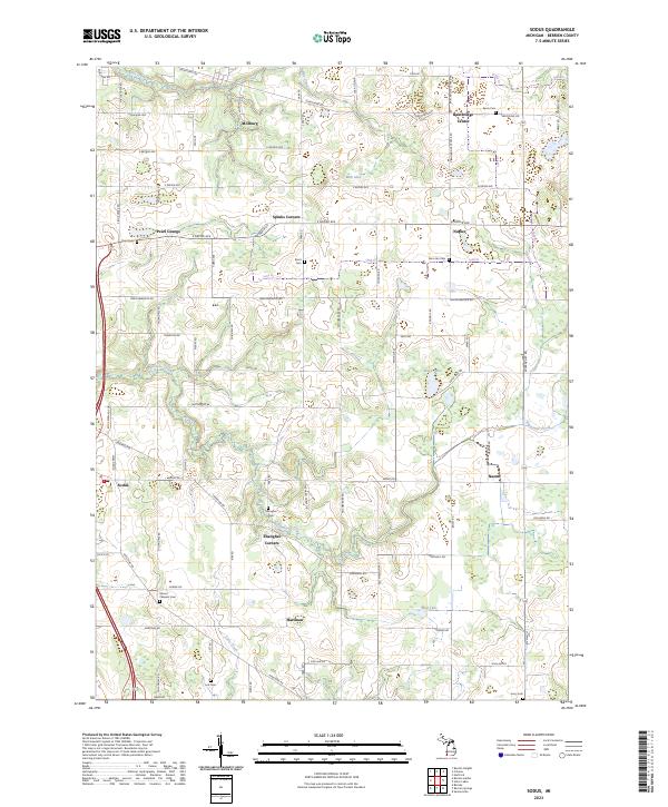 2023 Sodus2023 Print · USGSBerrien County crossroads and rural townships are captured here in the early twenty-first century. Genealogists and local historians can trace family locations near Shanghai Corners or explore sites like Mount Pleasant Cem and Bainbridge Center.
 - 2023 Map of Bridgman, 2023 Print
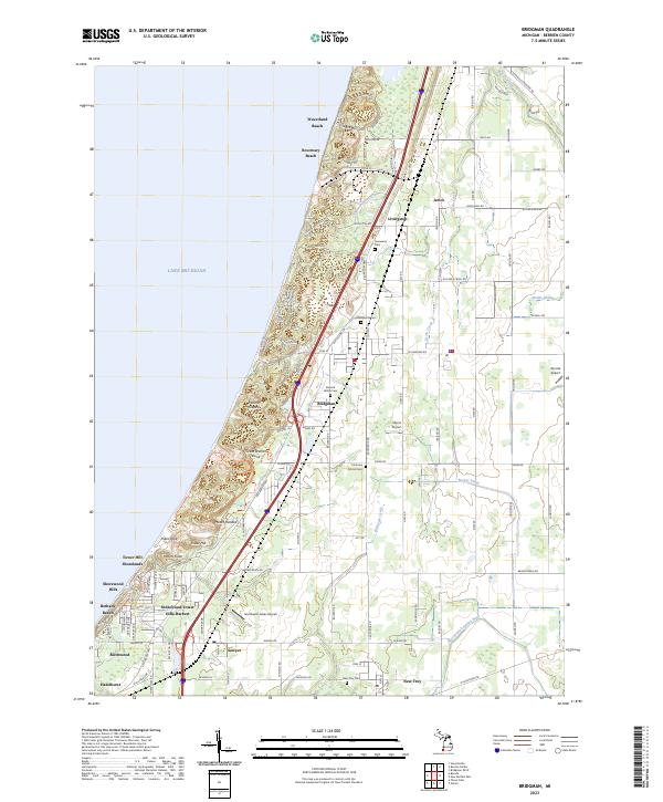 2023 Bridgman2023 Print · USGSThe Berrien County shoreline and its massive dunes are captured here in the early 2020s. Researchers can trace coastal development around Bridgman and Sawyer, and locate family legacy sites like Stanard Family Cem and Graceland Cem.
 - 2023 Map of Benton Heights, 2023 Print
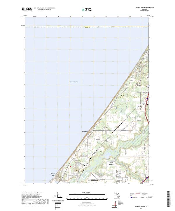 2023 Benton Heights2023 Print · USGSThe Lake Michigan shoreline northeast of Benton Harbor shows a unique blend of coastal retreats and aviation history. Trace the development of Benton Heights near the Southwest Michigan Regional Airport or locate family sites at Lake Shore Cem.
 - 2023 Map of Coloma, 2023 Print
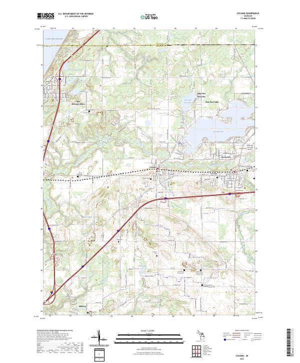 2023 Coloma2023 Print · USGSBerrien County is captured in this modern survey during a period of established lakeside recreation and rural settlement. Genealogists and local historians can locate many family burial sites, including Coloma Cem and Millburg Cem, while tracing the course of the Paw Paw River.
 - 2023 Map of Three Oaks, 2023 Print
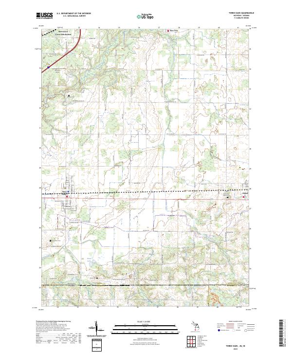 2023 Three Oaks2023 Print · USGSBerrien County and the Michigan-Indiana borderlands are captured here in the contemporary era, showing the enduring layout of rural townships and villages. Genealogists can locate family sites at Smith Germinder Ward Cem or Shedd Cem, and trace the path of CSX TRANSPORTATION rail through Three Oaks.
 - 2023 Map of Niles West, 2023 Print
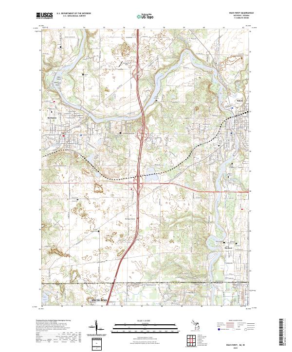 2023 Niles West2023 Print · USGSThe Michigan-Indiana border comes alive in this 2023 survey of the river country between Buchanan and Niles. Researchers can trace local history through numerous burial sites like Portage Prairie Cem and the Father Allouez Grave Site.
 - 2023 Map of New Buffalo East, 2023 Print
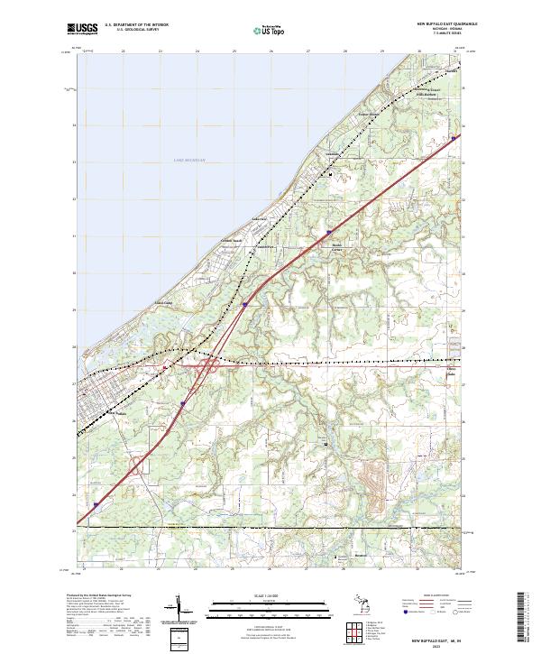 2023 New Buffalo East2023 Print · USGSThe Lake Michigan shoreline and the Michigan-Indiana border meet in this coastal study during the early 2020s. Researchers can trace the development of historic lakefront communities like Union Pier and Lakeside or locate family sites at Maudlin Cem.
 - 2023 Map of Stevensville, 2023 Print
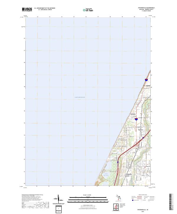 2023 Stevensville2023 Print · USGSThe Lake Michigan shoreline of Berrien County comes into focus in this contemporary survey of the coast between St. Joseph and Stevensville. Genealogists and local researchers can trace the modern layout of Shoreham and Glen Lord, or locate the Lincoln Charter Township Cem.
 - 2023 Map of Baroda, 2023 Print
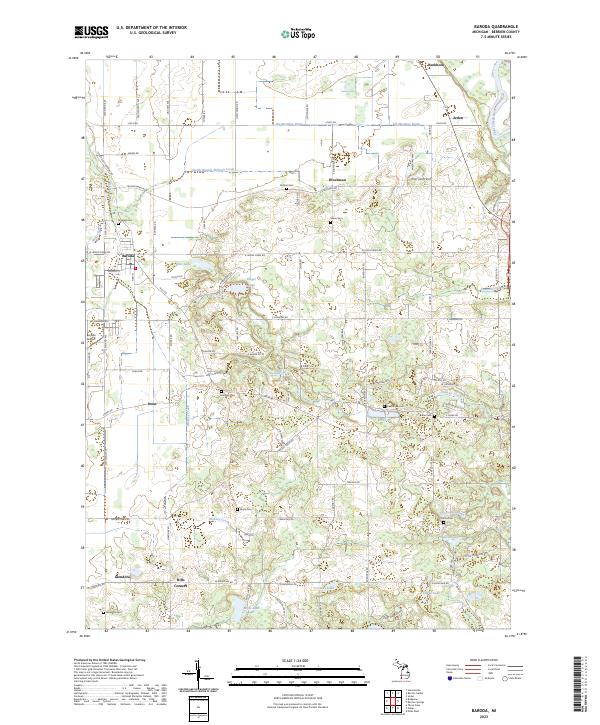 2023 Baroda2023 Print · USGSBerrien County agriculture is in full view on this modern survey of the Baroda area. Researchers can trace rural lineages through local landmarks like Glendora Cem, Hills Corners, and the small aviation history at Baroda Airport.
 - 2023 Map of New Buffalo West, 2023 Print
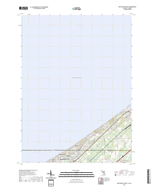 2023 New Buffalo West2023 Print · USGSThe Michigan-Indiana state line meets the coast in this modern survey of the lakeside communities between New Buffalo and Michigan City. Researchers can trace residential development and landmarks like Pine Grove Cem and Grand Beach.
 - 2023 Map of Benton Harbor, 2023 Print
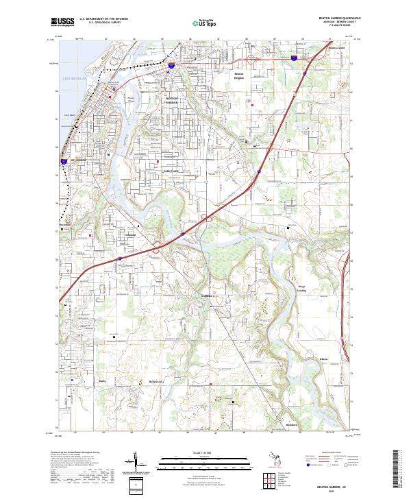 2023 Benton Harbor2023 Print · USGSThe Twin Cities of Benton Harbor and St. Joseph sit at the mouth of the Saint Joseph River in this 2023 survey. Researchers can trace the layout of the urban core near the Berrien County Courthouse or locate family plots at Crystal Springs Cem and Morton Cem.
 - 2023 Map of Hartford, 2023 Print
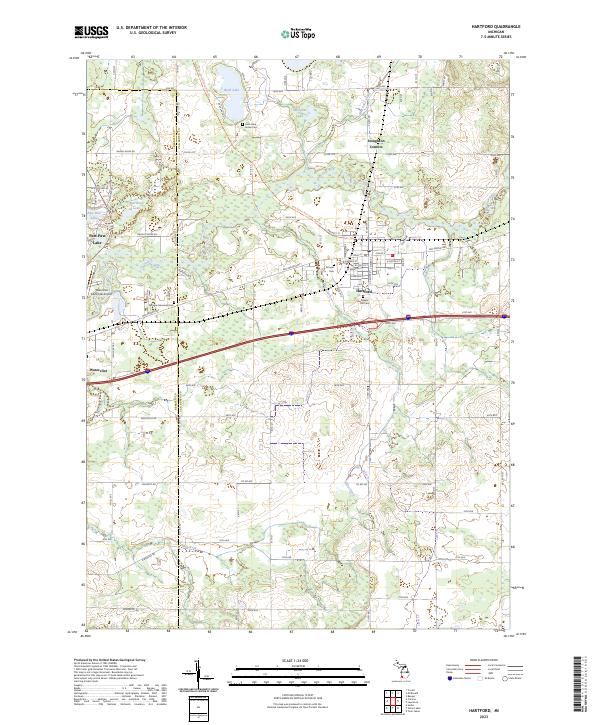 2023 Hartford2023 Print · USGSThe rural landscape of Van Buren County is captured here in the early twenty-first century, showing the town of Hartford and the winding Paw Paw River. Genealogists can trace family locations near Rush Lake Indian Cem, Pioneer Cem, and Stoughton Corners.
 - 2023 Map of Berrien Springs, 2023 Print
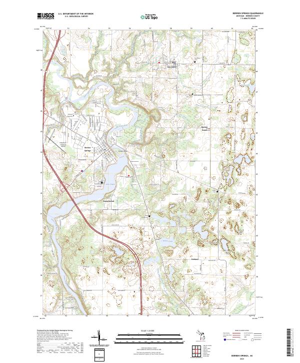 2023 Berrien Springs2023 Print · USGSThe Saint Joseph River valley in modern-day Berrien County shows a landscape defined by collegiate growth and rural crossroads. Researchers can trace family history through numerous sites like Rose Hill Cem, Union Cem, and the campus of Andrews University.
End of results
Showing maps 1-18 of 18
Top cities of Berrien County
- Niles historical maps
- Benton Harbor historical maps
- Saint Joseph historical maps
- Buchanan historical maps
- Bridgman historical maps
- New Buffalo historical maps
See more
Frequently asked questions
- What are the different types of historical maps available for Berrien County?
- What is the oldest map of Berrien County?
- Where can I purchase historical maps of Berrien County for my home or office?
- Where can I download high-res historical maps of Berrien County?
- Are there historical topographic maps available for Berrien County?
- Is there historical aerial imagery available for Berrien County?
- Where are historical maps of Berrien County sourced from?