Old Maps of Houghton County, Michigan for Metal Detecting
Plan your next treasure hunt with 248 historic maps of Houghton County. Find old homesites, ghost towns, trails, and gathering spots that may be lost to time — perfect for identifying promising metal detecting locations.
- Locate forgotten sites: Uncover places like long-lost settlements, abandoned rail lines, or gathering spots.
- Plan better hunts: Use map overlays combined with LiDAR or satellite views to narrow in on historically rich areas.
- Made for detectorists: Thousands of hobbyists use these maps to discover relics, coins, and hidden history.
Use these historic maps to boost your research and find new opportunities beneath the surface of Houghton County.
Houghton County, MI maps
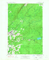
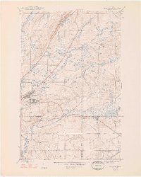
(248)- 1895 Map of Perch Lake
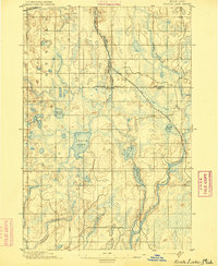 1895 Perch Lake1895 Print · USGSThe Upper Peninsula wilderness comes into focus in the mid-1890s as railroads began to pierce the deep woods of Iron and Baraga counties. Genealogists and historians can trace early rail routes like the D. S. S. and A. R. R. and remote waters such as Perch Lake and the Net River.3 unique versions available
 - 1915 Map of Houghton
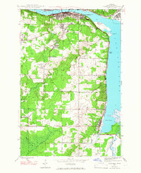
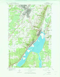
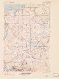
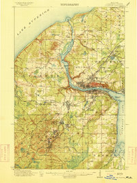 1915 Houghton1915 Print · USGSThe Keweenaw copper boom is in full swing on this map of the Upper Peninsula at the height of its industrial power. Genealogists can trace family roots through company towns like Atlantic Mine, South Range, and Baltic while following the path of the Copper Range RR.4 unique versions available
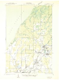
 - 1938 Map of Gay
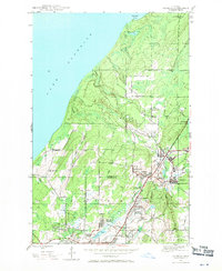
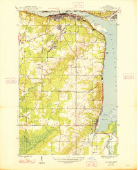
 1938 Gay1938 Print · USGSThe eastern Keweenaw shoreline comes to life in the late 1930s as a landscape of timber and copper transit. Genealogists can locate the footprint of Gay and Traverse Bay while tracing the winding paths of the Tobacco River and Copper Range Highway No 562.
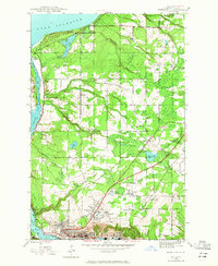
 - 1941 Map of Ahmeek
 1941 Ahmeek1941 Print · USGSThe Keweenaw copper district thrived in the early 1940s, when mining towns were connected by a dense web of steam rail. Genealogists and historians can trace the foundations of Allouez, Wolverine, and the Ahmeek Mine as they stood before mid-century changes.
 - 1941 Map of Mohawk
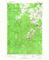
 1941 Mohawk1941 Print · USGSThe Keweenaw Peninsula's copper country comes into focus just before World War II, showing a landscape shaped by mining and rail. Researchers can trace the industrial corridor from Mohawk to Hebards via the Keweenaw Central Railroad and find the Gratiot Mine.
 - 1946 Map of Hancock, 1965 Print
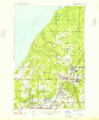
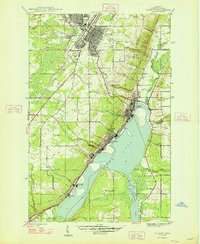
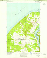
 1946 Hancock1965 Print · USGSHancock and the surrounding copper country appear here during the post-war industrial era. Genealogists and historians can trace the foundations of Suomi College, the deep excavations of the Franklin Mine, and the vanished stops of the Copper Range railroad.5 unique versions available
 - 1946 Map of Chassell, 1966 Print
 1946 Chassell1966 Print · USGSThe Copper Country of Michigan's Upper Peninsula comes to life in this mid-century survey of the port towns and mining districts along the Keweenaw. Genealogists and industrial historians can trace the Isle Royale Mine, the campus of the Michigan College of Mining and Technology, and small-town roots in Dodgeville or Atlantic Mine.2 unique versions available
 - 1946 Map of South Range, 1966 Print
 1946 South Range1966 Print · USGSHoughton County’s copper mining district is captured here just after the war, showing the tight-knit company towns and rail lines of the Keweenaw. Genealogists and industrial historians can trace the footprint of Painesdale, the Atlantic Mine, and the Copper Range railroad.3 unique versions available
 - 1946 Map of Mohawk, 1967 Print
 1946 Mohawk1967 Print · USGSThe copper country of the Keweenaw Peninsula is captured here in the mid-1940s as mining and rail operations defined the local economy. Genealogists and industrial historians can trace the footprint of the Gratiot Mine, the Calumet and Hecla RR, and company towns like Mohawk and Fulton.3 unique versions available
 - 1946 Map of Muggun Creek, 1967 Print
 1946 Muggun Creek1967 Print · USGSThe Keweenaw Peninsula's rugged shoreline meets the water in the mid-1940s, highlighting critical municipal infrastructure. Researchers can trace the coastal utility sites at Tamarack Waterworks and Calumet Waterworks along the banks of Muggun Creek.2 unique versions available
 - 1946 Map of Ahmeek, 1971 Print
 1946 Ahmeek1971 Print · USGSThe Keweenaw copper district comes alive in the 1940s, showing the dense network of mining locations and company towns. Trace the industrial operations of the Ahmeek Mine and Red Jacket Mine alongside settlements like Bumbletown and Copper City.3 unique versions available
 - 1946 Map of Laurium, 1974 Print
 1946 Laurium1974 Print · USGSThe Michigan Copper Country comes into sharp focus during the late 1940s, highlighting the industrial shoreline of Torch Lake. Genealogists and historians can trace the rail networks of the Mineral Range Railroad and locate vanished local landmarks like Quincy Mill and Osceola Sch.2 unique versions available
 - 1947 Map of Ahmeek
 1947 Ahmeek1947 Print · USGSKeweenaw's Copper Country is seen here at a post-war peak of industrial settlement and mining activity. Researchers can trace the extensive Calumet and Hecla rail network and locate historic sites like Ahmeek Mine and Centennial Heights.2 unique versions available
 - 1948 Map of South Range
 1948 South Range1948 Print · USGSThe Michigan Copper Country is captured here during the late 1940s, highlighting the industrial corridor from Atlantic Mine south through Painesdale. Genealogists and historians can trace the precise layouts of mining locations such as Baltic and Trimountain, as well as the COPPER RANGE rail network.2 unique versions available
 - 1948 Map of Muggun Creek
 1948 Muggun Creek1948 Print · USGSLake Superior's shoreline in Houghton and Keweenaw Counties is documented here just after the war. Local researchers can trace early infrastructure like the Tamarack Waterworks and Calumet Waterworks or follow the paths of Muggun Creek and Brewery Cr.2 unique versions available
 - 1948 Map of Laurium
 1948 Laurium1948 Print · USGSThe Michigan Copper Country is frozen in time during the late 1940s, showing the heavy industrial footprint of the Keweenaw Peninsula. Genealogists can trace family footprints from Calumet to Lake Linden, locating old schools like Osceola Sch and the lakeside Quincy Mill.2 unique versions available
 - 1948 Map of Mohawk
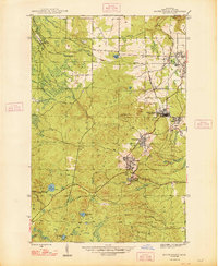
 1948 Mohawk1948 Print · USGSCopper mining and rail transport dominate the Keweenaw Peninsula in the late 1940s as industry follows the mineral-rich ridges. Genealogists and historians can trace the street grids of Mohawk and Fulton or locate industrial sites like the Gratiot Mine and the Hecla and Torch Lake RR.2 unique versions available
 - 1948 Map of Hancock
 1948 Hancock1948 Print · USGSThe Copper Country of Michigan's Upper Peninsula comes alive in the late 1940s, showing the intersection of heavy mining industry and Great Lakes maritime life. Genealogists can trace family roots through Hancock, Pewabic, and Paavola, or locate ancestors at WAASA CEM.2 unique versions available
 - 1948 Map of Chassell
 1948 Chassell1948 Print · USGSThe copper mining heart of the Keweenaw Peninsula is shown here during its mid-century industrial peak. Researchers can trace the rail lines of the Copper Range and locate old mining operations like the Isle Royale Mine and Old Superior Mine.2 unique versions available
 - 1954 Map of Traverse Island, 1955 Print
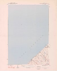
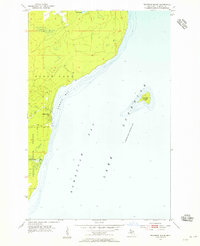 1954 Traverse Island1955 Print · USGSThe Keweenaw Peninsula’s eastern shore is captured in the mid-fifties, centered on the waters of Lake Superior. Researchers can trace the coastal settlement of Rabbit Bay and explore the wooded depths of Baraga State Forest near Traverse Island.3 unique versions available
 - 1954 Map of Gay, 1955 Print
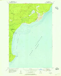 1954 Gay1955 Print · USGSCoastal Keweenaw County comes to life in the mid-fifties, showing the industrial interface between the copper mines and the Great Lakes. Trace the massive Tailings deposits at Gay and the transport path of the Copper Range along the shore.3 unique versions available
 - 1954 Map of Rice Lake, 1955 Print
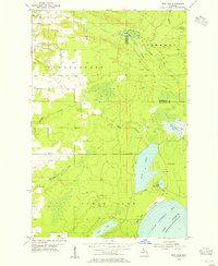 1954 Rice Lake1955 Print · USGSThe Keweenaw Peninsula’s watery interior comes into focus in the mid-fifties, showing the rugged lake-and-creek systems of the northern Copper Country. You can trace the shoreline of Little Traverse Bay or locate the site of Minnetonka Camp near Rice Lake.4 unique versions available
 - 1954 Map of Graveraet River, 1955 Print
 1954 Graveraet River1955 Print · USGSThe Keweenaw Peninsula shoreline and the timbered hills of Houghton County are captured here in the mid-fifties. Genealogists and local historians can locate the Finnish Ch, Toivola Cem, and the Heikkinen Sch along the Copper Range rail corridor.3 unique versions available
 - 1954 Map of Oskar, 1955 Print
 1954 Oskar1955 Print · USGSThe Keweenaw Peninsula’s northern edge comes into focus during the mid-fifties, showing the maritime corridor of the Portage Lake Ship Canal. You can trace local roots at the Redridge Cem or locate old school sites like Onnela Sch.3 unique versions available
 - 1954 Map of Rousseau, 1956 Print
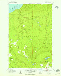
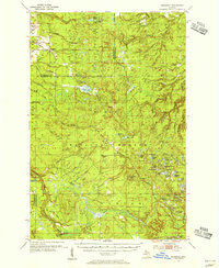 1954 Rousseau1956 Print · USGSHoughton and Ontonagon counties in the mid-1950s reveal a landscape defined by forestry and the reach of the rail lines. Researchers can trace the routes of the Chicago Milwaukee St Paul and Pacific Railroad and find sites like the Michigan College of Mining Forestry Camp and Rousseau.3 unique versions available
Showing maps 1-25 of 248
Top cities of Houghton County
Frequently asked questions
- What are the different types of historical maps available for Houghton County?
- What is the oldest map of Houghton County?
- Where can I purchase historical maps of Houghton County for my home or office?
- Where can I download high-res historical maps of Houghton County?
- Are there historical topographic maps available for Houghton County?
- Is there historical aerial imagery available for Houghton County?
- Where are historical maps of Houghton County sourced from?