Old Maps of Stanton Township, Michigan for Metal Detecting
Plan your next treasure hunt with 66 historic maps of Stanton Township. Find old homesites, ghost towns, trails, and gathering spots that may be lost to time — perfect for identifying promising metal detecting locations.
- Locate forgotten sites: Uncover places like long-lost settlements, abandoned rail lines, or gathering spots.
- Plan better hunts: Use map overlays combined with LiDAR or satellite views to narrow in on historically rich areas.
- Made for detectorists: Thousands of hobbyists use these maps to discover relics, coins, and hidden history.
Use these historic maps to boost your research and find new opportunities beneath the surface of Stanton Township.
Stanton Township, MI maps
(66)- 1915 Map of Houghton
 1915 Houghton1915 Print · USGSThe Keweenaw copper boom is in full swing on this map of the Upper Peninsula at the height of its industrial power. Genealogists can trace family roots through company towns like Atlantic Mine, South Range, and Baltic while following the path of the Copper Range RR.4 unique versions available
 - 1946 Map of Hancock, 1965 Print
 1946 Hancock1965 Print · USGSHancock and the surrounding copper country appear here during the post-war industrial era. Genealogists and historians can trace the foundations of Suomi College, the deep excavations of the Franklin Mine, and the vanished stops of the Copper Range railroad.5 unique versions available
 - 1946 Map of South Range, 1966 Print
 1946 South Range1966 Print · USGSHoughton County’s copper mining district is captured here just after the war, showing the tight-knit company towns and rail lines of the Keweenaw. Genealogists and industrial historians can trace the footprint of Painesdale, the Atlantic Mine, and the Copper Range railroad.3 unique versions available
 - 1948 Map of South Range
 1948 South Range1948 Print · USGSThe Michigan Copper Country is captured here during the late 1940s, highlighting the industrial corridor from Atlantic Mine south through Painesdale. Genealogists and historians can trace the precise layouts of mining locations such as Baltic and Trimountain, as well as the COPPER RANGE rail network.2 unique versions available
 - 1948 Map of Hancock
 1948 Hancock1948 Print · USGSThe Copper Country of Michigan's Upper Peninsula comes alive in the late 1940s, showing the intersection of heavy mining industry and Great Lakes maritime life. Genealogists can trace family roots through Hancock, Pewabic, and Paavola, or locate ancestors at WAASA CEM.2 unique versions available
 - 1954 Map of Graveraet River, 1955 Print
 1954 Graveraet River1955 Print · USGSThe Keweenaw Peninsula shoreline and the timbered hills of Houghton County are captured here in the mid-fifties. Genealogists and local historians can locate the Finnish Ch, Toivola Cem, and the Heikkinen Sch along the Copper Range rail corridor.3 unique versions available
 - 1954 Map of Oskar, 1955 Print
 1954 Oskar1955 Print · USGSThe Keweenaw Peninsula’s northern edge comes into focus during the mid-fifties, showing the maritime corridor of the Portage Lake Ship Canal. You can trace local roots at the Redridge Cem or locate old school sites like Onnela Sch.3 unique versions available
 - 1954 Map of Beacon Hill, 1956 Print
 1954 Beacon Hill1956 Print · USGSCoastal Houghton County comes into focus in the mid-fifties, showing the intersection of industrial rail and lakeside settlements. Trace the Copper Range tracks and explore the engineering of the Redridge Dam near Freda and Beacon Hill.3 unique versions available
 - 1954 Map of Rockhouse Point, 1956 Print
 1954 Rockhouse Point1956 Print · USGSThe Keweenaw Peninsula coastline remains largely wild in the mid-1950s, defined by the sweeping shores of Lake Superior. Researchers can trace the drainage of the Elm River and locate coastal landmarks like Stanton Park, Agate Beach, and Rockhouse Point.2 unique versions available
 - 1954 Map of Winona, 1956 Print
 1954 Winona1956 Print · USGSIn the mid-1950s, the Copper Country south of Houghton was a landscape of industrial mines and deep forests. Genealogists and historians can trace the foundations of Winona, locate the Winona Mine, and find rural landmarks like the Misery Bay Sch and Simar Landing Field.3 unique versions available
 - 1954 Map of Houghton, 1959 Print
 1954 Houghton1959 Print · USGSThe Keweenaw Peninsula copper mining district is shown here at mid-century, centering on the twin cities of Hancock and Houghton. Genealogists and industrial historians can trace the rail lines of the Duluth South Shore and Atlantic Railroad to legacy sites like Champion Mine, Mill Mine Junction, and Pewabic.2 unique versions available
 - 1958 Map of Hancock, 1967 Print
 1958 Hancock1967 Print · USGSThe Keweenaw Peninsula and Isle Royale are seen here during the mid-twentieth century as mining and maritime hubs. Trace the dense town layouts of Hancock and Calumet, or locate remote coastal markers like the Eagle Harbor Lighthouse and Rock of Ages Light.2 unique versions available
 - 1958 Map of Iron River, 1968 Print
 1958 Iron River1968 Print · USGSThe Upper Peninsula in the late fifties is captured here as a landscape of timber, iron, and rail. Genealogists and historians can trace rail stops like Mass Station or explore the coastlines of Lake Gogebic and Keweenaw Bay.3 unique versions available
 - 1960 Map of Iron River
 1960 Iron River1960 Print · USGSThe Upper Peninsula’s western reaches are shown in the late fifties, featuring the industrial infrastructure of the Copper Country and the vast Ottawa National Forest. Researchers can trace the rail lines of the Milwaukee Road through settlements like Bruce Crossing and the White Pine Mine.
 - 1960 Map of Hancock
 1960 Hancock1960 Print · USGSThe Keweenaw Peninsula and Isle Royale are captured in detail during the late 1950s. Researchers can trace copper-mining era settlements like Calumet and Laurium, or locate remote maritime landmarks such as the Isle Royale Lighthouse.
 - 1961 Map of Iron River
 1961 Iron River1961 Print · USGSThe Upper Peninsula and northern Wisconsin are shown here in the early 1960s, a landscape defined by the iron range and vast timberlands. Researchers can trace the legacy of mining and rail transport through Caspian, the Lac Du Flambeau Indian Reservation, and the Milwaukee Road.
 - 1961 Map of Hancock
 1961 Hancock1961 Print · USGSThe Keweenaw Peninsula and Isle Royale are shown here at the start of the 1960s, featuring the region's historic copper mining and maritime infrastructure. Genealogists and researchers can trace local families through settlements like Atlantic Mine and Painesdale, or locate remote landmarks including Rock of Ages Light and Eagle Harbor.
 - 1966 Map of Hancock, 1987 Print
 1966 Hancock1987 Print · USGSThe Keweenaw Peninsula and Isle Royale are captured in the mid-1960s during a pivotal era for Michigan’s Copper Country. Trace the industrial footprint of the SOO LINE through Calumet or locate historic maritime landmarks like Fort Wilkins and Rock of Ages Light.
 - 1967 Map of Iron River, 1968 Print
 1967 Iron River1968 Print · USGSThe Upper Peninsula and northern Wisconsin borderlands are shown here in the late sixties, a landscape of deep woods and iron-country rail lines. Genealogists and historians can trace the lakeside settlements of L'Anse and Ontonagon or follow the Soo Line through towns like Michigamme and Nestoria.
 - 1978 Map of Rockhouse Point
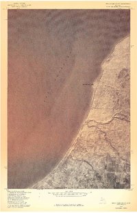 1978 Rockhouse Point1978 Print · USGSThe Houghton County shoreline near Rockhouse Point is captured in this late-seventies aerial survey. Researchers can study the untouched coastal landscape and the exact intersection of land lines against the waters of Lake Superior.
 - 1978 Map of Beacon Hill
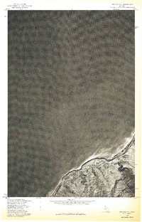 1978 Beacon Hill1978 Print · USGSThe Keweenaw Peninsula shoreline comes into sharp focus during the late 1970s in this detailed aerial perspective. Genealogists and local historians can trace the footprint of coastal settlements like Beacon Hill and Redridge against the waters of Lake Superior.
 - 1978 Map of Hancock, 1980 Print
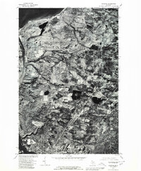 1978 Hancock1980 Print · USGSThe Keweenaw Peninsula is captured in the late seventies, showing the industrial and residential heart of Hancock along the water. Trace the path of the Portage Lake Ship Canal and locate rural crossroads like Paavola and Boston.
 - 1982 Map of Donken, 1983 Print
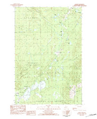 1982 Donken1983 Print · USGSThe Keweenaw Peninsula forestlands and glacial lakes are shown here in the early eighties as a quiet region of timber and recreation. Local historians can trace the small settlements of Donken and Toivola or the boundaries of Twin Lakes State Park.
 - 1982 Map of Winona North, 1983 Print
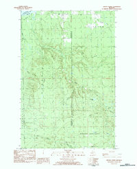 1982 Winona North1983 Print · USGSThe Upper Peninsula shoreline and the timberlands of Stanton are captured here in the early 1980s. Local researchers can trace the roads near Winona, locate the Townhall at Misery Bay, and find remote outposts like Camp 18 and Ahola.
 - 1985 Map of Hancock
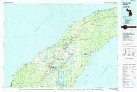 1985 Hancock1985 Print · USGSThe Keweenaw Peninsula in the mid-1980s reveals a landscape shaped by copper and the Great Lakes. You can trace the industrial legacy of the region through the Quincy Mine, the Old RR Grade, and old cemeteries like Forest Hill Cem.3 unique versions available
Showing maps 1-25 of 66
Top cities near Stanton Township
Top neighborhoods of Stanton Township
- Schmidt Corner historical maps
- Freda historical maps
- Redridge historical maps
- Salmon Trout historical maps
- Liminga historical maps
- Oskar historical maps
See more
Frequently asked questions
- What are the different types of historical maps available for Stanton Township?
- What is the oldest map of Stanton Township?
- Where can I purchase historical maps of Stanton Township for my home or office?
- Where can I download high-res historical maps of Stanton Township?
- Are there historical topographic maps available for Stanton Township?
- Is there historical aerial imagery available for Stanton Township?
- Where are historical maps of Stanton Township sourced from?