2020s Maps of Stanton Township, Michigan
Explore 8 historic maps of Stanton Township from the 2020s. These maps offer a rare glimpse into what life looked like during the 2020s — showing old roads, neighborhoods, homes, and landmarks that have changed or disappeared over time.
Whether you're researching your family's past, planning a metal detecting trip, or studying how Stanton Township's landscape evolved across the 2020s, these high-resolution maps are a powerful tool for exploring the history of this region.
- Focus on a specific era: All maps on this page are from the 2020s, giving you a focused view of this time period.
- See what’s changed: Compare century-old streets, trails, and buildings to today's modern landscape using overlays and satellite layers.
- Research with precision: Use these maps for genealogy, historical research, land use analysis, or educational projects.
- View, download, or print: Maps are fully viewable online in high resolution, and can be downloaded or printed for your own records.
Start exploring Stanton Township's history through authentic maps from the 2020s. This is your window into the past.
Stanton Township, MI maps
- 2023 Map of Beacon Hill, 2023 Print
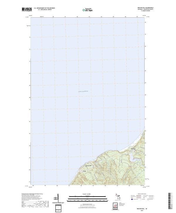 2023 Beacon Hill2023 Print · USGSThe copper-country coast of Houghton County is shown in this contemporary study of its shoreline settlements and drainage. Researchers can trace the layout of Beacon Hill, Freda, and Redridge or follow the course of the Salmon Trout River to the lake.
 - 2023 Map of South Range, 2023 Print
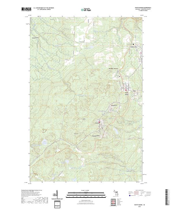 2023 South Range2023 Print · USGSModern-day Houghton County retains the deep footprints of the copper mining era in this contemporary survey. Genealogists and industrial historians can trace the foundations of Atlantic Mine, find family names in the Mountain View Cem, or follow the Bill Nicholls Route Trl.
 - 2023 Map of Winona North, 2023 Print
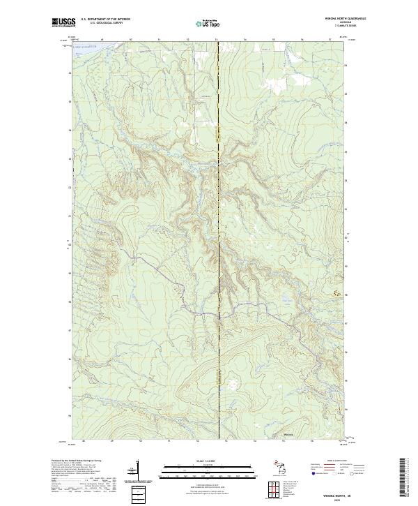 2023 Winona North2023 Print · USGSThe Lake Superior shoreline meets the heavy timberlands of the Upper Peninsula in this modern survey of the Ontonagon and Houghton county line. Local historians can trace the course of the Misery River and find landmarks like Wyandotte Falls and the settlement of Winona.
 - 2023 Map of Donken, 2023 Print
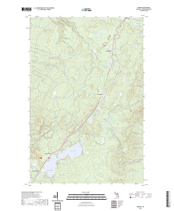 2023 Donken2023 Print · USGSHoughton County's Copper Country is revealed in this modern survey of the timber and lake lands around Donken. Researchers can trace the historic rail corridor along the Bill Nicholls Route Trl and locate family landmarks near Lake Gerald and Toivola.
 - 2023 Map of Graveraet River, 2023 Print
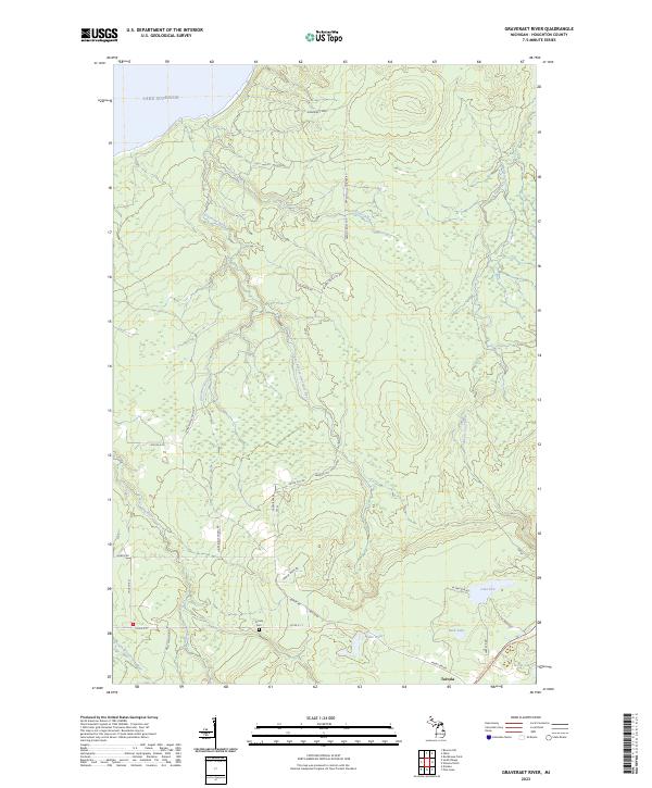 2023 Graveraet River2023 Print · USGSThe Keweenaw Peninsula backcountry near the shores of Lake Superior comes into focus in this recent survey. Genealogists and local historians can trace family-named roads near Toivola, find the Toivola Cem, or follow the Bill Nicholls Route Trl past Lake Weber.
 - 2023 Map of Rockhouse Point, 2023 Print
 2023 Rockhouse Point2023 Print · USGSCoastal Houghton County comes into focus in this contemporary survey of the Lake Superior shoreline. Trace the winding paths of Elm River and Little Elm River as they meet the lake at Agate Beach and Santa Monica Beach.
 - 2023 Map of Hancock, 2023 Print
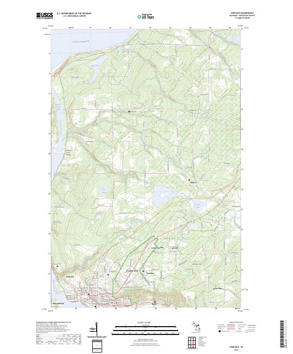 2023 Hancock2023 Print · USGSHoughton County's mining heritage is on full display in the early twenty-first century, spanning the industrial corridor between Hancock and Dollar Bay. Researchers can trace the layout of historic settlements like Franklin Mine, Paavola, and Boston.
 - 2023 Map of Oskar, 2023 Print
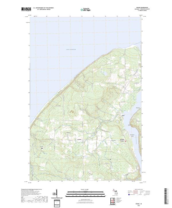 2023 Oskar2023 Print · USGSHoughton County's northern shore meets the Great Lakes in the 2020s, showing the settled landscape of the Keweenaw Peninsula. Genealogists can trace local landmarks like Oskar Cem and the rural crossroads of Liminga, Oskar, and Schmidt Corner.
End of results
Showing maps 1-8
Top cities near Stanton Township
Top neighborhoods of Stanton Township
- Schmidt Corner historical maps
- Freda historical maps
- Redridge historical maps
- Salmon Trout historical maps
- Liminga historical maps
- Oskar historical maps
See more
Frequently asked questions
- What are the different types of historical maps available for Stanton Township?
- What is the oldest map of Stanton Township?
- Where can I purchase historical maps of Stanton Township for my home or office?
- Where can I download high-res historical maps of Stanton Township?
- Are there historical topographic maps available for Stanton Township?
- Is there historical aerial imagery available for Stanton Township?
- Where are historical maps of Stanton Township sourced from?