1910s Maps of Ingham County, Michigan
Explore 7 historic maps of Ingham County from the 1910s. These maps offer a rare glimpse into what life looked like during the 1910s — showing old roads, neighborhoods, homes, and landmarks that have changed or disappeared over time.
Whether you're researching your family's past, planning a metal detecting trip, or studying how Ingham County's landscape evolved across the 1910s, these high-resolution maps are a powerful tool for exploring the history of this region.
- Focus on a specific era: All maps on this page are from the 1910s, giving you a focused view of this time period.
- See what’s changed: Compare century-old streets, trails, and buildings to today's modern landscape using overlays and satellite layers.
- Research with precision: Use these maps for genealogy, historical research, land use analysis, or educational projects.
- View, download, or print: Maps are fully viewable online in high resolution, and can be downloaded or printed for your own records.
Start exploring Ingham County's history through authentic maps from the 1910s. This is your window into the past.
Ingham County, MI maps
(7)- 1910 Map of Fowlerville
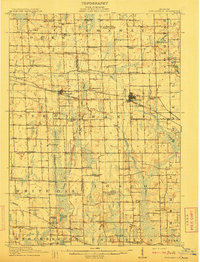 1910 Fowlerville1910 Print · USGSBefore the age of consolidated schools and modern highways, this 1910 survey shows the rural landscape of Ingham and Livingston counties at its peak. Researchers can trace dozens of country schoolhouses like Podunk School and Hogback School alongside the path of the Pere Marquette RR.2 unique versions available
 - 1910 Map of Lansing, 1958 Print
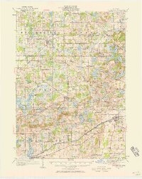
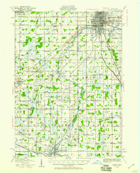 1910 Lansing1958 Print · USGSThe state capital and its surrounding agrarian townships are captured here during a period of significant growth at the start of the 1910s. Genealogists can trace hundreds of family farms and local landmarks including Dolly Varden School, Grovenberg Church, and the Pere Marquette rail lines.
 - 1911 Map of Mason
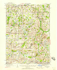
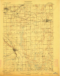 1911 Mason1911 Print · USGSIngham County at the start of the twentieth century shows a landscape of busy rail junctions and rural school districts. Genealogists can trace family roots through dozens of named country schools like White Dog School and Marble School, or locate ancestral property near Mason and Dansville.3 unique versions available
 - 1912 Map of Lansing
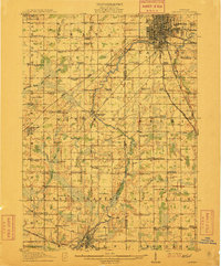 1912 Lansing1912 Print · USGSLansing and the surrounding townships are captured in 1912 as the region's rural character met the growing industrial city. Genealogists can trace family footprints through dozens of country school sites like Dolly Varden School or settlements such as Dimondale and Canada Settlement.4 unique versions available
 - 1919 Map of Stockbridge, 1958 Print
 1919 Stockbridge1958 Print · USGSSouthern Michigan at the end of the Great War is a landscape of rural school districts and expanding rail lines. Genealogists and local historians can locate dozens of country schools like Stilson School, family-named landmarks such as Sackrider Hill, and the rail junction at Bullis Crossing.2 unique versions available
 - 1919 Map of Springport, 1958 Print
 1919 Springport1958 Print · USGSSouthern Michigan at the close of the Great War is a landscape of rural schoolhouses and historic turnpikes. Genealogists can locate family landmarks like Chapel Cemetery or trace the early paths of the Old Plank Road and Michigan Central Railroad.3 unique versions available
 - 1919 Map of Rives Junction, 1960 Print
 1919 Rives Junction1960 Print · USGSThe rural landscapes of Ingham and Jackson Counties are captured here at the end of the Great War. Genealogists can trace family footprints across dozens of local school districts and settlements like Rives Junction, Bunker Hill Center, and Fitchburg.
End of results
Showing maps 1-7 of 7
Top cities of Ingham County
Frequently asked questions
- What are the different types of historical maps available for Ingham County?
- What is the oldest map of Ingham County?
- Where can I purchase historical maps of Ingham County for my home or office?
- Where can I download high-res historical maps of Ingham County?
- Are there historical topographic maps available for Ingham County?
- Is there historical aerial imagery available for Ingham County?
- Where are historical maps of Ingham County sourced from?