1920s Maps of Ingham County, Michigan
Explore 7 historic maps of Ingham County from the 1920s. These maps offer a rare glimpse into what life looked like during the 1920s — showing old roads, neighborhoods, homes, and landmarks that have changed or disappeared over time.
Whether you're researching your family's past, planning a metal detecting trip, or studying how Ingham County's landscape evolved across the 1920s, these high-resolution maps are a powerful tool for exploring the history of this region.
- Focus on a specific era: All maps on this page are from the 1920s, giving you a focused view of this time period.
- See what’s changed: Compare century-old streets, trails, and buildings to today's modern landscape using overlays and satellite layers.
- Research with precision: Use these maps for genealogy, historical research, land use analysis, or educational projects.
- View, download, or print: Maps are fully viewable online in high resolution, and can be downloaded or printed for your own records.
Start exploring Ingham County's history through authentic maps from the 1920s. This is your window into the past.
Ingham County, MI maps
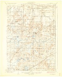
(7)- 1921 Map of Rives Junction
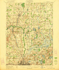 1921 Rives Junction1921 Print · USGSJackson and its northern rural townships are captured in the early twenties, a time of small school districts and steam-powered rail travel. Genealogists can locate family landmarks such as Bunker Hill Chapel, the County Infirmary, and East Rives Cemetery.3 unique versions available
 - 1921 Map of Springport
 1921 Springport1921 Print · USGSCentral Michigan's agricultural heartland at the end of the Great War reveals a landscape of dispersed farmsteads and numerous small school districts. Genealogists can trace family lands near Onondaga, Kinneville, and Chapel Cemetery, or locate vanished schoolhouses like Knight School and Fisk School.2 unique versions available
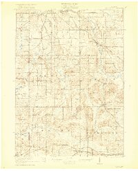
 - 1922 Map of Stockbridge
 1922 Stockbridge1922 Print · USGSSoutheastern Michigan at the start of the twenties is a land of rail-connected hamlets and countless country schools. Genealogists can trace family footprints near Stockbridge and Unadilla, or locate rural landmarks like Strobel School and Sylvan Sta.3 unique versions available
 - 1926 Map of Corunna, 1958 Print
 1926 Corunna1958 Print · USGSShiawassee County in the mid-twenties shows a landscape of busy rail junctions and productive farmland. Genealogists can trace family roots through numerous rural schools like Eddy Sch and settlements including Bancroft and Shiawasseetown.2 unique versions available
 - 1927 Map of De Witt
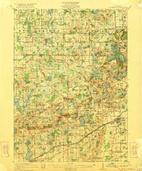
 1927 De Witt1927 Print · USGSClinton County and its neighbors are captured here in the 1920s, showing a landscape of small farming townships and river-fed settlements. Researchers can trace dozens of rural school sites like Bengal Center School and local landmarks like Oak Ridge Cemetery or the Wilsey Church.3 unique versions available
 - 1928 Map of Laingsburg
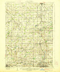
 1928 Laingsburg1928 Print · USGSCentral Michigan in the late twenties shows a landscape of busy rural school districts and multiple rail lines connecting the tri-county area. Local historians can trace family locations near Octagon Sch, Reed Church, and the tracks of the Michigan Electric Railway.5 unique versions available
 - 1929 Map of Corunna
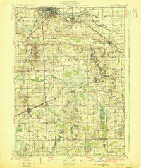 1929 Corunna1929 Print · USGSShiawassee County thrives as a rail and industrial hub during the late twenties, centered on the growing cities of Owosso and Corunna. Genealogists can trace family roots through dozens of rural landmarks like Bennington No 1 School, Shiawasseetown, and the Electric Railway route.3 unique versions available
End of results
Showing maps 1-7 of 7
Top cities of Ingham County
Frequently asked questions
- What are the different types of historical maps available for Ingham County?
- What is the oldest map of Ingham County?
- Where can I purchase historical maps of Ingham County for my home or office?
- Where can I download high-res historical maps of Ingham County?
- Are there historical topographic maps available for Ingham County?
- Is there historical aerial imagery available for Ingham County?
- Where are historical maps of Ingham County sourced from?