2020s Maps of Crystal Falls Township, Michigan
Explore 12 historic maps of Crystal Falls Township from the 2020s. These maps offer a rare glimpse into what life looked like during the 2020s — showing old roads, neighborhoods, homes, and landmarks that have changed or disappeared over time.
Whether you're researching your family's past, planning a metal detecting trip, or studying how Crystal Falls Township's landscape evolved across the 2020s, these high-resolution maps are a powerful tool for exploring the history of this region.
- Focus on a specific era: All maps on this page are from the 2020s, giving you a focused view of this time period.
- See what’s changed: Compare century-old streets, trails, and buildings to today's modern landscape using overlays and satellite layers.
- Research with precision: Use these maps for genealogy, historical research, land use analysis, or educational projects.
- View, download, or print: Maps are fully viewable online in high resolution, and can be downloaded or printed for your own records.
Start exploring Crystal Falls Township's history through authentic maps from the 2020s. This is your window into the past.
Crystal Falls Township, MI maps
(12)- 2023 Map of Nelson Lake, 2023 Print
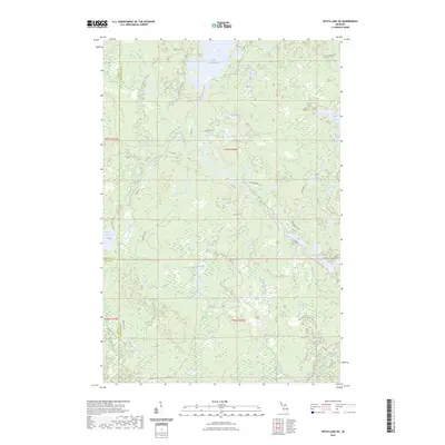
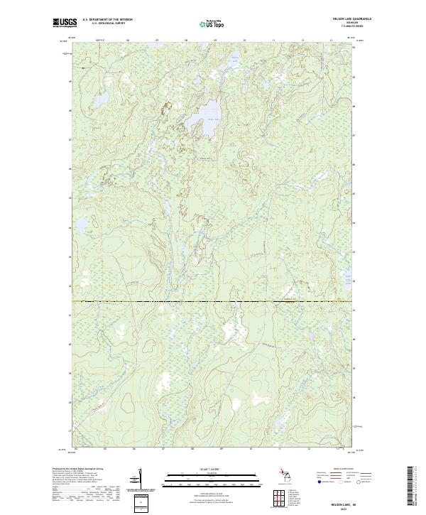 2023 Nelson Lake2023 Print · USGSThe wooded highlands of Baraga and Iron counties are captured here in the early 2020s, showing a landscape defined by the East Branch Fence River. Researchers can trace remote forest access via Fence River Rd and locate secluded water bodies like Nelson Lake and Fence Lake.
 - 2023 Map of Witch Lake, 2023 Print
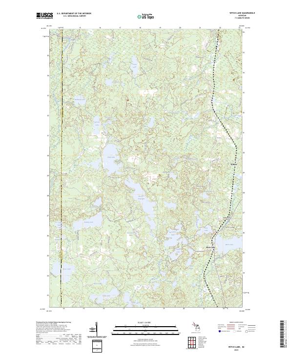 2023 Witch Lake2023 Print · USGSThe Marquette and Iron county line runs through this lake-rich portion of the Upper Peninsula in the 2020s. Researchers can trace the settlement of Witch Lake and explore the remote hydrography near Witbeck, including Chief Lake and the Michigan River.
 - 2023 Map of Ned Lake SE, 2023 Print
 2023 Ned Lake SE2023 Print · USGSIron County's forested lake country is documented in the 2020s, showing a remote Michigan landscape of timber tracts and headwaters. Trace the historic route of The Grade or explore the shores of Deer Lake and Square Lake.
 - 2023 Map of Amasa, 2023 Print
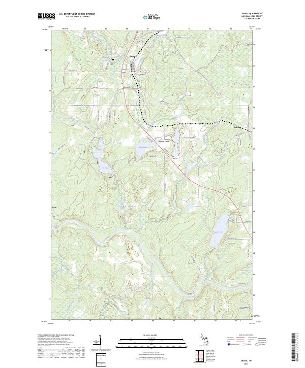 2023 Amasa2023 Print · USGSIron County’s timber and mining heritage remains visible in this recent survey of Amasa and its surrounding wetlands. Genealogists and historians can locate the Hematite Cem or trace the winding waters of the Paint River and Hemlock River.
 - 2023 Map of Hickman Lake, 2023 Print
 2023 Hickman Lake2023 Print · USGSIron County’s timberlands and river systems are shown in great detail during the early 2020s. Genealogists and outdoorsmen can trace remote access routes like Deerfoot Lodge Rd and water bodies including Bates Lake and the Fence River.
 - 2023 Map of Crystal Falls, 2023 Print
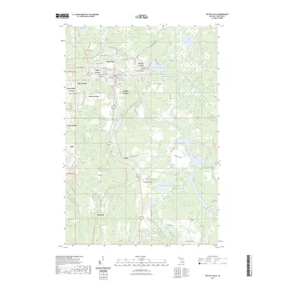 2023 Crystal Falls2023 Print · USGSCrystal Falls and the surrounding mining district of Iron County are documented here in the early twenty-first century. Researchers can trace the layout of traditional residential areas like Tobin and Shafer, or locate landmarks such as the Iron County Courthouse and Evergreen Memorial Cemetery.
 - 2023 Map of Ned Lake, 2023 Print
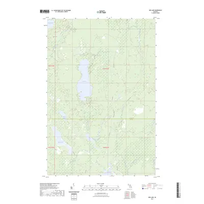 2023 Ned Lake2023 Print · USGSUpper Peninsula timberlands and glacial lakes are detailed here as they appeared in the early 2020s. Researchers can trace remote backcountry routes like The B Grade and locate secluded water bodies such as Shank Lake and Ned Lake.
 - 2023 Map of Kiernan, 2023 Print
 2023 Kiernan2023 Print · USGSIron County's northern forests and waterways appear in contemporary detail, centered on the small settlement of Kiernan and the expansive Michigamme Reservoir. Researchers can trace the winding paths of the Fence River, locate Huber Airport, and find family-named routes like Phelan Rd.
 - 2023 Map of Lake Mary, 2023 Print
 2023 Lake Mary2023 Print · USGSIron County’s Upper Peninsula wilderness is documented here in the early twenty-first century, centered on the flow of the Michigamme River. You can trace the historic Mansfield Location or explore the vast shorelines of Peavy Pond and Lake Mary.
 - 2023 Map of Kelso Junction, 2023 Print
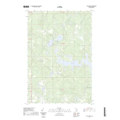 2023 Kelso Junction2023 Print · USGSIron County, Michigan, is mapped here in the early twenty-first century, centered on the confluence of the Kelso River and Paint River. You can trace the shoreline of the Michigamme Reservoir and locate legacy routes such as WPA Rd and the Enstrom Cutoff.
 - 2023 Map of Witch Lake NE, 2023 Print
 2023 Witch Lake NE2023 Print · USGSThe Michigan Upper Peninsula forestland at the junction of Baraga, Marquette, and Iron counties is detailed in this recent survey. Local historians can trace the paths of the Michigamme River and find named forest routes like Blue Snowshoe Trl and Elderberry Rd.
 - 2023 Map of Fortune Lakes, 2023 Print
 2023 Fortune Lakes2023 Print · USGSIron County's lake-studded landscape is captured in this contemporary survey of the Michigan-Wisconsin borderlands. Researchers can trace historical mining outposts like New Bristol Location and Dunn Location alongside the waters of Fortune Lakes.
End of results
Showing maps 1-12 of 12
Top cities near Crystal Falls Township
Top neighborhoods of Crystal Falls Township
- Monongahela Location historical maps
- Odgers Location historical maps
- Shafer Location historical maps
- Tobin Location historical maps
- Balsam historical maps
- Erickson Landing historical maps
See more
Frequently asked questions
- What are the different types of historical maps available for Crystal Falls Township?
- What is the oldest map of Crystal Falls Township?
- Where can I purchase historical maps of Crystal Falls Township for my home or office?
- Where can I download high-res historical maps of Crystal Falls Township?
- Are there historical topographic maps available for Crystal Falls Township?
- Is there historical aerial imagery available for Crystal Falls Township?
- Where are historical maps of Crystal Falls Township sourced from?