1950s Maps of Crystal Falls Township, Michigan
Explore 8 historic maps of Crystal Falls Township from the 1950s. These maps offer a rare glimpse into what life looked like during the 1950s — showing old roads, neighborhoods, homes, and landmarks that have changed or disappeared over time.
Whether you're researching your family's past, planning a metal detecting trip, or studying how Crystal Falls Township's landscape evolved across the 1950s, these high-resolution maps are a powerful tool for exploring the history of this region.
- Focus on a specific era: All maps on this page are from the 1950s, giving you a focused view of this time period.
- See what’s changed: Compare century-old streets, trails, and buildings to today's modern landscape using overlays and satellite layers.
- Research with precision: Use these maps for genealogy, historical research, land use analysis, or educational projects.
- View, download, or print: Maps are fully viewable online in high resolution, and can be downloaded or printed for your own records.
Start exploring Crystal Falls Township's history through authentic maps from the 1950s. This is your window into the past.
Crystal Falls Township, MI maps
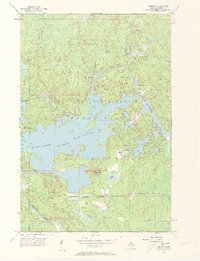
(8)- 1955 Map of Witch Lake, 1956 Print
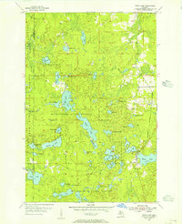 1955 Witch Lake1956 Print · USGSThe Upper Peninsula wilderness of the mid-fifties is captured here along the Iron and Marquette county line. Genealogists and collectors can trace the rail sidings at Witbeck and explore dozens of named waters like Fence Lake and Sundog Lake.3 unique versions available
 - 1955 Map of Ned Lake, 1956 Print
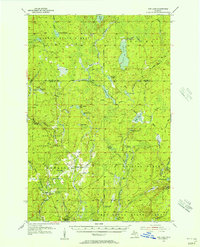 1955 Ned Lake1956 Print · USGSIron County's timberlands and glacial lakes are captured in the mid-fifties, showing a landscape of state forests and rail history. Trace local landmarks like the Triangle Ranch, the Amasa Landing Field, and the Old Railroad Grade.3 unique versions available
 - 1955 Map of Witch Lake NE, 1956 Print
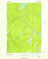 1955 Witch Lake NE1956 Print · USGSUpper Peninsula wilderness at the edge of Marquette County is documented here during the mid-fifties. Researchers can trace the winding Michigamme River and find named landmarks like Trout Falls, Dashwa Lake, and the Iron Range State Forest.2 unique versions available
 - 1955 Map of Witch Lake, 1957 Print
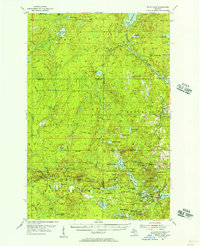 1955 Witch Lake1957 Print · USGSThe Upper Peninsula timber and rail landscape is captured here in the mid-fifties, showing the intersection of Marquette, Baraga, and Iron counties. You can trace the path of the Chicago and North Western railroad past Witbeck or locate the Lookout Tower and Nilsson Dam deep in the state forests.3 unique versions available
 - 1956 Map of Kiernan, 1957 Print
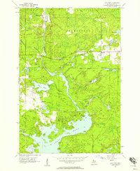
 1956 Kiernan1957 Print · USGSThe Iron Range State Forest area in the mid-1950s is defined by the massive Michigamme Reservoir and its surrounding timberlands. Researchers can trace the path of the Chicago Milwaukee St Paul and Pacific railroad through Kiernan and locate early sites like McMillan Camp and Way Dam.4 unique versions available
 - 1956 Map of Sagola, 1957 Print
 1956 Sagola1957 Print · USGSUpper Peninsula timber and rail history converge in the mid-fifties at the junction of the Chicago and North Western Railway. Trace the footprints of logging and mining settlements at Channing, Mansfield Location, and the McMillan Camp.
 - 1956 Map of Lake Mary, 1957 Print
 1956 Lake Mary1957 Print · USGSIron County's timber and river lands are captured here in the mid-fifties, just as the region's industrial footprint was evolving. Genealogists and historians can trace the Railroad Grade near Mansfield and locate the historic Mansfield Location.3 unique versions available
 - 1958 Map of Iron River, 1968 Print
 1958 Iron River1968 Print · USGSThe Upper Peninsula in the late fifties is captured here as a landscape of timber, iron, and rail. Genealogists and historians can trace rail stops like Mass Station or explore the coastlines of Lake Gogebic and Keweenaw Bay.3 unique versions available
End of results
Showing maps 1-8 of 8
Top cities near Crystal Falls Township
Top neighborhoods of Crystal Falls Township
- Monongahela Location historical maps
- Odgers Location historical maps
- Shafer Location historical maps
- Tobin Location historical maps
- Balsam historical maps
- Erickson Landing historical maps
See more
Frequently asked questions
- What are the different types of historical maps available for Crystal Falls Township?
- What is the oldest map of Crystal Falls Township?
- Where can I purchase historical maps of Crystal Falls Township for my home or office?
- Where can I download high-res historical maps of Crystal Falls Township?
- Are there historical topographic maps available for Crystal Falls Township?
- Is there historical aerial imagery available for Crystal Falls Township?
- Where are historical maps of Crystal Falls Township sourced from?