2020s Maps of Iron River Township, Michigan
Explore 11 historic maps of Iron River Township from the 2020s. These maps offer a rare glimpse into what life looked like during the 2020s — showing old roads, neighborhoods, homes, and landmarks that have changed or disappeared over time.
Whether you're researching your family's past, planning a metal detecting trip, or studying how Iron River Township's landscape evolved across the 2020s, these high-resolution maps are a powerful tool for exploring the history of this region.
- Focus on a specific era: All maps on this page are from the 2020s, giving you a focused view of this time period.
- See what’s changed: Compare century-old streets, trails, and buildings to today's modern landscape using overlays and satellite layers.
- Research with precision: Use these maps for genealogy, historical research, land use analysis, or educational projects.
- View, download, or print: Maps are fully viewable online in high resolution, and can be downloaded or printed for your own records.
Start exploring Iron River Township's history through authentic maps from the 2020s. This is your window into the past.
Iron River Township, MI maps
(11)- 2023 Map of Gaastra, 2023 Print
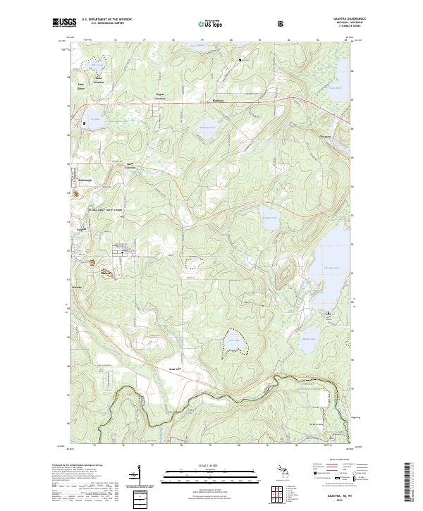 2023 Gaastra2023 Print · USGSUpper Peninsula mining and forest life converge in this study of the Iron River area in the early twenty-first century. Researchers can trace the layout of Gaastra, Stambaugh, and Palatka or locate local landmarks like the Bates Cem and Indian Burial Ground.
 - 2023 Map of Hagerman Lake, 2023 Print
 2023 Hagerman Lake2023 Print · USGSThe borderlands of Iron County and Wisconsin come alive in this recent survey of the deep northwoods. Researchers can trace the winding Brule River through Nelma or locate specific lakeside properties along Hagerman Lake and Brule Lake.
 - 2023 Map of Gibbs City, 2023 Print
 2023 Gibbs City2023 Print · USGSUpper Peninsula timberlands and river systems are documented in detail here during the early twenty-first century. Researchers can trace the network of forest trails and water bodies surrounding Gibbs City and Hazel, including Iron Lake and the Paint Wild and Scenic River.
 - 2023 Map of Iron River, 2023 Print
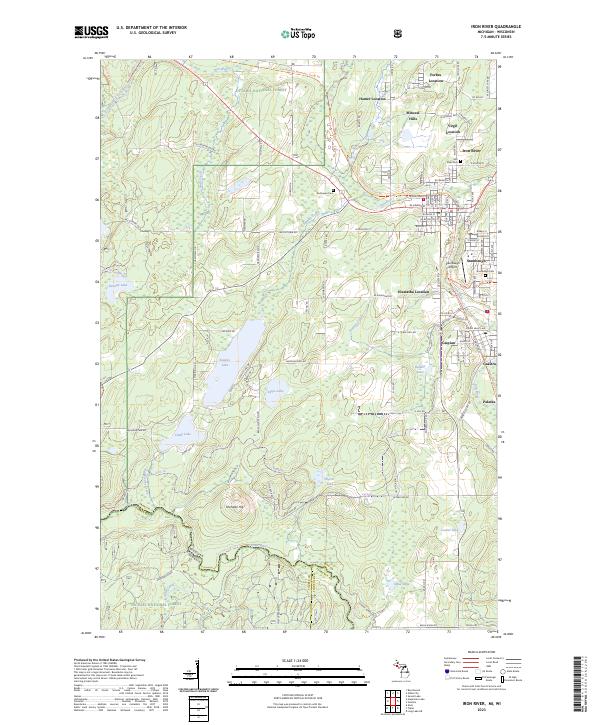 2023 Iron River2023 Print · USGSIron County's mining heritage is preserved in this detailed study of the Upper Peninsula at the border of Wisconsin. Researchers can trace the layout of legacy communities like Mineral Hills and Gaastra, or locate family sites at River Cem and Stambaugh Cem.
 - 2023 Map of Sunset Lake, 2023 Print
 2023 Sunset Lake2023 Print · USGSUpper Peninsula timberlands and river systems take center stage in this recent survey of Iron County. Researchers can trace local history through family-named routes and waterways like Parks Farm Rd, Lake Nine, and the Hemlock Rapids of the Paint River.
 - 2023 Map of Kenton, 2023 Print
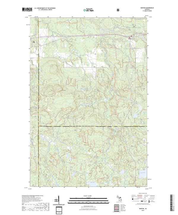 2023 Kenton2023 Print · USGSThe Upper Peninsula backcountry near Kenton is documented here as it appeared recently, dominated by the Ottawa National Forest. Researchers can locate family sites at the Kenton Cem or trace the winding waters of the Jumbo River past Dumpy Falls and Lake Twentyeight.
 - 2023 Map of Winslow Lake, 2023 Print
 2023 Winslow Lake2023 Print · USGSUpper Peninsula timberlands and river corridors are charted here in the twenty-first century, centered on the Paint Wild and Scenic River. Researchers can trace remote waterways and forest access points like Big Spring Hole, Winslow Lake, and Gibbs City Rd.
 - 2023 Map of Lake Mitigwaki, 2023 Print
 2023 Lake Mitigwaki2023 Print · USGSThe northern Michigan wilderness at the junction of Iron, Ontonagon, and Gogebic counties remains a landscape defined by water and timber. Foresters and hikers can trace the remote access roads and primitive trails leading to secluded waters like Lake Mitigwaki, Whisper Lake, and Paint Lake.
 - 2023 Map of Glitter Lake, 2023 Print
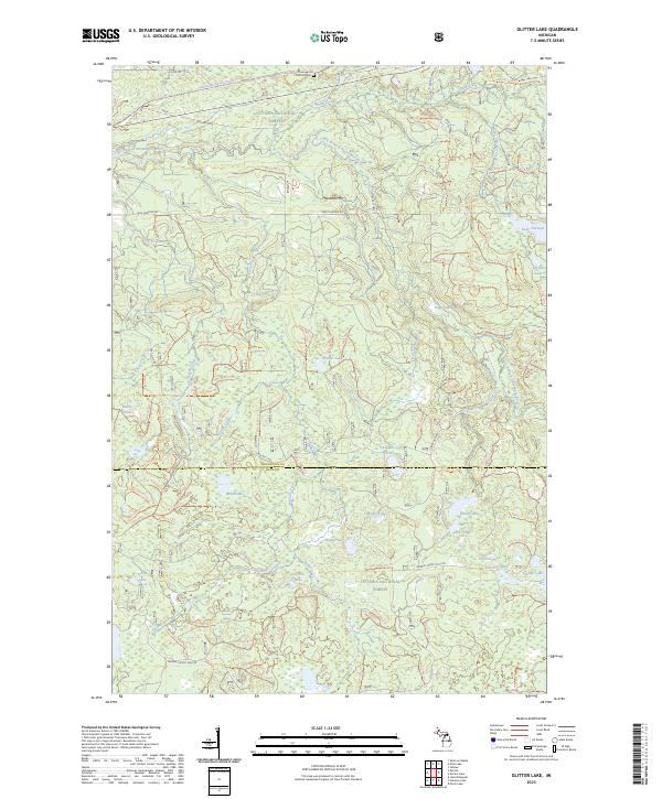 2023 Glitter Lake2023 Print · USGSThe Northwoods of the Upper Peninsula are documented here in recent detail, spanning the border of Houghton and Iron Counties. You can trace modern forest access and land use along the Ontonagon Wild and Scenic River or locate the remote Kitchie Cem.
 - 2023 Map of Perch Lake, 2023 Print
 2023 Perch Lake2023 Print · USGSIron County's lake country is captured here during the 2020s, showing a landscape shaped by water and the Ottawa National Forest. Trace forest routes like Ponozzo Rd to find secluded spots such as Hannah Webb Lake and Petrow Lake.
 - 2023 Map of Beechwood, 2023 Print
 2023 Beechwood2023 Print · USGSIron County’s Upper Peninsula timberlands are documented in this recent survey of the Ottawa National Forest. Researchers can locate the settlement of Basswood, trace the Paint Wild and Scenic River, or find family records at Rosehill Cem.
End of results
Showing maps 1-11 of 11
Top cities near Iron River Township
- Iron River historical maps
- Phelps historical maps
- Stambaugh historical maps
- Caspian historical maps
- Gaastra historical maps
- Alvin historical maps
Top neighborhoods of Iron River Township
Frequently asked questions
- What are the different types of historical maps available for Iron River Township?
- What is the oldest map of Iron River Township?
- Where can I purchase historical maps of Iron River Township for my home or office?
- Where can I download high-res historical maps of Iron River Township?
- Are there historical topographic maps available for Iron River Township?
- Is there historical aerial imagery available for Iron River Township?
- Where are historical maps of Iron River Township sourced from?