Old Maps of Naults, Mastodon Township for Academic Research
Study the evolution of Naults with 12 high-resolution historic maps. Whether you're teaching, researching, or modeling changes in land use, these maps provide essential visual documentation of urban, environmental, and geographic change.
- Analyze long-term change: Track patterns in development, transportation, and natural features.
- Ideal for environmental or urban studies: Support academic projects with primary historical map data.
- Use in the classroom or lab: Educators and researchers rely on these maps to bring historical context to life.
These maps are a powerful tool for teaching, research, and visualizing how Naults has changed over the decades.
Naults, Mastodon Township maps
(12)- 1941 Map of Florence
 1941 Florence1941 Print · USGSFlorence and the surrounding lake country appear in this early 1940s survey just as modern highways began to bypass the old rail corridors. Local researchers can trace rural schoolhouse locations like Fern Sch and landmarks like the Rainbow Firetower.
 - 1947 Map of Naults
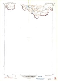 1947 Naults1947 Print · USGSThe Brule River borderland was a remote frontier of rail and timber in the late 1940s. Genealogists and historians can trace the settlement at Naults and the route of the Chicago and Northwestern railroad through the Mastodon area.
 - 1954 Map of Iron Mountain, 1964 Print
 1954 Iron Mountain1964 Print · USGSUpper Michigan and Northeastern Wisconsin are shown in detail during the mid-fifties, when the logging and mining economies still moved by rail. Trace the rail lines of the Soo Line to remote stops like Koepenick Station or explore the Iron Range near Iron Mountain.2 unique versions available
 - 1959 Map of Iron Mountain
 1959 Iron Mountain1959 Print · USGSThe northwoods of Wisconsin and the Michigan border are captured here in the mid-fifties, showing a landscape defined by timber, water, and rail. Researchers can trace historic junctions like Hiles Junction, the expansive Nicolet National Forest, and lakefront settlements from Rhinelander to Tomahawk.2 unique versions available
 - 1962 Map of Naults, 1964 Print
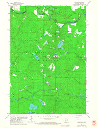 1962 Naults1964 Print · USGSWisconsin's northern borderlands meet the Michigan state line in the early sixties, where the Brule River and Pine River wind through deep timber. Genealogists and historians can locate the Naults settlement along the Chicago and North Western tracks and identify the Florence Lookout Tower standing over a landscape of dozens of named glacial lakes.3 unique versions available
 - 1991 Map of Iron Mountain
 1991 Iron Mountain1991 Print · USGSThe Michigan-Wisconsin borderlands appear here in the early nineties, centered on the industrial corridor along the Menominee River. Local researchers can trace the Soo Line through remote timber settlements or locate mining sites like the Bradley Mine and Trader Mine.
 - 2011 Map of Naults, 2011 Print
 2011 Naults2011 Print · USGSCovers Naults, including Florence, Fern, and other nearby areas
 - 2013 Map of Naults, 2013 Print
 2013 Naults2013 Print · USGSCovers Naults, including Florence, Fern, and other nearby areas
 - 2014 Map of Naults, 2014 Print
 2014 Naults2014 Print · USGSCovers Naults, including Florence, Fern, and other nearby areas
 - 2017 Map of Naults, 2017 Print
 2017 Naults2017 Print · USGSCovers Naults, including Florence, Fern, and other nearby areas
 - 2019 Map of Naults, 2019 Print
 2019 Naults2019 Print · USGSCovers Naults, including Florence, Fern, and other nearby areas
 - 2023 Map of Naults, 2023 Print
 2023 Naults2023 Print · USGSThe Michigan-Wisconsin borderlands are shown here in the 2020s, dominated by the timber and water of the Whisker Lake Wilderness. You can trace old routes near the settlement of Naults or locate remote water bodies like Camp Thirteen Lake and Boot Lake.
End of results
Showing maps 1-12 of 12
Top cities near Naults
- Iron River historical maps
- Crystal Falls historical maps
- Aurora historical maps
- Caspian historical maps
- Mastodon historical maps
- Florence historical maps
See more
Frequently asked questions
- What are the different types of historical maps available for Naults?
- What is the oldest map of Naults?
- Where can I purchase historical maps of Naults for my home or office?
- Where can I download high-res historical maps of Naults?
- Are there historical topographic maps available for Naults?
- Is there historical aerial imagery available for Naults?
- Where are historical maps of Naults sourced from?