1950s Maps of Keweenaw County, Michigan
Explore 4 historic maps of Keweenaw County from the 1950s. These maps offer a rare glimpse into what life looked like during the 1950s — showing old roads, neighborhoods, homes, and landmarks that have changed or disappeared over time.
Whether you're researching your family's past, planning a metal detecting trip, or studying how Keweenaw County's landscape evolved across the 1950s, these high-resolution maps are a powerful tool for exploring the history of this region.
- Focus on a specific era: All maps on this page are from the 1950s, giving you a focused view of this time period.
- See what’s changed: Compare century-old streets, trails, and buildings to today's modern landscape using overlays and satellite layers.
- Research with precision: Use these maps for genealogy, historical research, land use analysis, or educational projects.
- View, download, or print: Maps are fully viewable online in high resolution, and can be downloaded or printed for your own records.
Start exploring Keweenaw County's history through authentic maps from the 1950s. This is your window into the past.
Keweenaw County, MI maps
(4)- 1954 Map of Gay, 1955 Print
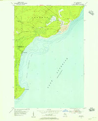 1954 Gay1955 Print · USGSCoastal Keweenaw County comes to life in the mid-fifties, showing the industrial interface between the copper mines and the Great Lakes. Trace the massive Tailings deposits at Gay and the transport path of the Copper Range along the shore.3 unique versions available
 - 1954 Map of Rice Lake, 1955 Print
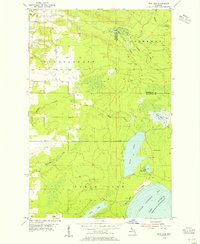 1954 Rice Lake1955 Print · USGSThe Keweenaw Peninsula’s watery interior comes into focus in the mid-fifties, showing the rugged lake-and-creek systems of the northern Copper Country. You can trace the shoreline of Little Traverse Bay or locate the site of Minnetonka Camp near Rice Lake.4 unique versions available
 - 1958 Map of Hancock, 1967 Print
 1958 Hancock1967 Print · USGSThe Keweenaw Peninsula and Isle Royale are seen here during the mid-twentieth century as mining and maritime hubs. Trace the dense town layouts of Hancock and Calumet, or locate remote coastal markers like the Eagle Harbor Lighthouse and Rock of Ages Light.2 unique versions available
 - 1959 Map of Fort William, 1967 Print
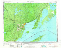 1959 Fort William1967 Print · USGSThe northern shore of Lake Superior at the close of the 1950s shows a thriving rail and shipping network connecting the twin ports and the remote island wilderness. Trace family roots and local industry in Port Arthur, Vickers Heights, and Isle Royale National Park.3 unique versions available
End of results
Showing maps 1-4 of 4
Frequently asked questions
- What are the different types of historical maps available for Keweenaw County?
- What is the oldest map of Keweenaw County?
- Where can I purchase historical maps of Keweenaw County for my home or office?
- Where can I download high-res historical maps of Keweenaw County?
- Are there historical topographic maps available for Keweenaw County?
- Is there historical aerial imagery available for Keweenaw County?
- Where are historical maps of Keweenaw County sourced from?