1980s Maps of Keweenaw County, Michigan
Explore 18 historic maps of Keweenaw County from the 1980s. These maps offer a rare glimpse into what life looked like during the 1980s — showing old roads, neighborhoods, homes, and landmarks that have changed or disappeared over time.
Whether you're researching your family's past, planning a metal detecting trip, or studying how Keweenaw County's landscape evolved across the 1980s, these high-resolution maps are a powerful tool for exploring the history of this region.
- Focus on a specific era: All maps on this page are from the 1980s, giving you a focused view of this time period.
- See what’s changed: Compare century-old streets, trails, and buildings to today's modern landscape using overlays and satellite layers.
- Research with precision: Use these maps for genealogy, historical research, land use analysis, or educational projects.
- View, download, or print: Maps are fully viewable online in high resolution, and can be downloaded or printed for your own records.
Start exploring Keweenaw County's history through authentic maps from the 1980s. This is your window into the past.
Keweenaw County, MI maps
(18)- 1985 Map of Todd Harbor
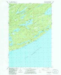
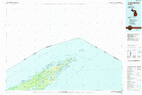 1985 Todd Harbor1985 Print · USGSIsle Royale is mapped here in the mid-1980s as a managed wilderness, illustrating the island's ridges and isolated interior lakes. Researchers can locate remote park facilities like the Park Headquarters and trace copper mining history at the Saginaw Mine and Mine Point.2 unique versions available
 - 1985 Map of Copper Harbor
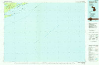
 1985 Copper Harbor1985 Print · USGSThe northern tip of the Keweenaw Peninsula is captured in the mid-eighties, showing the rugged shoreline from Bete Grise to Keweenaw Point. Local historians can trace landmarks like Ft Wilkins State Park, Mount Houghton, and the isolated Manitou Island lighthouse.2 unique versions available
 - 1985 Map of Siskiwit Bay
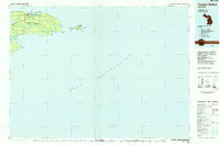
 1985 Siskiwit Bay1985 Print · USGSIsle Royale’s southern coast and interior ridges are captured here in the mid-1980s, documenting the wilderness before modern shifts in park management. Map collectors can trace maritime landmarks like the Isle Royale Lighthouse or locate remote spots like Fishermans Home and Siskiwit Falls.2 unique versions available
 - 1985 Map of Hancock
 1985 Hancock1985 Print · USGSThe Keweenaw Peninsula in the mid-1980s reveals a landscape shaped by copper and the Great Lakes. You can trace the industrial legacy of the region through the Quincy Mine, the Old RR Grade, and old cemeteries like Forest Hill Cem.3 unique versions available
 - 1985 Map of Grand Portage
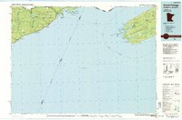 1985 Grand Portage1985 Print · USGSThe international border along Lake Superior is shown in detail during the mid-1980s, bridging the wilderness of Minnesota and Michigan. Researchers can trace the varied terrain of Isle Royale National Park and the lakeside settlements of Hovland and Mineral Center.2 unique versions available
 - 1985 Map of Lake Richie, 1986 Print
 1985 Lake Richie1986 Print · USGSIsle Royale in the mid-1980s reveals a wilderness shaped by its ancient ridges and copper-mining legacy. Researchers can trace historic sites like the Minong Mine and Datolite Mine or follow the backcountry routes of the Indian Portage Trail near Chippewa Harbor.2 unique versions available
 - 1985 Map of Feldtmann Ridge, 1986 Print
 1985 Feldtmann Ridge1986 Print · USGSIsle Royale in the mid-1980s reveals a preserved wilderness of ridges and reef-lined shores. Researchers can trace the elevation at Feldtmann Lookout Tower or locate coastal features like Attwood Beach and the Big Siskiwit River.2 unique versions available
 - 1985 Map of Todd Harbor, 1986 Print
 1985 Todd Harbor1986 Print · USGSMid-century Isle Royale is captured here in its rugged wilderness state within Houghton County. Trace the paths of the Minong Trail, locate the historical Haytown Mine, and explore the shoreline from Todd Harbor to Siskiwit Lake.2 unique versions available
 - 1985 Map of McCargoe Cove, 1986 Print
 1985 McCargoe Cove1986 Print · USGSKeweenaw County's island wilderness is documented in the mid-1980s, showing the complex shoreline and interior ridges of the national park. Trace the historic Minong Mine or follow the Minong Ridge Trail past Sargent Lake.
 - 1985 Map of Rock Harbor Lodge, 1986 Print
 1985 Rock Harbor Lodge1986 Print · USGSIsle Royale's rugged northeastern tip comes to life in the mid-1980s, documenting the remote trails and maritime routes of the national park. Researchers can trace historic copper extraction at the Prehistoric Mine (Restored) and locate backcountry sites like Merritt Lane Campground or Lookout Louise.
 - 1985 Map of Feldtmann Lake, 1986 Print
 1985 Feldtmann Lake1986 Print · USGSIsle Royale’s southwestern wilderness is documented here during the mid-eighties as a landscape of isolated trails and maritime landmarks. Researchers can trace the Feldtmann Trail to the interior Feldtmann Lake or locate the remote Rock of Ages Lighthouse.
 - 1985 Map of Belle Harbor, 1986 Print
 1985 Belle Harbor1986 Print · USGSThe northeast reaches of Isle Royale appear in the mid-1980s as a wild landscape of ridges and deep-water harbors. Trace the footpaths and campgrounds at Lane Cove, Belle Harbor, and the heights of Greenstone Ridge.
 - 1985 Map of Passage Island, 1986 Print
 1985 Passage Island1986 Print · USGSIsle Royale's northeastern frontier is captured here in the mid-1980s, documenting the lonely maritime outposts of Lake Superior. Researchers can trace the international boundary and find specific navigation aids like the Lighthouse and Radio Towers on Passage Island.
 - 1985 Map of Malone Bay, 1986 Print
 1985 Malone Bay1986 Print · USGSThe south shore of Isle Royale in the mid-1980s reveals a wilderness of reefs and islands shaped by Lake Superior. Trace maritime landmarks like the Isle Royale Lighthouse on Menagerie Island or the sheltered waters of Dog Harbor and Malone Bay.
 - 1985 Map of Windigo, 1986 Print
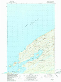 1985 Windigo1986 Print · USGSIsle Royale's southwestern tip is shown in the mid-1980s, centered on the protected waters of Washington Harbor and the outpost of Windigo. Trace the island's history from the Wendigo Mines to the wilderness paths of the Minong Ridge Trail.2 unique versions available
 - 1985 Map of Little Todd Harbor, 1986 Print
 1985 Little Todd Harbor1986 Print · USGSIsle Royale's rugged northern coast is captured here in the mid-1980s, showcasing the remote wilderness and trail networks of the national park. Trace established hiking routes across Minong Ridge to landmarks like the Lookout Tower and Thompsonite Beach.
 - 1985 Map of Mott Island, 1986 Print
 1985 Mott Island1986 Print · USGSIsle Royale in the mid-1980s was a remote island landscape of copper mining history and protected wilderness. Trace the remnants of the industrial past at the Saginaw Mine or locate early island landmarks like the Caribou Island Light and Park Headquarters.
 - 1985 Map of Sugar Mountain, 1986 Print
 1985 Sugar Mountain1986 Print · USGSIsle Royale's rugged interior and copper mining history are detailed in this mid-1980s survey of the island's high ridges. Trace the footpaths and industry of the past at the Island Mine, Sugar Mountain, and the shoreline of Siskiwit Bay.2 unique versions available
End of results
Showing maps 1-18 of 18
Frequently asked questions
- What are the different types of historical maps available for Keweenaw County?
- What is the oldest map of Keweenaw County?
- Where can I purchase historical maps of Keweenaw County for my home or office?
- Where can I download high-res historical maps of Keweenaw County?
- Are there historical topographic maps available for Keweenaw County?
- Is there historical aerial imagery available for Keweenaw County?
- Where are historical maps of Keweenaw County sourced from?